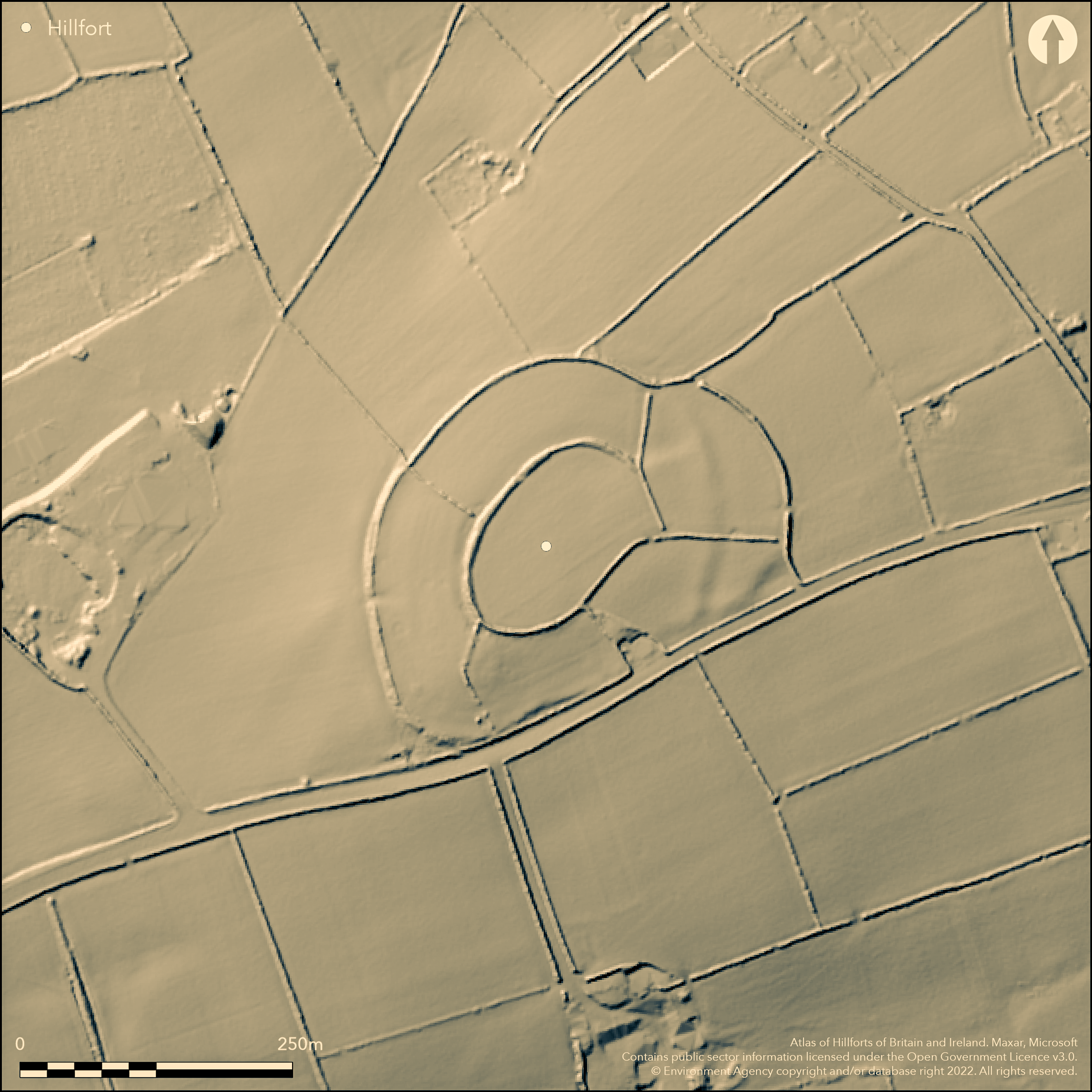
LiDAR 1m DTM Hillshade
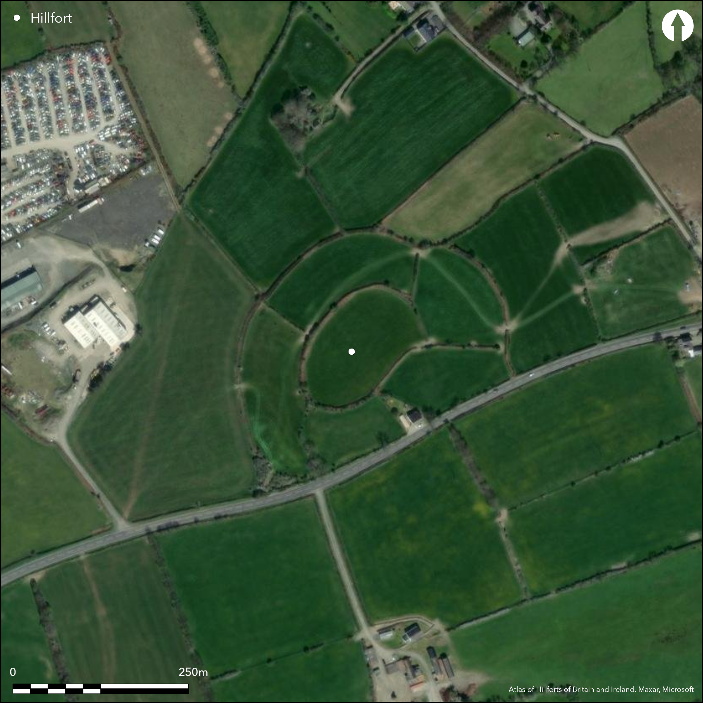
Satellite Imagery
LiDAR 1m DTM Hillshade
Satellite Imagery
Scroll left/right to view further images.
HER: Dyfed 2101 (None)
NMR: SN 25 SE 4 (304136)
SM: CD053
NGR: SN29855040
X: 229850 Y: 250400 (OSGB36)
Contour hillfort, large for the area, situated on a hill at the headwaters of the Afon Dulas, a tributary of the Afon Teifi, and overlooking Aberporth Bay. Moderate surrounding slopes to N, E and W, moderate to strong on S. Possibly sited on E-W ridge route along watershed. Defined by two widely-spaced ramparts, with an inner oval c. 122m NE-SW by 74m, and an outer, making the site 244m NE-SW by 183m overall. Overall internal area c.3.28ha. Both circuits have banks and ditches, now either up to c. 2m-3m high or reduced to scarps. Possible additional banks on E, to 1m high, between inner enclosure and a roughly crescentic annexe c. 30m wide by 110m long. Good earthworks in field to SE alongside main road and additonal scarps between inner and outer enclosures, and beyond W rampart. No entrance visible. Evidence of massive stone-work used in rampart walling. Notable for the finding of the ritual 'Penbryn' spoons in the nineteenth century, now in the Ashmolean Museum, Oxford. Three cinerary urns were discovered in what may have been a cist within interior. These may have been Bronze Age, but a Romano-British date is also possible and the finds in general could indicate re-use of the site in the Roman period for funerary purposes. Five fields radiate outwards from the central hillfort enclosure. Improved pasture. On 1st Ed. OS map (1889). Minimal investigations, undated.
Citizen Science: ✗
Reliability of Data: Confirmed
Reliability of Interpretation: Confirmed
X: -499497 Y: 6822870 (EPSG: 3857)
Longitude: -4.487056078324988 Latitude: 52.125616435114864 (EPSG:4326)
Country: Wales
Current County or Unitary Authority: Ceredigion
Historic County: Cardiganshire
Current Parish/Community/Council/Townland: Penbryn
Banks now reduced to scarps. Five fields radiate outwards from the central hillfort enclosure.
| Extant | ✓ |
| Cropmark | ✗ |
| Likely Destroyed | ✗ |
Improved pasture.
| Woodland | ✗ |
| Commercial Forestry Plantation | ✗ |
| Parkland | ✗ |
| Pasture (Grazing) | ✓ |
| Arable | ✗ |
| Scrub/Bracken | ✗ |
| Bare Outcrop | ✗ |
| Heather/Moorland | ✗ |
| Heath | ✗ |
| Built-up | ✗ |
| Coastal Grassland | ✗ |
| Other | ✗ |
Contour hillfort, larger for the area, situated on a hill at the headwaters of the Afon Dulas, a tributary of the Afon Teifi, and overlooking Aberporth Bay. Moderate surrounding slopes to N, E and W, moderate to strong on S.
| Contour Fort | ✓ |
| Partial Contour Fort | ✗ |
| Promontory Fort | ✗ |
| Hillslope Fort | ✗ |
| Level Terrain Fort | ✗ |
| Marsh Fort | ✗ |
| Multiple Enclosure Fort | ✗ |
| Hilltop | ✓ |
| Coastal Promontory | ✗ |
| Inland Promontory | ✗ |
| Valley Bottom | ✗ |
| Knoll/Hillock/Outcrop | ✗ |
| Ridge | ✗ |
| Cliff/Plateau-edge/Scarp | ✗ |
| Hillslope | ✗ |
| Lowland | ✗ |
| Spur | ✗ |
Dominant Topographic Feature: Hill top
| North | ✗ |
| Northeast | ✗ |
| East | ✗ |
| Southeast | ✗ |
| South | ✗ |
| Southwest | ✗ |
| West | ✗ |
| Northwest | ✗ |
| Level | ✓ |
Altitude: 212.0m
N/A
Romano-British Penbryn spoons evidence.
Reliability: D - None
| Pre 1200BC | ✗ |
| 1200BC - 800BC | ✗ |
| 800BC - 400BC | ✗ |
| 400BC - AD50 | ✗ |
| AD50 - AD400 | ✗ |
| AD400 - AD 800 | ✗ |
| Post AD800 | ✗ |
| Unknown | ✓ |
| Pre Hillfort: | Three cinerary urns were discovered in what may have been a cist within interior. These may have been Bronze Age, but a Romano-British date is also possible. |
| Post Hillfort: | Finds may suggest the re-use of an earlier settlement site for funerary purposes in Roman period. |
| Artefactual: | Penbryn spoons and cinerary urns. |
First mentioned in the 1695 edition of Camden's Britannia, with observations by Edward Lhuyd. On 1st Ed. OS map (1889). Cambria Archaeology defended enclosures survey 2006.
| 1st Identified Written Reference (1695): | First mentioned in the 1695 edition of Camden's Britannia. |
| 1st Identified Map Depiction (1889): | OS map. |
| Other (2006): | Cambria Archaeology defended enclosures survey. |
Notable for the finding of the ritual 'Penbryn' spoons in the nineteenth century, now in the Ashmolean Museum, Oxford. Three cinerary urns were discovered in what may have been a cist within interior. These may have been Bronze Age, but a Romano-British date is also possible and the finds in general could indicate re-use of the site in the Roman period for funerary puposes.
Prominent rock-cut spring marked by pool of water lies against inner rampart. Afon Dulas/stream 0.4km outside fort.
| None | ✗ |
| Spring | ✗ |
| Stream | ✗ |
| Pool | ✓ |
| Flush | ✗ |
| Well | ✗ |
| Other | ✗ |
None
| No Known Features | ✓ |
| Round Stone Structures | ✗ |
| Rectangular Stone Structures | ✗ |
| Curvilinear Platforms | ✗ |
| Other Roundhouse Evidence | ✗ |
| Pits | ✗ |
| Quarry Hollows | ✗ |
| Other | ✗ |
None
| No Known Excavation | ✓ |
| Pits | ✗ |
| Postholes | ✗ |
| Roundhouses | ✗ |
| Rectangular Structures | ✗ |
| Roads/Tracks | ✗ |
| Quarry Hollows | ✗ |
| Other | ✗ |
| Nothing Found | ✗ |
None
| No Known Geophysics | ✓ |
| Pits | ✗ |
| Roundhouses | ✗ |
| Rectangular Structures | ✗ |
| Roads/Tracks | ✗ |
| Quarry Hollows | ✗ |
| Other | ✗ |
| Nothing Found | ✗ |
Notable for the finding of the ritual 'Penbryn' spoons in the nineteenth century, now in the Ashmolean Museum, Oxford. Three cinerary urns were discovered in what may have been a cist within interior. These may have been Bronze Age, but a Romano-British date is also possible and the finds in general could indicate re-use of the site in the Roman period for funerary puposes.
| No Known Finds | ✗ |
| Pottery | ✓ |
| Metal | ✓ |
| Metalworking | ✗ |
| Human Bones | ✗ |
| Animal Bones | ✗ |
| Lithics | ✗ |
| Environmental | ✗ |
| Other | ✗ |
None
| APs Not Checked | ✓ |
| None | ✗ |
| Roundhouses | ✗ |
| Rectangular Structures | ✗ |
| Pits | ✗ |
| Postholes | ✗ |
| Roads/Tracks | ✗ |
| Other | ✗ |
None visible.
| 0: | None |
| 2: | None |
Guard Chambers: ✗
Chevaux de Frise: ✗
Defined by two widely-spaced ramparts, with an inner oval c. 122m NE-SW by 74m, and an outer, making the site 244m NE-SW by 183m overall. Internal area 3.28ha. Both circuits have banks and ditches, now reduced to scarps. Possible additional banks on E. Evidence of massive stone-work used in rampart walling.
| Area 1: | 3.28ha. |
| Total: | 3.28ha. |
Total Footprint Area: Noneha.
None
| ✗ | None |
| ✓ | None |
| NE Quadrant: | 2 |
| SE Quadrant: | 2 |
| SW Quadrant: | 2 |
| NW Quadrant: | 2 |
| Total: | 2 |
| Partial Univallate | ✗ |
| Univallate | ✗ |
| Partial Bivallate | ✗ |
| Bivallate | ✓ |
| Partial Multivallate | ✗ |
| Multivallate | ✗ |
| Unknown | ✗ |
| Partial Univallate | ✗ |
| Univallate | ✗ |
| Partial Bivallate | ✗ |
| Bivallate | ✗ |
| Partial Multivallate | ✗ |
| Multivallate | ✗ |
Evidence of massive stone-work used in rampart walling.
| None | ✗ |
| Earthen Bank | ✗ |
| Stone Wall | ✓ |
| Rubble | ✗ |
| Wall-walk | ✗ |
| Evidence of Timber | ✗ |
| Vitrification | ✗ |
| Other Burning | ✗ |
| Palisade | ✗ |
| Counter Scarp Bank | ✗ |
| Berm | ✗ |
| Unfinished | ✗ |
| Other | ✗ |
None
| None | ✗ |
| Earthen Bank | ✗ |
| Stone Wall | ✗ |
| Murus Duplex | ✗ |
| Timber-framed | ✗ |
| Timber-laced | ✗ |
| Vitrification | ✗ |
| Other Burning | ✗ |
| Palisade | ✗ |
| Counter Scarp Bank | ✗ |
| Berm | ✗ |
| Unfinished | ✗ |
| No Known Excavation | ✓ |
| Other | ✗ |
| ✗ | None |
| ✓ | None |
Number of Ditches: 2
| ✓ | On E roughly crescentic annexe c. 30m wide by 110m long. |
Barnwell, E.L. 1862, Bronze articles supposed to be spoons, Arch Camb, 3rd series, 8, 208-219.
Davies, J. L. and Hogg, A. H. A. 1994. The Iron Age, in eds Davies, J.L. and Kirby, D.A.. Cardiganshire County History, Vol 1, From the earliest times to the coming of the Normans, Cardiff: University of Wales Press.
Hogg, A.H.A. 1962. List of hill-forts in Cardiganshire, Bull Board Celtic Stud, 19, 364.
Murphy, K., Savory, H. N., Caseldine, A. E., Dresser, Q., Williams, G., Wilkinson, J. L. and Crowther, J. 1992. Plas Gogerddan, Dyfed: a multi-period burial and ritual site. Arch J ,149, 1-38.
Murphy, K, Ramsey, R. and Page, M. 2006. A survey of defended enclosures in Ceredigion 2006: Gazetteer of Ordnance Survey Grid Squares SNX, Project Report No. 2006/20, Project Record No. 54269, Llandeilo: Cambria Archaeology.
Rees, S. 1992. A guide to ancient and historic Wales - Dyfed, London: HMSO, 214.
Way, A. 1870. Notices of certain bronze relics, of a peculiar type, assigned to the late Celitc period, Arch Camb, 4th series, I, 199-234.
Atlas of Hillforts:
Wikidata:
This work is licensed under CC BY-SA 4.0

 and should be cited as:
Lock, Gary and Ralston, Ian. 2024. Atlas of Hillforts of Britain and Ireland. Available at: https://hillforts.arch.ox.ac.uk
Document Version 1.1