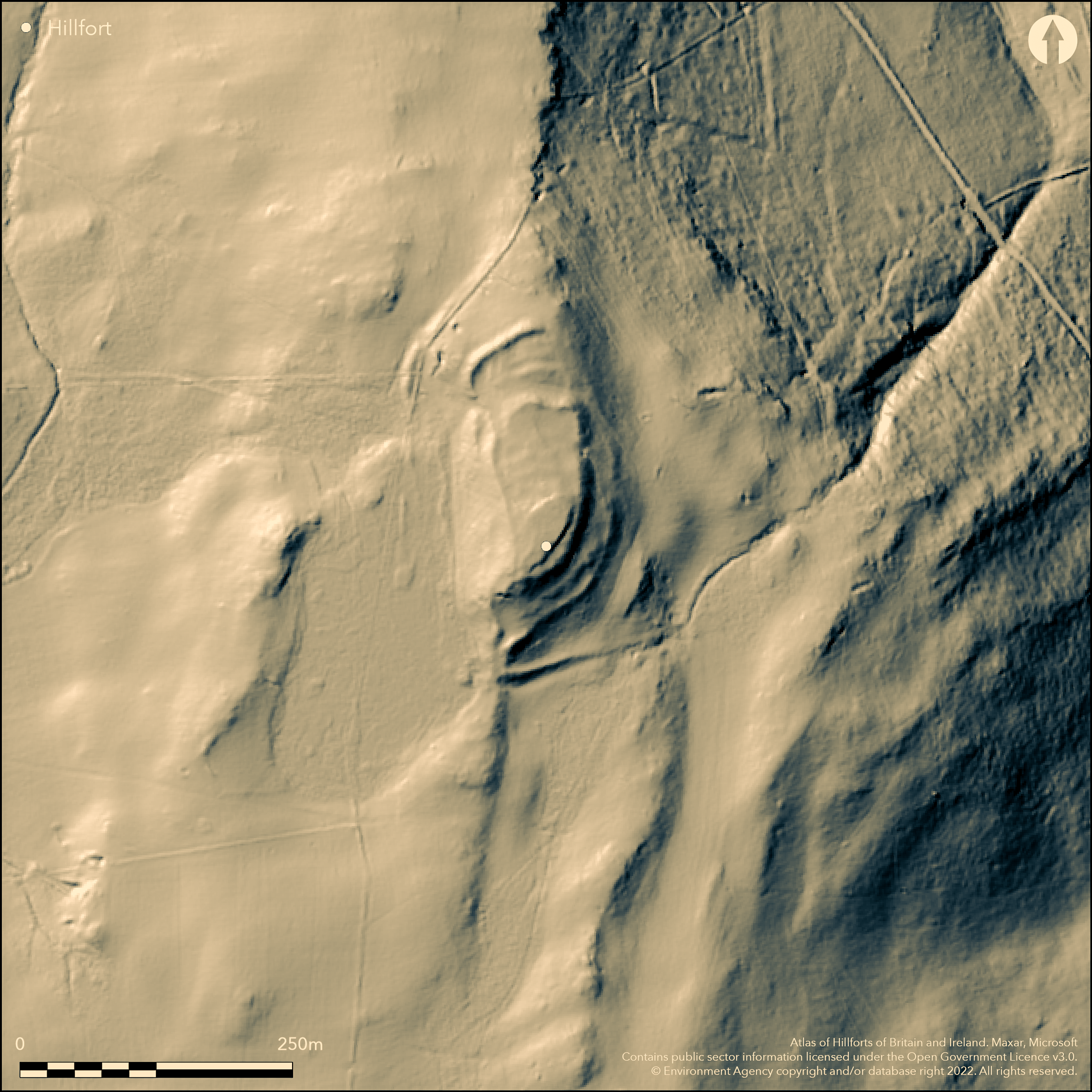
LiDAR 1m DTM Hillshade
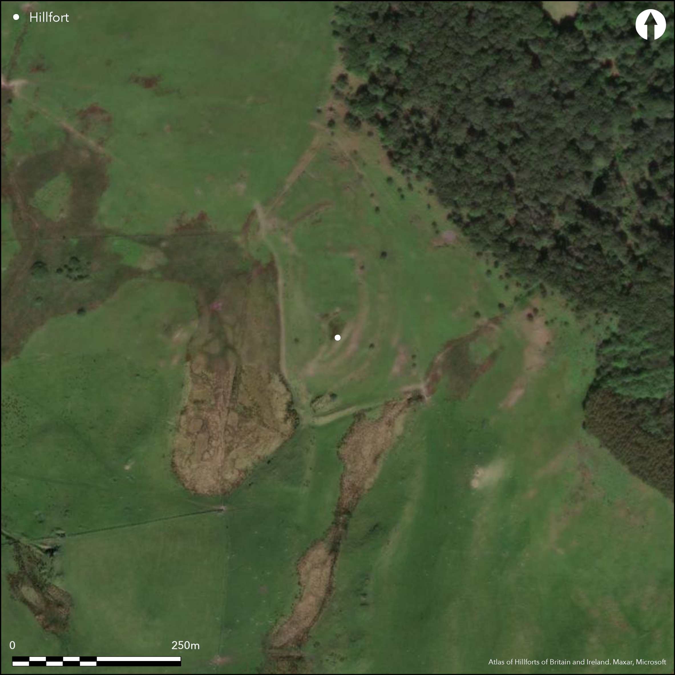
Satellite Imagery
LiDAR 1m DTM Hillshade
Satellite Imagery
Scroll left/right to view further images.
HER: Dyfed 2012 (None)
NMR: SN 68 NE (101990)
SM: CD102
NGR: SN67728767
X: 267720 Y: 287670 (OSGB36)
High, mulivallate, rocky and complex contour hillfort, located in commanding position on prominent outcrop on E edge of upland plateau of Banc Mynydd Gorddu, above Nant y Ffrwd to W, and stream and valley of Afon Leri to E. Steep or very steep slopes to N and E, moderate to S and moderate to strong to W. Interior measures c. 200m N-S by 70m, with internal area c. 3 ha. Complex site, considered three phased by Davies and Hogg (1994). Main enclosure (90m by 40m) on highest part of site where slight stony bank 2m-3m wide and to 0.3m high, more substantial on N. Rampart loops out enclosing second enclosure. A rampart also encloses entire site, best on SE. Steep W flanks of outcrop surmounted by low footing wall at top of the slope, possibly, originally, supporting timber defences. These slopes are further embellished with stone revetment. No evidence for ditches. Entrance at S tip of outcrop, flanked by bastion approached by a causeway over boggy ground. Possible second entrance on NW side, with a bastion on S side, but layout confused and possibly later modified or blocked. Hut platforms in interior. Rough rocky upland grazing. On 1st Ed. OS map (1887). Minimal investigations, undated.
Citizen Science: ✗
Reliability of Data: Confirmed
Reliability of Interpretation: Confirmed
X: -439587 Y: 6885716 (EPSG: 3857)
Longitude: -3.9488772286637475 Latitude: 52.4708643332443 (EPSG:4326)
Country: Wales
Current County or Unitary Authority: Ceredigion
Historic County: Cardiganshire
Current Parish/Community/Council/Townland: Ceulanymaesmawr
Fair condition.
| Extant | ✓ |
| Cropmark | ✗ |
| Likely Destroyed | ✗ |
Rough rocky upland grazing.
| Woodland | ✗ |
| Commercial Forestry Plantation | ✗ |
| Parkland | ✗ |
| Pasture (Grazing) | ✓ |
| Arable | ✗ |
| Scrub/Bracken | ✗ |
| Bare Outcrop | ✗ |
| Heather/Moorland | ✗ |
| Heath | ✗ |
| Built-up | ✗ |
| Coastal Grassland | ✗ |
| Other | ✗ |
High, mulivallate, rocky and complex contour hillfort, located in commanding position on prominent outcrop on E edge of upland plateau of Banc Mynydd Gorddu, above Nant y Ffrwd to W, and stream and valley of Afon Leri to E. Steep or very steep slopes to N and E, moderate to S and moderate to strong to W.
| Contour Fort | ✓ |
| Partial Contour Fort | ✗ |
| Promontory Fort | ✗ |
| Hillslope Fort | ✗ |
| Level Terrain Fort | ✗ |
| Marsh Fort | ✗ |
| Multiple Enclosure Fort | ✗ |
| Hilltop | ✗ |
| Coastal Promontory | ✗ |
| Inland Promontory | ✗ |
| Valley Bottom | ✗ |
| Knoll/Hillock/Outcrop | ✓ |
| Ridge | ✗ |
| Cliff/Plateau-edge/Scarp | ✗ |
| Hillslope | ✗ |
| Lowland | ✗ |
| Spur | ✗ |
Dominant Topographic Feature: Rocky outcrop
| North | ✗ |
| Northeast | ✗ |
| East | ✗ |
| Southeast | ✗ |
| South | ✗ |
| Southwest | ✗ |
| West | ✗ |
| Northwest | ✗ |
| Level | ✓ |
Altitude: 260.0m
N/A
None
Reliability: D - None
| Pre 1200BC | ✗ |
| 1200BC - 800BC | ✗ |
| 800BC - 400BC | ✗ |
| 400BC - AD50 | ✗ |
| AD50 - AD400 | ✗ |
| AD400 - AD 800 | ✗ |
| Post AD800 | ✗ |
| Unknown | ✓ |
| Pre Hillfort: | None |
| Post Hillfort: | None |
On 1st Ed. OS map (1887). Cambria Archaeology defended enclosures survey 2006. Survey and sampling programme RCAHMW in collaboration with Aberystwyth University, researching metal ore deposits within fort 2011, 2012.
| 1st Identified Map Depiction (1887): | OS map. |
| Other (2006): | Cambria Archaeology defended enclosures survey 2006. |
| Other (None): | Ore deposits sampling programme RCAHMW in collaboration with Aberystwyth University, |
Hut platforms in interior. Chance finds of iron slag lump and buff pottery sherd. Two abraded daub fragments.
Stream 0.35km outside fort.
| None | ✓ |
| Spring | ✗ |
| Stream | ✗ |
| Pool | ✗ |
| Flush | ✗ |
| Well | ✗ |
| Other | ✗ |
Hut platforms in interior.
| No Known Features | ✗ |
| Round Stone Structures | ✗ |
| Rectangular Stone Structures | ✗ |
| Curvilinear Platforms | ✓ |
| Other Roundhouse Evidence | ✗ |
| Pits | ✗ |
| Quarry Hollows | ✗ |
| Other | ✗ |
None
| No Known Excavation | ✓ |
| Pits | ✗ |
| Postholes | ✗ |
| Roundhouses | ✗ |
| Rectangular Structures | ✗ |
| Roads/Tracks | ✗ |
| Quarry Hollows | ✗ |
| Other | ✗ |
| Nothing Found | ✗ |
None
| No Known Geophysics | ✓ |
| Pits | ✗ |
| Roundhouses | ✗ |
| Rectangular Structures | ✗ |
| Roads/Tracks | ✗ |
| Quarry Hollows | ✗ |
| Other | ✗ |
| Nothing Found | ✗ |
Chance finds of iron slag lump and buff pottery sherd. Two abraded daub fragments.
| No Known Finds | ✗ |
| Pottery | ✓ |
| Metal | ✗ |
| Metalworking | ✓ |
| Human Bones | ✗ |
| Animal Bones | ✗ |
| Lithics | ✗ |
| Environmental | ✗ |
| Other | ✓ |
None
| APs Not Checked | ✓ |
| None | ✗ |
| Roundhouses | ✗ |
| Rectangular Structures | ✗ |
| Pits | ✗ |
| Postholes | ✗ |
| Roads/Tracks | ✗ |
| Other | ✗ |
Entrance at S tip of outcrop, flanked by bastion approached by a causeway over boggy ground. Possible second entrance on NW side, with a bastion on S side, but layout confused and possibly later modified or blocked.
| 2: | None |
| 2: | None |
Guard Chambers: ✗
Chevaux de Frise: ✗
| 1. Outworks (South east): | Flanked by bastion approached by a causeway. |
| 2. Outworks (North west): | Possible entrance with bastion on S side, but confused and maybe blocked. |
| 2. Blocked (North west): | Possibly blocked or modified. |
Main enclosure (90m by 40m) on highest part of site where slight stony bank 2m-3m wide and to 0.3m high, more substantial on N. Rampart loops out enclosing second enclosure. A rampart also encloses entire site, best on SE. Steep W flanks of outcrop surmounted by low footing wall at top of the slope, possibly, originally, supporting timber defences. These slopes are further embellished with stone revetment. No evidence for ditches.
| Area 1: | 3.0ha. |
| Total: | 3.0ha. |
Total Footprint Area: Noneha.
None
| ✓ | Complex site, considered three phased by Davies and Hogg (1994). |
| ✓ | None |
| NE Quadrant: | 3 |
| SE Quadrant: | 3 |
| SW Quadrant: | 3 |
| NW Quadrant: | 3 |
| Total: | 3 |
| Partial Univallate | ✗ |
| Univallate | ✗ |
| Partial Bivallate | ✗ |
| Bivallate | ✗ |
| Partial Multivallate | ✗ |
| Multivallate | ✓ |
| Unknown | ✗ |
| Partial Univallate | ✓ |
| Univallate | ✗ |
| Partial Bivallate | ✗ |
| Bivallate | ✗ |
| Partial Multivallate | ✗ |
| Multivallate | ✗ |
Steep W flanks of outcrop summounted by low footing wall at top of the slope, possibly, originally, supporting timber defences. These slopes are further embellished with stone revetment.
| None | ✗ |
| Earthen Bank | ✓ |
| Stone Wall | ✓ |
| Rubble | ✗ |
| Wall-walk | ✗ |
| Evidence of Timber | ✓ |
| Vitrification | ✗ |
| Other Burning | ✗ |
| Palisade | ✗ |
| Counter Scarp Bank | ✗ |
| Berm | ✗ |
| Unfinished | ✗ |
| Other | ✓ |
None
| None | ✗ |
| Earthen Bank | ✗ |
| Stone Wall | ✗ |
| Murus Duplex | ✗ |
| Timber-framed | ✗ |
| Timber-laced | ✗ |
| Vitrification | ✗ |
| Other Burning | ✗ |
| Palisade | ✗ |
| Counter Scarp Bank | ✗ |
| Berm | ✗ |
| Unfinished | ✗ |
| No Known Excavation | ✓ |
| Other | ✗ |
| ✗ | None |
| ✗ | No ditch defined. |
Number of Ditches: 0
| ✗ | None |
Davies, J. L. and Hogg, A. H. A. 1994. The Iron Age, in eds Davies, J.L. and Kirby, D.A.. Cardiganshire County History, Vol 1, From the earliest times to the coming of the Normans, Cardiff: University of Wales Press.
Hogg, A.H.A. 1962. List of hill-forts in Cardiganshire, Bull Board Celtic Stud, 19, 363.
Hughes, I.T. 1926. A regional survey of the prehistoric earthworks of North Cardiganshire, Trans Cardiganshire Ant Soc, 4 (1926), 22-56.
Murphy, K, Ramsey, R. and Page, M. 2006. A survey of defended enclosures in Ceredigion 2006: Gazetteer of Ordnance Survey Grid Squares SN54 and SN55, Project Report No. 2006/20, Project Record No. 54269, Llandeilo: Cambria Archaeology.
Atlas of Hillforts:
Wikidata:
This work is licensed under CC BY-SA 4.0

 and should be cited as:
Lock, Gary and Ralston, Ian. 2024. Atlas of Hillforts of Britain and Ireland. Available at: https://hillforts.arch.ox.ac.uk
Document Version 1.1