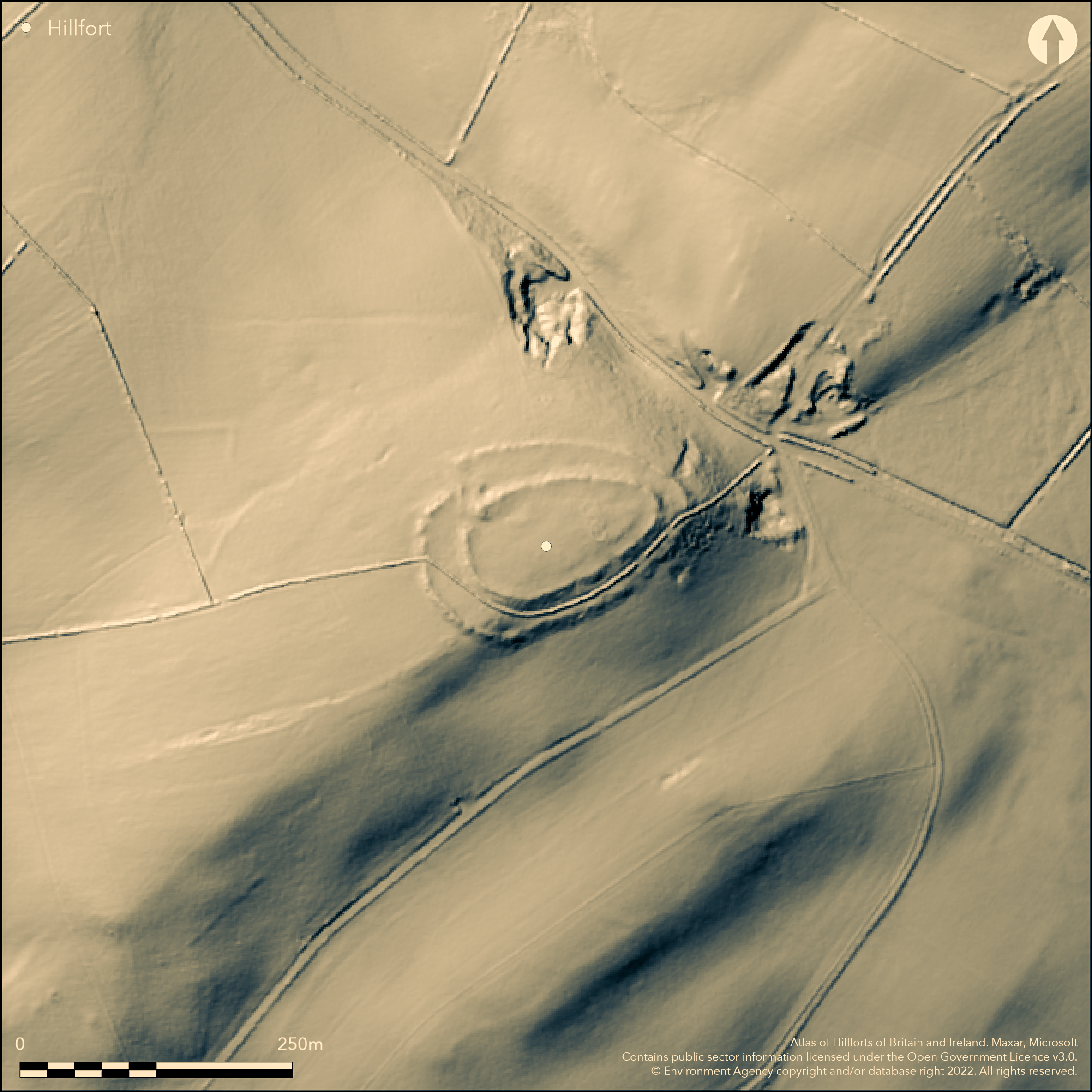
LiDAR 1m DTM Hillshade
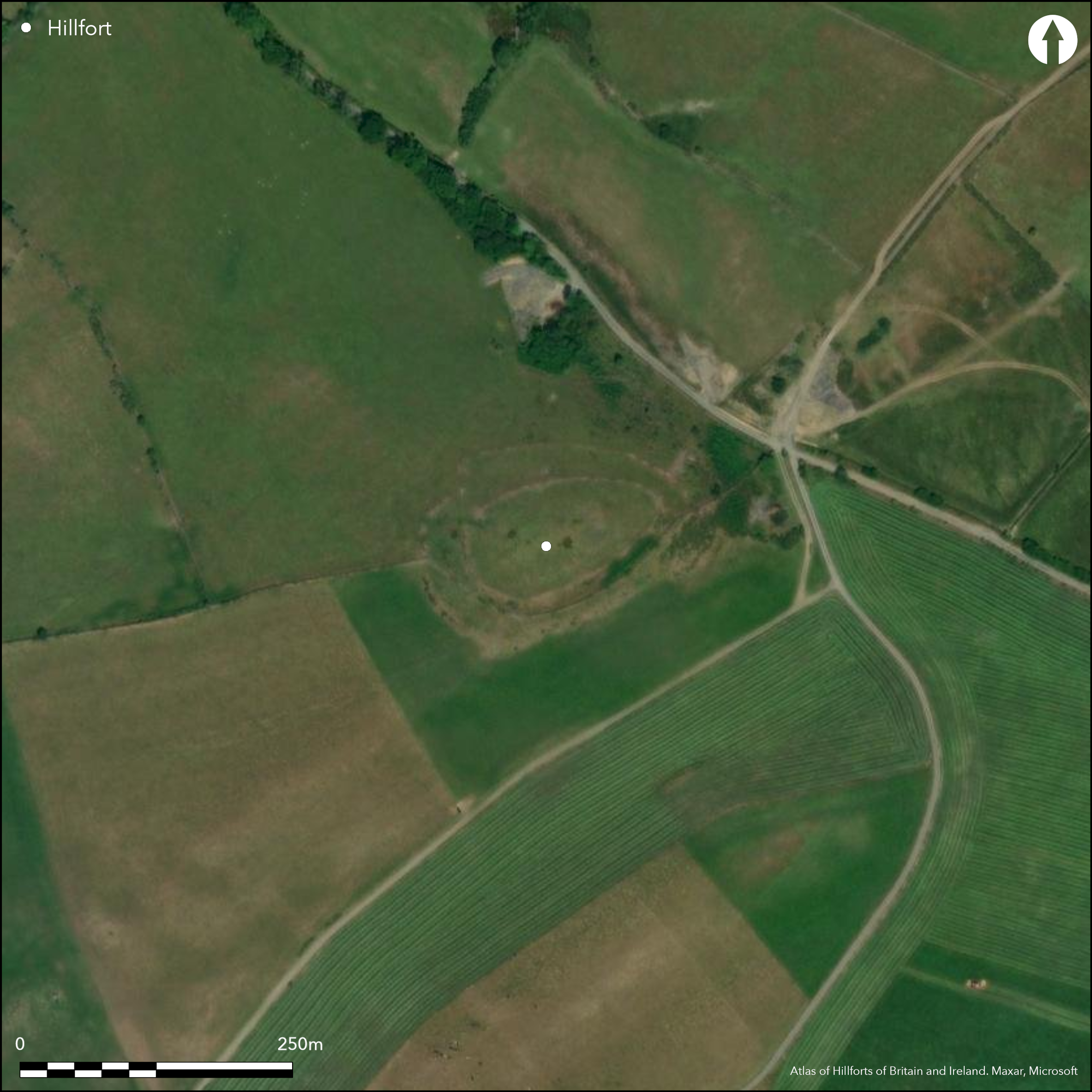
Satellite Imagery
LiDAR 1m DTM Hillshade
Satellite Imagery
Scroll left/right to view further images.
HER: Dyfed 4780 (None)
NMR: SN 55 NW 6 (300148)
SM: CD062
NGR: SN52835897
X: 252830 Y: 258970 (OSGB36)
A multiple enclosures hillfort, on SW-facing spur of isolated plateau above the Afon Aeron to SW and the Nant y Drindod to NW. Steep surrounding slopes, less on NE. Ovoid in shape, measuring c. 160m E-W by 110m overall, with total area 1.8ha and internal measurements as c. 110m ENE-WSW by 60m, with area c. 0.65ha. Defined by two widely separated banks without ditches. Inner bank to 2m high has quarry ditch inside. Outer circuit, c. 20m distant on W and NW, reduced to c. 10m elsewhere. Along SE, where the two circuits produce a distinctive terrace, it is visible in erosion features as a slab-faced wall. Counterscarp on NW. Inner NW-facing entrance. Outer entrance is set at a re-entrant on the NNW and offset from the inner. The E bank terminals of both entrances appear to have been expanded/enhanced. Holloway, probably contemporary, approaching hillfort entrance. Surface evidence of huts and quarry hollows in interior. Field system outside fort to NW. Rough grazing interior with some scrub on banks. On 1st Ed. OS map (1885-1900). Minimal investigations, undated.
Citizen Science: ✗
Reliability of Data: Confirmed
Reliability of Interpretation: Confirmed
X: -462571 Y: 6838042 (EPSG: 3857)
Longitude: -4.155349379553136 Latitude: 52.20921180100615 (EPSG:4326)
Country: Wales
Current County or Unitary Authority: Ceredigion
Historic County: Cardiganshire
Current Parish/Community/Council/Townland: Cilcennin
Fair conditton.
| Extant | ✓ |
| Cropmark | ✗ |
| Likely Destroyed | ✗ |
Rough grazing interior with some scrub on banks.
| Woodland | ✗ |
| Commercial Forestry Plantation | ✗ |
| Parkland | ✗ |
| Pasture (Grazing) | ✓ |
| Arable | ✗ |
| Scrub/Bracken | ✗ |
| Bare Outcrop | ✗ |
| Heather/Moorland | ✗ |
| Heath | ✗ |
| Built-up | ✗ |
| Coastal Grassland | ✗ |
| Other | ✗ |
Multiple enclosures hillfort, strategically sited on SW-facing spur of isolated plateau above the Afon Aeron to SW and the Nant y Drindod to NW. Steep surrounding slopes, less on NE.
| Contour Fort | ✗ |
| Partial Contour Fort | ✗ |
| Promontory Fort | ✗ |
| Hillslope Fort | ✗ |
| Level Terrain Fort | ✗ |
| Marsh Fort | ✗ |
| Multiple Enclosure Fort | ✓ |
| Hilltop | ✗ |
| Coastal Promontory | ✗ |
| Inland Promontory | ✗ |
| Valley Bottom | ✗ |
| Knoll/Hillock/Outcrop | ✗ |
| Ridge | ✗ |
| Cliff/Plateau-edge/Scarp | ✗ |
| Hillslope | ✗ |
| Lowland | ✗ |
| Spur | ✓ |
Dominant Topographic Feature: Spur
| North | ✗ |
| Northeast | ✗ |
| East | ✗ |
| Southeast | ✗ |
| South | ✗ |
| Southwest | ✗ |
| West | ✗ |
| Northwest | ✗ |
| Level | ✓ |
Altitude: 271.0m
N/A
None
Reliability: D - None
| Pre 1200BC | ✗ |
| 1200BC - 800BC | ✗ |
| 800BC - 400BC | ✗ |
| 400BC - AD50 | ✗ |
| AD50 - AD400 | ✗ |
| AD400 - AD 800 | ✗ |
| Post AD800 | ✗ |
| Unknown | ✓ |
| Pre Hillfort: | None |
| Post Hillfort: | Several later structures in interior, not defined and possibly modern.. |
On 1st Ed. OS map (1885-1900). RCAHMW aerial reconnaissance 1999. Cambria Archaeology defended enclosures survey 2006.
| Other (1999): | RCAHMW aerial reconnaissance. |
| Other (2006): | Cambria Archaeology defended enclosures survey. |
| 1st Identified Map Depiction (None): | None |
Footings of roundhouse. Quarry ditch inside inner bank. Aerial reconnaissance by RCAHMW 1999 shows tripartite internal hut. Possibly three overlapping rings representing different hut phases, or central hut with two accreted 'D'-shaped enclosures. Possible building platform.
None
| None | ✓ |
| Spring | ✗ |
| Stream | ✗ |
| Pool | ✗ |
| Flush | ✗ |
| Well | ✗ |
| Other | ✗ |
Inside, footings of a roundhouse, 6m diameter, surviving as low turf covered wall. Quarry ditch inside inner bank, 7m-10m across and most clearly defined on the SE, where its inner edge appears kerbed. Possible building platform c. 10m in diameter, across quarry ditch on E of NW-facing entrance.
| No Known Features | ✗ |
| Round Stone Structures | ✓ |
| Rectangular Stone Structures | ✗ |
| Curvilinear Platforms | ✓ |
| Other Roundhouse Evidence | ✗ |
| Pits | ✗ |
| Quarry Hollows | ✓ |
| Other | ✓ |
None
| No Known Excavation | ✓ |
| Pits | ✗ |
| Postholes | ✗ |
| Roundhouses | ✗ |
| Rectangular Structures | ✗ |
| Roads/Tracks | ✗ |
| Quarry Hollows | ✗ |
| Other | ✗ |
| Nothing Found | ✗ |
None
| No Known Geophysics | ✓ |
| Pits | ✗ |
| Roundhouses | ✗ |
| Rectangular Structures | ✗ |
| Roads/Tracks | ✗ |
| Quarry Hollows | ✗ |
| Other | ✗ |
| Nothing Found | ✗ |
None
| No Known Finds | ✓ |
| Pottery | ✗ |
| Metal | ✗ |
| Metalworking | ✗ |
| Human Bones | ✗ |
| Animal Bones | ✗ |
| Lithics | ✗ |
| Environmental | ✗ |
| Other | ✗ |
Aerial reconnaissance by RCAHMW 1999 shows tripartite internal hut. Possibly three overlapping rings representing different hut phases, or central hut with two accreted 'D'-shaped enclosures. AP shows well-marked holloway, probably contemporary, approaching hillfort entrance.
| APs Not Checked | ✗ |
| None | ✗ |
| Roundhouses | ✗ |
| Rectangular Structures | ✗ |
| Pits | ✗ |
| Postholes | ✗ |
| Roads/Tracks | ✗ |
| Other | ✓ |
Inner NW-facing entrance. Outer entrance is set at a re-entrant on the NNW and offset from the inner in zigzag fashion. The E bank terminals of both entrances appear to have been expanded/enhanced. Well-marked holloway, probably contemporary, approaching hillfort entrance.
| 2: | None |
| 2: | None |
Guard Chambers: ✗
Chevaux de Frise: ✗
| 1. Over-lapping (North west): | Zigzag inner entrance. |
| 2. Over-lapping (North west): | Zigzag outer entrance. |
| 2. Hollow Way (North west): | Hollow way. |
Defined by two widely separated banks without ditches to 2m high. Inner bank to 2m high has quarry ditch inside. Outer circuit, c. 20m distant on W and NW, reduced to c. 10m elsewhere. Along SE, where the two circuits produce a distinctive terrace, it is visible in erosion features as a slab-faced wall. Counterscarp on NW.
| Area 1: | 0.65ha. |
| Area 2: | 1.8ha. |
| Total: | 1.8ha. |
Total Footprint Area: Noneha.
None
| ✗ | None |
| ✓ | None |
| NE Quadrant: | 2 |
| SE Quadrant: | 2 |
| SW Quadrant: | 2 |
| NW Quadrant: | 2 |
| Total: | 2 |
| Partial Univallate | ✗ |
| Univallate | ✗ |
| Partial Bivallate | ✗ |
| Bivallate | ✓ |
| Partial Multivallate | ✗ |
| Multivallate | ✗ |
| Unknown | ✗ |
| Partial Univallate | ✗ |
| Univallate | ✗ |
| Partial Bivallate | ✗ |
| Bivallate | ✗ |
| Partial Multivallate | ✗ |
| Multivallate | ✗ |
Outer circuit visible as slab-faced wall on SE. Counterscarp on NW.
| None | ✗ |
| Earthen Bank | ✓ |
| Stone Wall | ✓ |
| Rubble | ✗ |
| Wall-walk | ✗ |
| Evidence of Timber | ✗ |
| Vitrification | ✗ |
| Other Burning | ✗ |
| Palisade | ✗ |
| Counter Scarp Bank | ✓ |
| Berm | ✗ |
| Unfinished | ✗ |
| Other | ✗ |
None
| None | ✗ |
| Earthen Bank | ✗ |
| Stone Wall | ✗ |
| Murus Duplex | ✗ |
| Timber-framed | ✗ |
| Timber-laced | ✗ |
| Vitrification | ✗ |
| Other Burning | ✗ |
| Palisade | ✗ |
| Counter Scarp Bank | ✗ |
| Berm | ✗ |
| Unfinished | ✗ |
| No Known Excavation | ✓ |
| Other | ✗ |
| ✗ | None |
| ✗ | No ditch visible. |
Number of Ditches: 0
| ✗ | None |
Murphy, K, Ramsey, R. and Page, M. 2006. A survey of defended enclosures in Ceredigion 2006: Gazetteer of Ordnance Survey Grid Squares SN54 and SN55, Project Report No. 2006/20, Project Record No. 54269, Llandeilo: Cambria Archaeology.
Atlas of Hillforts:
Wikidata:
This work is licensed under CC BY-SA 4.0

 and should be cited as:
Lock, Gary and Ralston, Ian. 2024. Atlas of Hillforts of Britain and Ireland. Available at: https://hillforts.arch.ox.ac.uk
Document Version 1.1