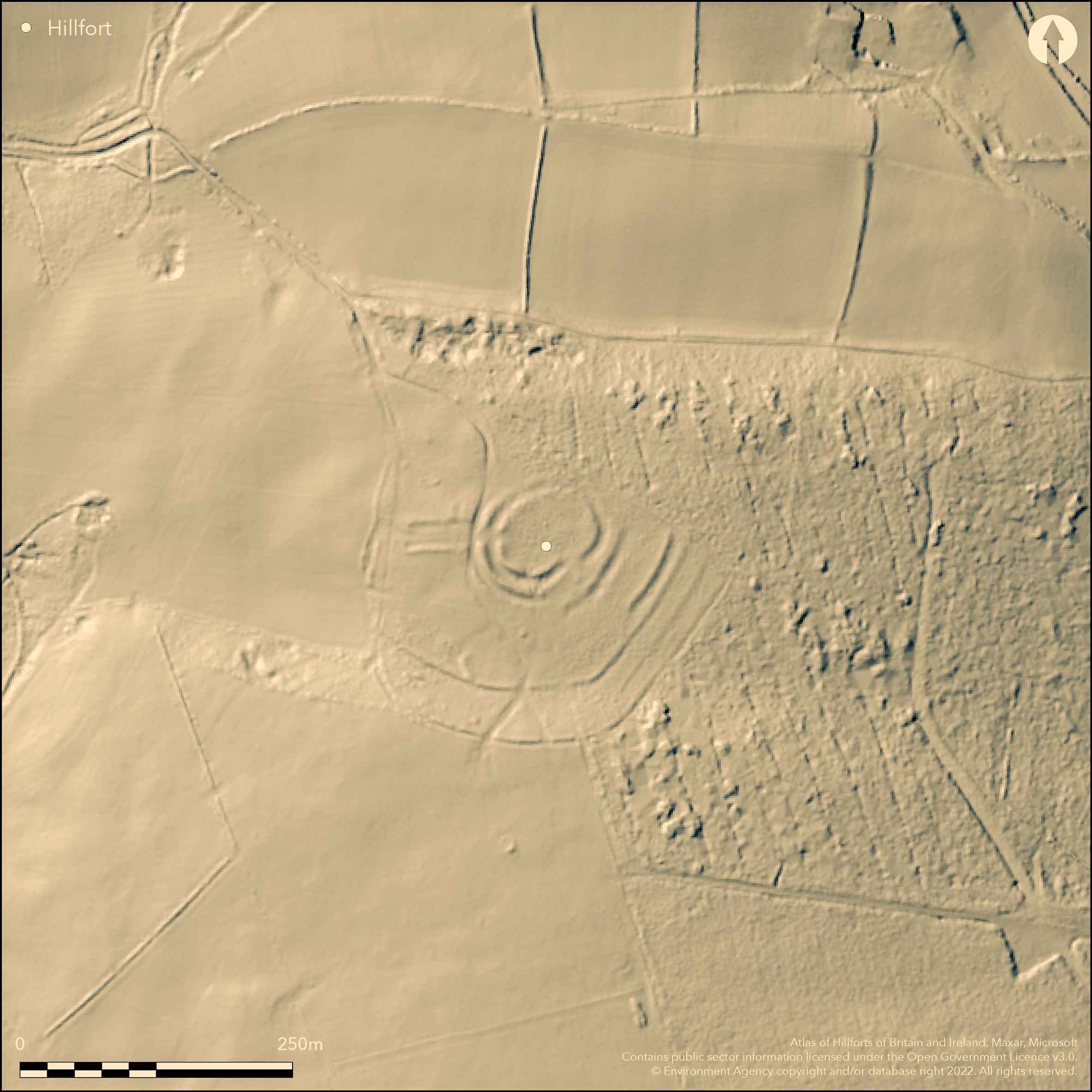
LiDAR 1m DTM Hillshade
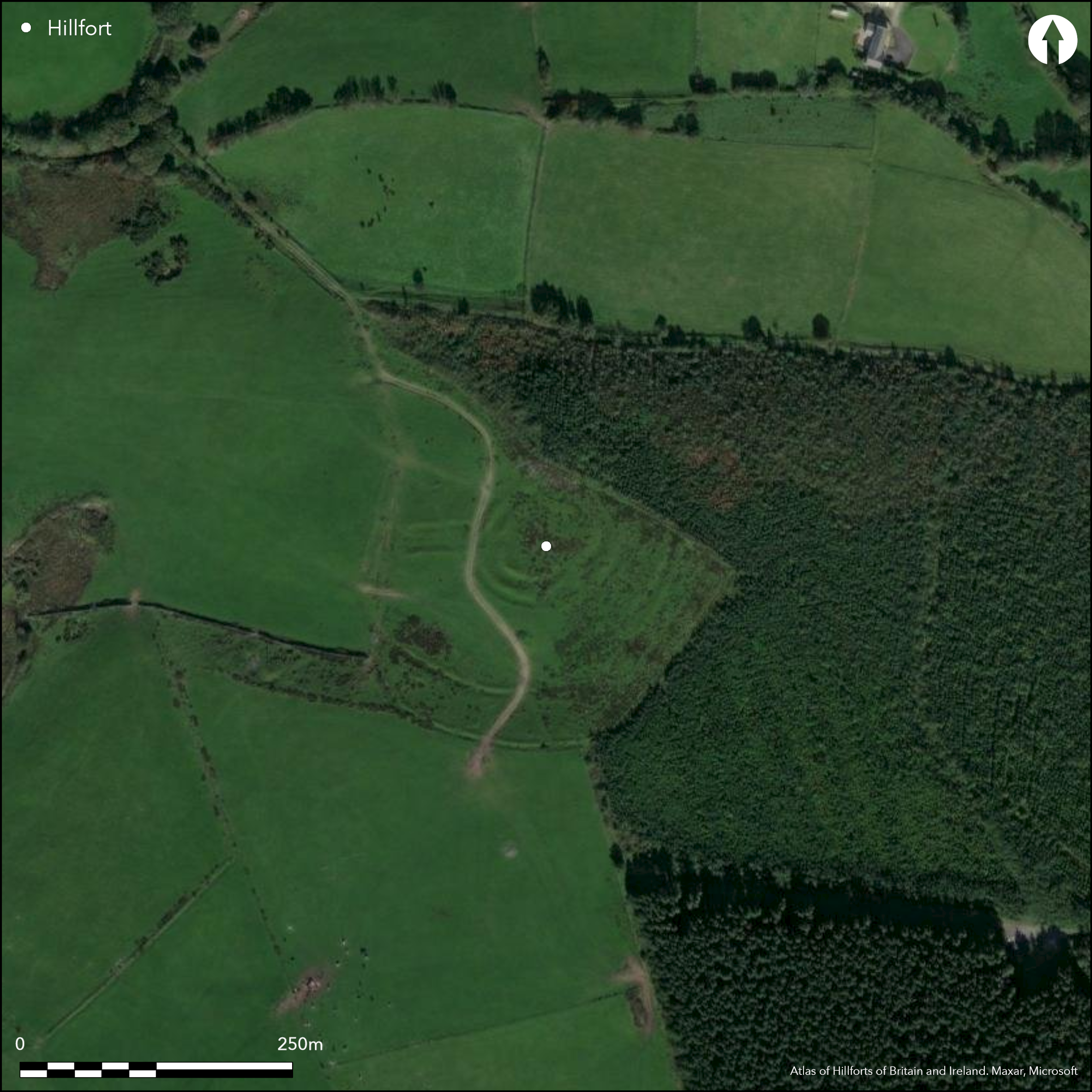
Satellite Imagery
LiDAR 1m DTM Hillshade
Satellite Imagery
Scroll left/right to view further images.
HER: Glamorgan Gwent 00651w (None)
NMR: SS 79 SE 32 (301316)
SM: GM055
NGR: SS76579425
X: 276570 Y: 194250 (OSGB36)
Complex, partial contour hillfort located on N slopes of Mynydd-y-Gaer above Margam Forest to E and W, Nant Gelli-gaer to NE and bifurcating streams of Pant Howel Ddu to NW and 3km E of Briton Ferry. 700m to S of Buarth y Gaer hillfort (Atlas No 2403). Steep surrounding slopes to N and W from 240m contour, to S and E ground rises steadily. Defined by 240m of ruinous rampart surrounding site, measuring c. 164m by 210m, with internal area c. 3.4ha. N outer banks destroyed by cultivation, giving D-shaped plan, but other remains well-preserved. In centre of shelf is oval enclosure, c. 55m by 30m of c. 0.1ha internal area defined by two banks and ditches with counterscarp, with total width c. 25m, suggesting either phasing or this is a multiple enclosure. Damaged and part-lost to N, circuits probably in place originally before cultivation intervened. Main entrance on W, with another on SE to give access from outer defences to inner enclosure, shown as diagonal gap through defences which here show change in direction. Outside this central enclosure, for distance, ground rises gently to slight intermediate bank, visible on S and E, but much damaged on W. Slight outer bank survives on S and E but elsewhere. Two slight additional lengths of bank on SE side run parallel to intermediate and outer banks to give six banks in total (including inner enclosure) for short distance. Also on S, short length of bank curves from intermediate bank towards inner enclosure. Function of these extra banks obscure. On W side, intermediate and outer banks possibly join, but there damage here with modern wall and field bank. From this present junction a hollow way, c. 3m wide, runs ENW for 14m towards inner enclosure passing between two low parallel inturned banks c. 12m apart to link up with entrance on W of central enclosure and joining counterscarp bank. Two small depressions, probably original, within the inturned ends. Complex arrangement with ceremonial overtones. On SW side five small cairns (4m wide by 0.6m high) between intermediate and outer banks. General rough pasture with juncus, suggesting poor drainage. On OS 2500 map 1918 (not 1st Ed.). Undated.
Citizen Science: ✗
Reliability of Data: Confirmed
Reliability of Interpretation: Confirmed
X: -421331 Y: 6734115 (EPSG: 3857)
Longitude: -3.784880214574781 Latitude: 51.633433699178795 (EPSG:4326)
Country: Wales
Current County or Unitary Authority: Neath Port Talbot
Historic County: Glamorgan
Current Parish/Community/Council/Townland: Briton Ferry
N outer banks destroyed by cultivation; other earthworks remains good condition.
| Extant | ✓ |
| Cropmark | ✗ |
| Likely Destroyed | ✓ |
Rough pasture with juncus.
| Woodland | ✗ |
| Commercial Forestry Plantation | ✗ |
| Parkland | ✗ |
| Pasture (Grazing) | ✓ |
| Arable | ✗ |
| Scrub/Bracken | ✓ |
| Bare Outcrop | ✗ |
| Heather/Moorland | ✗ |
| Heath | ✗ |
| Built-up | ✗ |
| Coastal Grassland | ✗ |
| Other | ✗ |
Partial contour hillfort, phased or multiple enclosure, located on a shelf at c. 250m O.D. on N slopes of Mynydd-y-Gaer above Margam Forest to E and W, Nant Gelli-gaer to NE and bifurcating streams of Pant Howel Ddu to NW and 3km E of Briton Ferry. Steep surrounding slopes to N and W from 240m contour, to S and E ground rises steadily.
| Contour Fort | ✗ |
| Partial Contour Fort | ✓ |
| Promontory Fort | ✗ |
| Hillslope Fort | ✗ |
| Level Terrain Fort | ✗ |
| Marsh Fort | ✗ |
| Multiple Enclosure Fort | ✓ |
| Hilltop | ✓ |
| Coastal Promontory | ✗ |
| Inland Promontory | ✗ |
| Valley Bottom | ✗ |
| Knoll/Hillock/Outcrop | ✗ |
| Ridge | ✗ |
| Cliff/Plateau-edge/Scarp | ✗ |
| Hillslope | ✗ |
| Lowland | ✗ |
| Spur | ✗ |
Dominant Topographic Feature: Hill top
| North | ✓ |
| Northeast | ✗ |
| East | ✗ |
| Southeast | ✗ |
| South | ✗ |
| Southwest | ✗ |
| West | ✗ |
| Northwest | ✗ |
| Level | ✗ |
Altitude: 250.0m
N/A
None
Reliability: D - None
| Pre 1200BC | ✗ |
| 1200BC - 800BC | ✗ |
| 800BC - 400BC | ✗ |
| 400BC - AD50 | ✗ |
| AD50 - AD400 | ✗ |
| AD400 - AD 800 | ✗ |
| Post AD800 | ✗ |
| Unknown | ✓ |
| Pre Hillfort: | Five cairns among the defences. |
| Post Hillfort: | None |
On OS map 2500 map 1918 (not 1st Ed.). RCAHMW investigation 1964. GGAT Prehistoric defended enclosures in Glamorgan survey 2005.
| Other (1918): | OS map. |
| Other (1964): | RCAHMW investigation. |
| Other (2005): | GGAT Prehistoric defended enclosures in Glamorgan survey. |
None
Juncus suggests poor drainage and possible water supply on site.
| None | ✗ |
| Spring | ✗ |
| Stream | ✗ |
| Pool | ✗ |
| Flush | ✗ |
| Well | ✗ |
| Other | ✓ |
Two small depressions, probably original, within the inturned ends of entrance on W of central enclosure, but of unknown function.
| No Known Features | ✓ |
| Round Stone Structures | ✗ |
| Rectangular Stone Structures | ✗ |
| Curvilinear Platforms | ✗ |
| Other Roundhouse Evidence | ✗ |
| Pits | ✗ |
| Quarry Hollows | ✗ |
| Other | ✓ |
None
| No Known Excavation | ✓ |
| Pits | ✗ |
| Postholes | ✗ |
| Roundhouses | ✗ |
| Rectangular Structures | ✗ |
| Roads/Tracks | ✗ |
| Quarry Hollows | ✗ |
| Other | ✗ |
| Nothing Found | ✗ |
None
| No Known Geophysics | ✓ |
| Pits | ✗ |
| Roundhouses | ✗ |
| Rectangular Structures | ✗ |
| Roads/Tracks | ✗ |
| Quarry Hollows | ✗ |
| Other | ✗ |
| Nothing Found | ✗ |
None
| No Known Finds | ✓ |
| Pottery | ✗ |
| Metal | ✗ |
| Metalworking | ✗ |
| Human Bones | ✗ |
| Animal Bones | ✗ |
| Lithics | ✗ |
| Environmental | ✗ |
| Other | ✗ |
None
| APs Not Checked | ✓ |
| None | ✗ |
| Roundhouses | ✗ |
| Rectangular Structures | ✗ |
| Pits | ✗ |
| Postholes | ✗ |
| Roads/Tracks | ✗ |
| Other | ✗ |
Main entrance of inner enclosure on W, with another on SE to give access from outer defences to inner enclosure, shown as a diagonal or oblique gap through defences which here show change in direction. On W side, the intermediate and outer banks seem to join, but there is damage here with modern wall and field bank. However, from this present junction, a hollow way c. 3m wide runs ENW for 14m towards inner enclosure passing between two low parallel inturned banks c. 12 apart to link up with the entrance on the W of the central enclosure and joining the counterscarp bank.There are two small pits, probably original, within in the inturned ends.
| 5: | Three modern gaps to S. |
| 2: | None |
Guard Chambers: ✗
Chevaux de Frise: ✗
| 1. Simple Gap (West): | Entrance to inner enclosure. |
| 2. Oblique (South east): | Another entrance on SE to give access from outer defences to inner enclosure, shown as a diagonal or oblique gap through defences which here show change in direction. |
Inner enclosure, c. 55m by 30m of c. 0.1ha internal area and defined by two banks and ditches with counterscarp, with total width of c.25m. Damaged and part lost to N, its circuits were probably in place originally before cultivation intervened. Outside this central enclosure,for a distance the ground rises gently to a slight intermediate bank, visible on the S and E, but much damaged on W. A slight outer bank survives on S and E but not other sides. Two slight additional lengths of bank on the SE side run parallel to the intermediate and outer banks to give six banks in total (including inner enclosure) for a short distance here. Also on S, short length of bank curves from intermediate bank towards inner enclosure. The function of these extra banks is obscure. On W side, the intermediate and outer banks seem to coalesc, but there is damage here with modern wall and field bank.
| Area 1: | 0.1ha. |
| Area 2: | 3.4ha. |
| Total: | 3.4ha. |
Total Footprint Area: Noneha.
None
| ✓ | Possibly phased or multiple enclosure. Inner enclosure 0.1ha, outer enclosure area c. 3.4ha. |
| ✗ | Complex and quadrants estimated. Outer ramparts lost to N. |
| NE Quadrant: | 0 |
| SE Quadrant: | 6 |
| SW Quadrant: | 4 |
| NW Quadrant: | 1 |
| Total: | 6 |
| Partial Univallate | ✓ |
| Univallate | ✗ |
| Partial Bivallate | ✗ |
| Bivallate | ✗ |
| Partial Multivallate | ✓ |
| Multivallate | ✗ |
| Unknown | ✗ |
| Partial Univallate | ✗ |
| Univallate | ✗ |
| Partial Bivallate | ✗ |
| Bivallate | ✓ |
| Partial Multivallate | ✗ |
| Multivallate | ✗ |
Probably rubble banks.
| None | ✗ |
| Earthen Bank | ✗ |
| Stone Wall | ✗ |
| Rubble | ✓ |
| Wall-walk | ✗ |
| Evidence of Timber | ✗ |
| Vitrification | ✗ |
| Other Burning | ✗ |
| Palisade | ✗ |
| Counter Scarp Bank | ✓ |
| Berm | ✗ |
| Unfinished | ✗ |
| Other | ✗ |
None
| None | ✗ |
| Earthen Bank | ✗ |
| Stone Wall | ✗ |
| Murus Duplex | ✗ |
| Timber-framed | ✗ |
| Timber-laced | ✗ |
| Vitrification | ✗ |
| Other Burning | ✗ |
| Palisade | ✗ |
| Counter Scarp Bank | ✗ |
| Berm | ✗ |
| Unfinished | ✗ |
| No Known Excavation | ✓ |
| Other | ✗ |
| ✗ | N outer ramparts gone. |
| ✓ | Two ditches defined, probably more as buried features. |
Number of Ditches: 2
| ✗ | None |
Gerrard, C., Wiggins, H., and Evans, E. 2006. Prehistoric defended enclosures in Glamorgan with recommendations for fieldwork: Year 3 Report, GGAT Report No. 2006/089, Project No. GGAT78, Swansea: GGAT
RCAHMW 1976. An inventory of the ancient monuments in Glamorgan, Vol I: Pre-Norman, Part II The Iron Age and the Roman occupation, No. 690, Cardiff: HMSO.
Atlas of Hillforts:
Wikidata:
This work is licensed under CC BY-SA 4.0

 and should be cited as:
Lock, Gary and Ralston, Ian. 2024. Atlas of Hillforts of Britain and Ireland. Available at: https://hillforts.arch.ox.ac.uk
Document Version 1.1