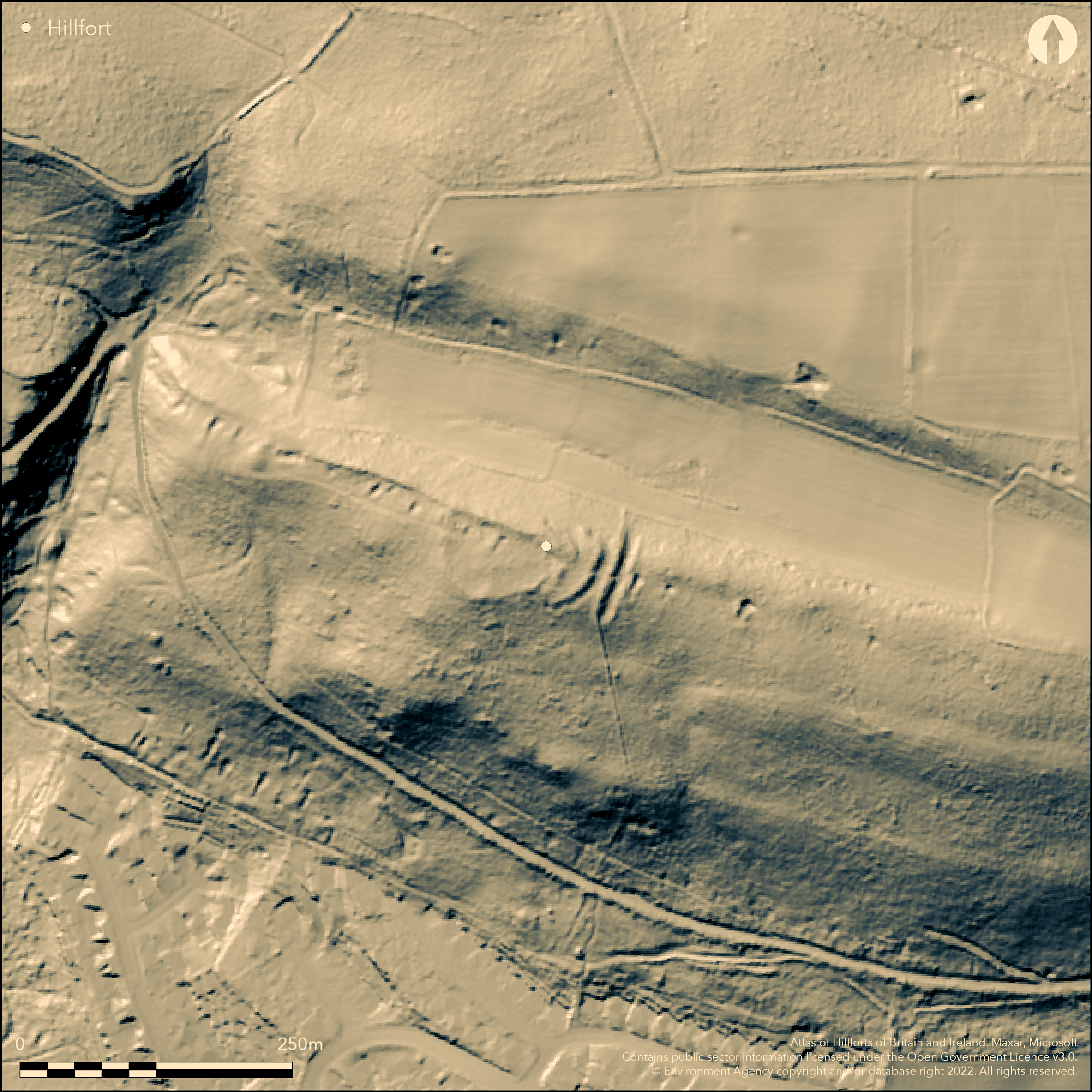
LiDAR 1m DTM Hillshade
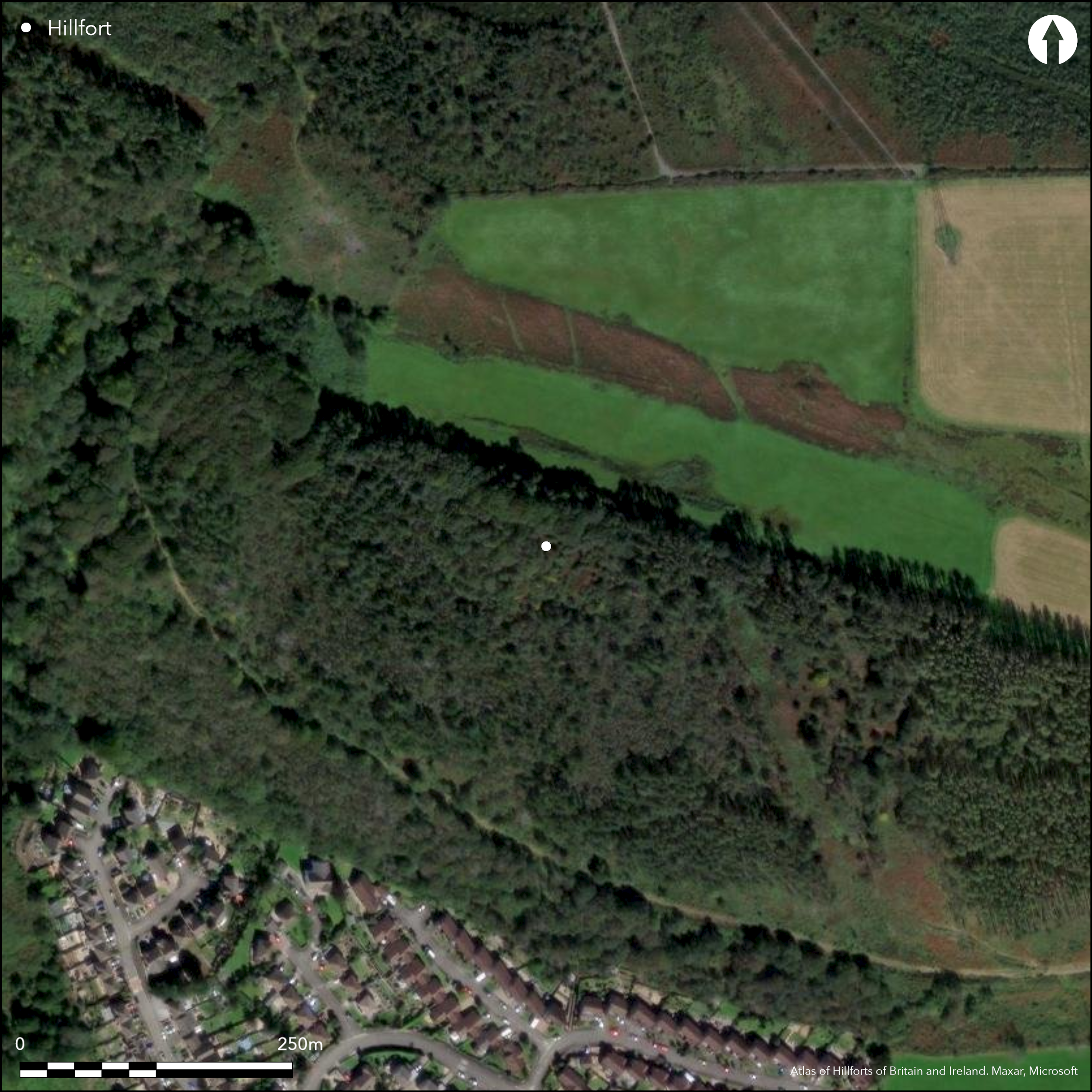
Satellite Imagery
LiDAR 1m DTM Hillshade
Satellite Imagery
Scroll left/right to view further images.
HER: Glamorgan Gwent 00652w (None)
NMR: SS 79 SE 4 (301313)
SM: GM263
NGR: SS75659338
X: 275650 Y: 193380 (OSGB36)
Small strong partial contour hillfort located on a narrow steep-sided spur on the SW slopes of Mynydd y Gaer within Briton Ferry Woods above Baglan Heights and overlooking Baglan to NE Defined by ruinous rubble wall following the complete circuit to form enclosure measuring c. 65m E-W by 40m N-S and enclosing 0.2ha. Hardly visible on S side but, on N, where follows spine of ridge, shows as spread of stones and rubble up to 9m wide and 2.5m on inner face. Entrance gap c. 3m wide towards tip of spur on NW, where rampart terminals seem thickened with hint of inturn. Another gap on E side may also be an entrance. To E end of enclosure two additional outer banks and ditches, the first, or middle, bank separated from inner circuit described above by some 6-20m with shallow ditch for some 10m to N. Middle bank slightly curved with ditch, c. 10m overall and to 2m high. Gap to just N of centre. Outermost rampart straight with ditch, c. 12m wide and to 2m high overall with short length of counterscarp at end. This outer rampart is unbroken and, without an entrance gap, cuts off access into the interior as suggested by RCAHMW (1976, 48), similar to the later additions at Dinas Powys dated to 12th century AD; thus it is possibly a later addition to an original site comprising the two inner ramparts and E entrance. Heavily overgrown with scrub and young trees. Internal features probably test cuts for minerals. On OS 1:2500 map 1919 (not 1st Ed.). Minimal investigations, undated.
Citizen Science: ✗
Reliability of Data: Confirmed
Reliability of Interpretation: Confirmed
X: -422776 Y: 6732677 (EPSG: 3857)
Longitude: -3.79785727986411 Latitude: 51.62541222923089 (EPSG:4326)
Country: Wales
Current County or Unitary Authority: Neath Port Talbot
Historic County: Glamorgan
Current Parish/Community/Council/Townland: Baglan
Near intact, although walls ruinous.
| Extant | ✓ |
| Cropmark | ✗ |
| Likely Destroyed | ✗ |
Heavily overgrown with scrub and young trees. Mining trial cuts.
| Woodland | ✓ |
| Commercial Forestry Plantation | ✗ |
| Parkland | ✗ |
| Pasture (Grazing) | ✗ |
| Arable | ✗ |
| Scrub/Bracken | ✓ |
| Bare Outcrop | ✗ |
| Heather/Moorland | ✗ |
| Heath | ✗ |
| Built-up | ✗ |
| Coastal Grassland | ✗ |
| Other | ✓ |
Small strong partial contour hillfort located on a narrow steep-sided spur on the SW slopes of Mynydd y Gaer wityhin Briton Ferry Woods above Baglan Heights and overlooking Baglan to NE.
| Contour Fort | ✗ |
| Partial Contour Fort | ✓ |
| Promontory Fort | ✗ |
| Hillslope Fort | ✗ |
| Level Terrain Fort | ✗ |
| Marsh Fort | ✗ |
| Multiple Enclosure Fort | ✗ |
| Hilltop | ✗ |
| Coastal Promontory | ✗ |
| Inland Promontory | ✗ |
| Valley Bottom | ✗ |
| Knoll/Hillock/Outcrop | ✗ |
| Ridge | ✗ |
| Cliff/Plateau-edge/Scarp | ✗ |
| Hillslope | ✗ |
| Lowland | ✗ |
| Spur | ✓ |
Dominant Topographic Feature: Spur
| North | ✗ |
| Northeast | ✗ |
| East | ✗ |
| Southeast | ✗ |
| South | ✗ |
| Southwest | ✓ |
| West | ✗ |
| Northwest | ✗ |
| Level | ✗ |
Altitude: 210.0m
N/A
None
Reliability: D - None
| Pre 1200BC | ✗ |
| 1200BC - 800BC | ✗ |
| 800BC - 400BC | ✗ |
| 400BC - AD50 | ✗ |
| AD50 - AD400 | ✗ |
| AD400 - AD 800 | ✗ |
| Post AD800 | ✗ |
| Unknown | ✓ |
| Pre Hillfort: | None |
| Post Hillfort: | Mining trial cuts. |
On OS 1:2500 map 1919 (not 1st Ed.). RCAHMW investigation 1964. GGAT Prehistoric defended enclosures in Glamorgan survey 2005.
| 1st Identified Map Depiction (1919): | OS map. |
| Other (1964): | RCAHMW investigation. |
| Other (2005): | GGAT Prehistoric defended enclosures in Glamorgan survey. |
Mining trial cuts outside outer bank to E and in interior.
None
| None | ✓ |
| Spring | ✗ |
| Stream | ✗ |
| Pool | ✗ |
| Flush | ✗ |
| Well | ✗ |
| Other | ✗ |
None
| No Known Features | ✓ |
| Round Stone Structures | ✗ |
| Rectangular Stone Structures | ✗ |
| Curvilinear Platforms | ✗ |
| Other Roundhouse Evidence | ✗ |
| Pits | ✗ |
| Quarry Hollows | ✗ |
| Other | ✗ |
None
| No Known Excavation | ✓ |
| Pits | ✗ |
| Postholes | ✗ |
| Roundhouses | ✗ |
| Rectangular Structures | ✗ |
| Roads/Tracks | ✗ |
| Quarry Hollows | ✗ |
| Other | ✗ |
| Nothing Found | ✗ |
None
| No Known Geophysics | ✓ |
| Pits | ✗ |
| Roundhouses | ✗ |
| Rectangular Structures | ✗ |
| Roads/Tracks | ✗ |
| Quarry Hollows | ✗ |
| Other | ✗ |
| Nothing Found | ✗ |
None
| No Known Finds | ✓ |
| Pottery | ✗ |
| Metal | ✗ |
| Metalworking | ✗ |
| Human Bones | ✗ |
| Animal Bones | ✗ |
| Lithics | ✗ |
| Environmental | ✗ |
| Other | ✗ |
None
| APs Not Checked | ✓ |
| None | ✗ |
| Roundhouses | ✗ |
| Rectangular Structures | ✗ |
| Pits | ✗ |
| Postholes | ✗ |
| Roads/Tracks | ✗ |
| Other | ✗ |
Entrance gap c. 3m wide towards tip of spur on NW, where rampart terminals seem thickened with hint of inturn. Another gap on E side may also be an entrance.
| 2: | None |
| 2: | Possible. |
Guard Chambers: ✗
Chevaux de Frise: ✗
| 1. In-turned (North west): | None |
| 2. Simple Gap (East): | Possible only. |
Defined by ruinous rubble wall following the complete circuit to form enclosure measuring c. 65m E-W by 40m N-S and enclosing 0.2ha. Hardly visible on S side but, on N, where follows spine of ridge, shows as spread of stones and rubble up to 9m wide and 2.5m on inner face. To E end of enclosure two additional outer banks and ditches, the first, or middle, bank separated from inner circuit described above by some 6-20m with shallow ditch for some 10m to N. Middle bank slightly curved with ditch, c. 10m overall and to 2m high. Outermost rampart straight with ditch, c. 12 wide and to 2m high overall with short length of counterscarp at end.
| Area 1: | 0.2ha. |
| Total: | 0.2ha. |
Total Footprint Area: Noneha.
None
| ✓ | Outermost rampart straight with ditch, c. 12m wide and to 2m high overall with short length of counterscarp at end. This outer rampart is unbroken and, without an entrance gap, cuts off access into the interior as suggested by RCAHMW (1976, 48), similar to the later additions at Dinas Powys dated to 12th century AD; thus it is possibly a later addition to an original site comprising the two inner ramparts and E entrance. |
| ✓ | Inner bank shows complete circuit of ruinous walls. |
| NE Quadrant: | 3 |
| SE Quadrant: | 3 |
| SW Quadrant: | 1 |
| NW Quadrant: | 1 |
| Total: | 3 |
| Partial Univallate | ✓ |
| Univallate | ✗ |
| Partial Bivallate | ✗ |
| Bivallate | ✗ |
| Partial Multivallate | ✓ |
| Multivallate | ✗ |
| Unknown | ✗ |
| Partial Univallate | ✗ |
| Univallate | ✗ |
| Partial Bivallate | ✓ |
| Bivallate | ✗ |
| Partial Multivallate | ✗ |
| Multivallate | ✗ |
Rubble walls. Short length of counterscarp to outer rampart.
| None | ✗ |
| Earthen Bank | ✗ |
| Stone Wall | ✗ |
| Rubble | ✓ |
| Wall-walk | ✗ |
| Evidence of Timber | ✗ |
| Vitrification | ✗ |
| Other Burning | ✗ |
| Palisade | ✗ |
| Counter Scarp Bank | ✓ |
| Berm | ✗ |
| Unfinished | ✗ |
| Other | ✗ |
None
| None | ✗ |
| Earthen Bank | ✗ |
| Stone Wall | ✗ |
| Murus Duplex | ✗ |
| Timber-framed | ✗ |
| Timber-laced | ✗ |
| Vitrification | ✗ |
| Other Burning | ✗ |
| Palisade | ✗ |
| Counter Scarp Bank | ✗ |
| Berm | ✗ |
| Unfinished | ✗ |
| No Known Excavation | ✓ |
| Other | ✗ |
| ✗ | None |
| ✓ | None |
Number of Ditches: 2
| ✗ | None |
Gerrard, C., Wiggins, H., and Evans, E. 2006. Prehistoric defended enclosures in Glamorgan with recommendations for fieldwork: Year 3 Report, GGAT Report No. 2006/089, Project No. GGAT78, Swansea: GGAT
RCAHMW 1976. An inventory of the ancient monuments in Glamorgan, Vol I: Pre-Norman, Part II The Iron Age and the Roman occupation, No. 678, Cardiff: HMSO.
Atlas of Hillforts:
Wikidata:
This work is licensed under CC BY-SA 4.0

 and should be cited as:
Lock, Gary and Ralston, Ian. 2024. Atlas of Hillforts of Britain and Ireland. Available at: https://hillforts.arch.ox.ac.uk
Document Version 1.1