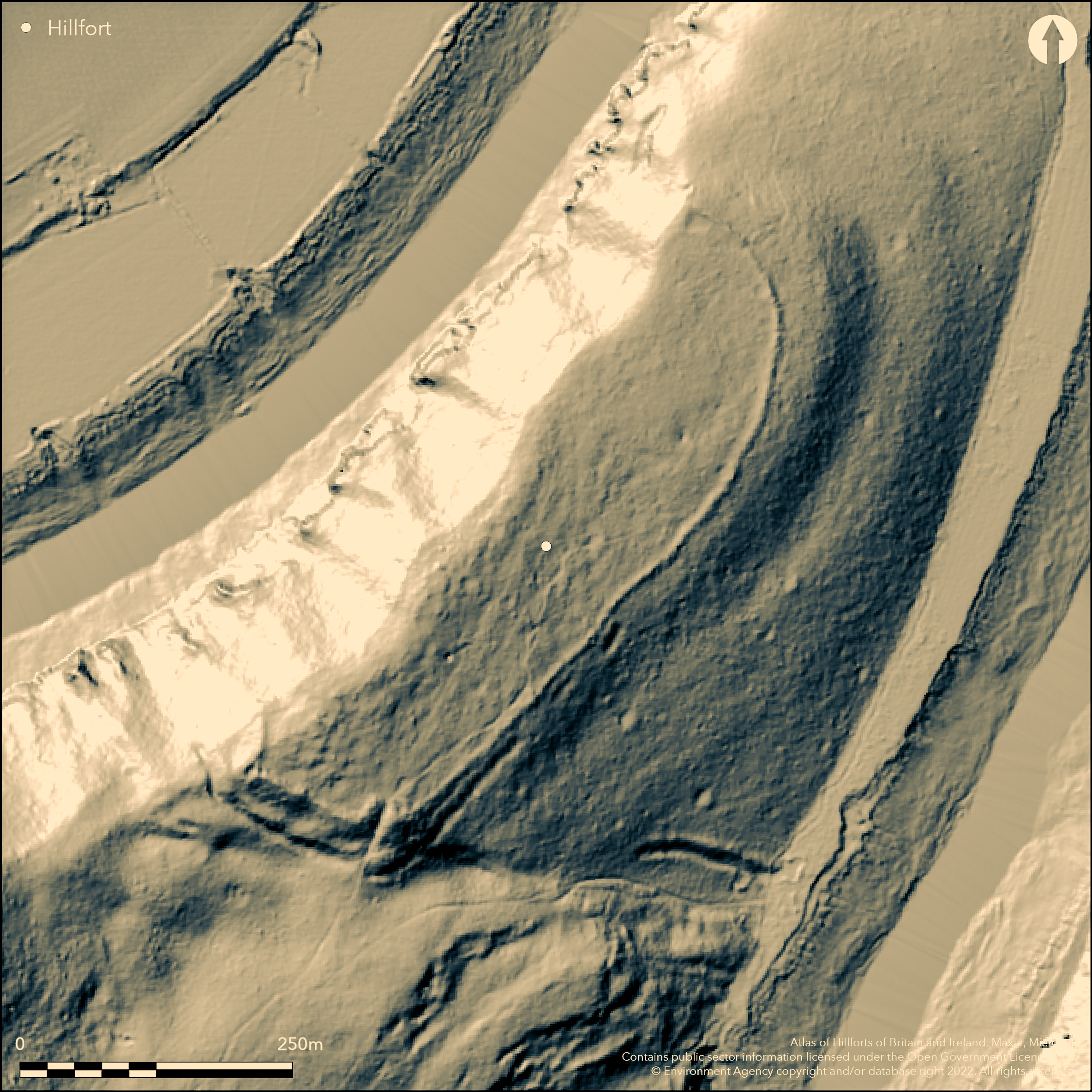
LiDAR 1m DTM Hillshade
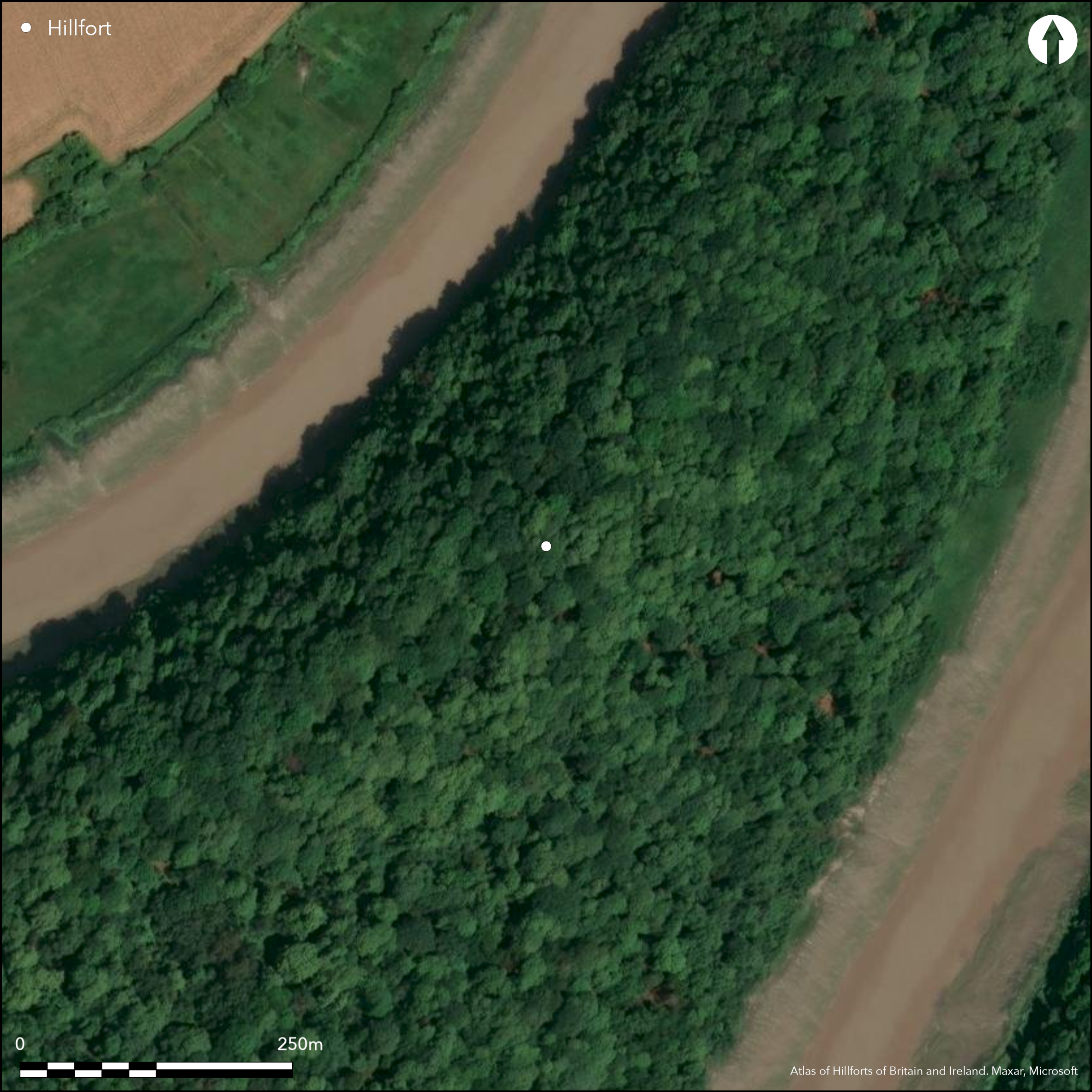
Satellite Imagery
LiDAR 1m DTM Hillshade
Satellite Imagery
Scroll left/right to view further images.
HER: Glamorgan Gwent 00772g (None)
NMR: ST 59 NW (307998)
SM: MM020B
NGR: ST53639596
X: 353630 Y: 195960 (OSGB36)
Oblong contour hillfort located on a prominent spur and strategically placed on precipitous and rocky slopes, forming its N boundary, directly above a significant bend of the River Wye, to dominate the river. Adjacent to Piercefield Little Camp to W, with which there could be a connection. Densely wooded in common with many of the major sites along this part of the Wye. Probable erosion of the cliffs above the river have taken some of the site. N, E and W sides precipitous slopes to river. Moderate slopes to SW. Nothing on NW where precipitous Piercefield Cliffs. Measures c. 388m by 110m with internal area of 4.16ha. Impressive two banks with medial ditches of main defence on SW side, where the ground slopes away less steeply. Outside the inner bank on SW is shallow ditch c. 1m deep on the outside, continues round the end, becoming narrower and peters out before the scarp. Outer bank of earth, with a very slight internal height and external height of 2.5m. Outside is a ditch c. 2m wide and 1.5m deep on the outside. These continue almost to edge of the scarp but stop, leaving a narrow neck. On the long SE side bank or wall now reduced to a low band of tumbled stone c. 5-6m wide. Berm in evidence. Entrance situated in S corner, with passage formed by return of the bank to E and W. Causeway leads through the ditch, followed by a recent, but now largely disused, path which appears as a slight hollow way inside the camp. On 1st Ed. OS map (1881-82). Minimal investigations, undated.
Citizen Science: ✗
Reliability of Data: Confirmed
Reliability of Interpretation: Confirmed
X: -297424 Y: 6738962 (EPSG: 3857)
Longitude: -2.67180140944349 Latitude: 51.66045392707974 (EPSG:4326)
Country: Wales
Current County or Unitary Authority: Monmouth
Historic County: Monmouthshire
Current Parish/Community/Council/Townland: St Arvans
Probable erosion of the cliffs above the river have taken some of the site.
| Extant | ✓ |
| Cropmark | ✗ |
| Likely Destroyed | ✗ |
Now densely wooded, in common with many of the major sites along this part of the Wye.
| Woodland | ✓ |
| Commercial Forestry Plantation | ✗ |
| Parkland | ✗ |
| Pasture (Grazing) | ✗ |
| Arable | ✗ |
| Scrub/Bracken | ✗ |
| Bare Outcrop | ✗ |
| Heather/Moorland | ✗ |
| Heath | ✗ |
| Built-up | ✗ |
| Coastal Grassland | ✗ |
| Other | ✗ |
Oblong contour hillfort located on a spur and strategically placed on precipitous and rocky slopes, forming its N boundary directly above a significant bend of the River Wye, to dominate the river. N, E and W sides precipitous slopes to river. Moderate slopes to SW.
| Contour Fort | ✗ |
| Partial Contour Fort | ✓ |
| Promontory Fort | ✗ |
| Hillslope Fort | ✗ |
| Level Terrain Fort | ✗ |
| Marsh Fort | ✗ |
| Multiple Enclosure Fort | ✗ |
| Hilltop | ✗ |
| Coastal Promontory | ✗ |
| Inland Promontory | ✗ |
| Valley Bottom | ✗ |
| Knoll/Hillock/Outcrop | ✗ |
| Ridge | ✗ |
| Cliff/Plateau-edge/Scarp | ✗ |
| Hillslope | ✗ |
| Lowland | ✗ |
| Spur | ✓ |
Dominant Topographic Feature: Spur
| North | ✗ |
| Northeast | ✗ |
| East | ✗ |
| Southeast | ✗ |
| South | ✗ |
| Southwest | ✗ |
| West | ✗ |
| Northwest | ✗ |
| Level | ✓ |
Altitude: 75.0m
N/A
None
Reliability: D - None
| Pre 1200BC | ✗ |
| 1200BC - 800BC | ✗ |
| 800BC - 400BC | ✗ |
| 400BC - AD50 | ✗ |
| AD50 - AD400 | ✗ |
| AD400 - AD 800 | ✗ |
| Post AD800 | ✗ |
| Unknown | ✓ |
| Pre Hillfort: | None |
| Post Hillfort: | None |
On 1st Ed. OS map (1881-82). GGAT Prehistoric defended enclosures in Glamorgan survey 2005.
| Other (2005): | GGAT Prehistoric defended enclosures in Glamorgan survey. |
| 1st Identified Map Depiction (None): | OS map. |
None
River Wye 0.02km directly below fort.
| None | ✓ |
| Spring | ✗ |
| Stream | ✗ |
| Pool | ✗ |
| Flush | ✗ |
| Well | ✗ |
| Other | ✗ |
None
| No Known Features | ✓ |
| Round Stone Structures | ✗ |
| Rectangular Stone Structures | ✗ |
| Curvilinear Platforms | ✗ |
| Other Roundhouse Evidence | ✗ |
| Pits | ✗ |
| Quarry Hollows | ✗ |
| Other | ✗ |
None
| No Known Excavation | ✓ |
| Pits | ✗ |
| Postholes | ✗ |
| Roundhouses | ✗ |
| Rectangular Structures | ✗ |
| Roads/Tracks | ✗ |
| Quarry Hollows | ✗ |
| Other | ✗ |
| Nothing Found | ✗ |
None
| No Known Geophysics | ✓ |
| Pits | ✗ |
| Roundhouses | ✗ |
| Rectangular Structures | ✗ |
| Roads/Tracks | ✗ |
| Quarry Hollows | ✗ |
| Other | ✗ |
| Nothing Found | ✗ |
None
| No Known Finds | ✓ |
| Pottery | ✗ |
| Metal | ✗ |
| Metalworking | ✗ |
| Human Bones | ✗ |
| Animal Bones | ✗ |
| Lithics | ✗ |
| Environmental | ✗ |
| Other | ✗ |
None
| APs Not Checked | ✓ |
| None | ✗ |
| Roundhouses | ✗ |
| Rectangular Structures | ✗ |
| Pits | ✗ |
| Postholes | ✗ |
| Roads/Tracks | ✗ |
| Other | ✗ |
Entrance situated in S corner with passage formed by return of the bank to E and W. Causeway leads through the ditch, followed by a recent, but now largely disused, path which appears as a slight hollow way inside the camp. Possibly guard chamber on promontory, but uncertain.
| 1: | None |
| 2: | None |
Guard Chambers: ✓
Chevaux de Frise: ✗
| 1. In-turned (South): | Causewayed. |
| 1. Passage-way/Corridor (South): | Causewayed. |
| 1. Recesses/Guard Chambers (South): | Uncerain. |
Impressive three banks with medial ditches of main defence on SW side, where the ground slopes away less steeply. On the long SE side reduced bank or wall of low band of tumbled stone c. 5-6m wide. Berm.
| Area 1: | 4.16ha. |
| Total: | 4.16ha. |
Total Footprint Area: Noneha.
None
| ✗ | None |
| ✗ | None |
| NE Quadrant: | 1 |
| SE Quadrant: | 1 |
| SW Quadrant: | 2 |
| NW Quadrant: | 0 |
| Total: | 2 |
| Partial Univallate | ✓ |
| Univallate | ✗ |
| Partial Bivallate | ✓ |
| Bivallate | ✗ |
| Partial Multivallate | ✗ |
| Multivallate | ✗ |
| Unknown | ✗ |
| Partial Univallate | ✗ |
| Univallate | ✗ |
| Partial Bivallate | ✗ |
| Bivallate | ✗ |
| Partial Multivallate | ✗ |
| Multivallate | ✗ |
Banks composed of large angular stone or earth. Berm in evidence.
| None | ✗ |
| Earthen Bank | ✓ |
| Stone Wall | ✗ |
| Rubble | ✓ |
| Wall-walk | ✗ |
| Evidence of Timber | ✗ |
| Vitrification | ✗ |
| Other Burning | ✗ |
| Palisade | ✗ |
| Counter Scarp Bank | ✗ |
| Berm | ✓ |
| Unfinished | ✗ |
| Other | ✗ |
None
| None | ✗ |
| Earthen Bank | ✗ |
| Stone Wall | ✗ |
| Murus Duplex | ✗ |
| Timber-framed | ✗ |
| Timber-laced | ✗ |
| Vitrification | ✗ |
| Other Burning | ✗ |
| Palisade | ✗ |
| Counter Scarp Bank | ✗ |
| Berm | ✗ |
| Unfinished | ✗ |
| No Known Excavation | ✓ |
| Other | ✗ |
| ✗ | NW defences are steep cliffs. |
| ✓ | None |
Number of Ditches: 2
| ✗ | None |
Gerrard, C., Wiggins, H., and Evans, E. 2006. Prehistoric defended enclosures in Glamorgan with recommendations for fieldwork: Year 3 Report, GGAT Report No. 2006/089, Project No. GGAT78, Swansea: GGAT.
Savory, H.N. 1950. List of hill-fort and other earthworks in Wales, II. Monmouthshire, Bull Board Celtic Stud, 13, 233.
Atlas of Hillforts:
Wikidata:
This work is licensed under CC BY-SA 4.0

 and should be cited as:
Lock, Gary and Ralston, Ian. 2024. Atlas of Hillforts of Britain and Ireland. Available at: https://hillforts.arch.ox.ac.uk
Document Version 1.1