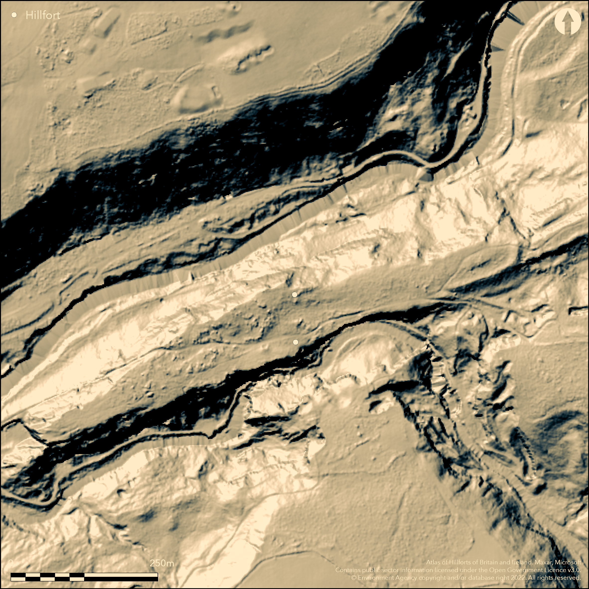
LiDAR 1m DTM Hillshade
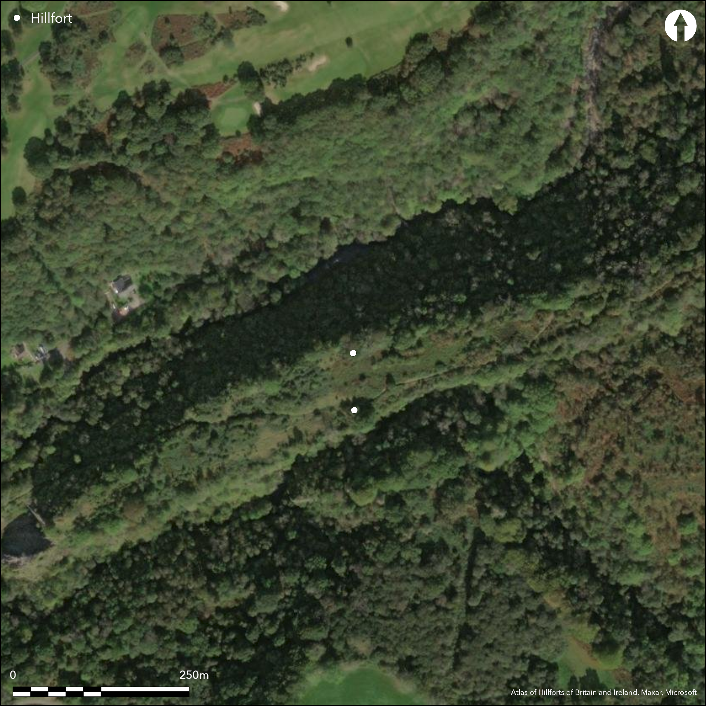
Satellite Imagery
LiDAR 1m DTM Hillshade
Satellite Imagery
Scroll left/right to view further images.
HER: Glamorgan Gwent 01107m (None)
NMR: SN 90 NW (None)
SM: None
NGR: SN9150008100
X: 291500 Y: 208100 (OSGB36)
Almost destroyed inland promontory fort located on limestone ridge of Craig-y-Dinas rising to c.150m O.D. Surrounded for most of area by steep cliffs and original W end quarried away but was probably a very steep bluff. Two artificial defensive lines cut off neck of ridge on crests of very steep slopes which form N edge of narrow, high hanging valley. The first and inner line defends an area c. 542m long with maximum width of 77m, and c. 2.52ha internal area. This tree-covered bank of limestone rubble runs W-E along crest of a steep natural scarp before curving across neck of the ridge to stop just short of its N edge. Old field-wall follows the top of the bank. No ditch, but possible attempt to construct one. Possible quarry ditch visible. Outer line similar in construction to inner, but poorer condition, varying in height from 0.5 to 3m. Modern, vertical-sided mining cut in possible position of original ditch. Area defended by this outer rampart c.103m long with maximum 16m width, an area of c. 0.15ha. Old track runs though fort passing through an oblique breach near W end of inner bank; possibly the original entrance. Tramway destroyed the junction of this rampart with the cliffs of the S side of the ridge. Also narrow gaps between ends of both ramparts and N slopes of the promontory where small gates erected. No other visible structures, other than from recent industrial activity as site quarried for silica for c. 200 years. Now under rough grass, scrub and trees. Minimal investigations, undated.
Citizen Science: ✗
Reliability of Data: Confirmed
Reliability of Interpretation: Confirmed
X: -397807 Y: 6757026 (EPSG: 3857)
Longitude: -3.5735592308695603 Latitude: 51.76099733327623 (EPSG:4326)
Country: Wales
Current County or Unitary Authority: Rhondda Cynon Taff
Historic County: Glamorgan
Current Parish/Community/Council/Townland: Hirwaun
Almost destroyed. In the last two hundred years the Craig y Dinas area has been extensively quarried for silica, and the W end and part of N edge of the ridge have been quarried away. Part of an old road crosses the site, and it is possible to trace the remains of two tramways running across the site between quarry workings on the SE and W end.
| Extant | ✓ |
| Cropmark | ✗ |
| Likely Destroyed | ✓ |
Rough grass, scrub and trees. Quarried, tramways and road.
| Woodland | ✓ |
| Commercial Forestry Plantation | ✗ |
| Parkland | ✗ |
| Pasture (Grazing) | ✗ |
| Arable | ✗ |
| Scrub/Bracken | ✓ |
| Bare Outcrop | ✗ |
| Heather/Moorland | ✗ |
| Heath | ✗ |
| Built-up | ✗ |
| Coastal Grassland | ✗ |
| Other | ✓ |
Almost destroyed inland promontory fort located on limestone ridge of Craig-y-Dinas rising to c.150m O.D. Defended for most of area by steep cliffs and original W end quarried away but was probably a very steep bluff. Two
| Contour Fort | ✗ |
| Partial Contour Fort | ✗ |
| Promontory Fort | ✓ |
| Hillslope Fort | ✗ |
| Level Terrain Fort | ✗ |
| Marsh Fort | ✗ |
| Multiple Enclosure Fort | ✗ |
| Hilltop | ✗ |
| Coastal Promontory | ✗ |
| Inland Promontory | ✓ |
| Valley Bottom | ✗ |
| Knoll/Hillock/Outcrop | ✗ |
| Ridge | ✓ |
| Cliff/Plateau-edge/Scarp | ✗ |
| Hillslope | ✗ |
| Lowland | ✗ |
| Spur | ✗ |
Dominant Topographic Feature: Ridge
| North | ✗ |
| Northeast | ✗ |
| East | ✗ |
| Southeast | ✗ |
| South | ✗ |
| Southwest | ✗ |
| West | ✗ |
| Northwest | ✗ |
| Level | ✓ |
Altitude: 150.0m
N/A
None
Reliability: D - None
| Pre 1200BC | ✗ |
| 1200BC - 800BC | ✗ |
| 800BC - 400BC | ✗ |
| 400BC - AD50 | ✗ |
| AD50 - AD400 | ✗ |
| AD400 - AD 800 | ✗ |
| Post AD800 | ✗ |
| Unknown | ✓ |
| Pre Hillfort: | None |
| Post Hillfort: | None |
GGAT Prehistoric defended enclosures in Glamorgan survey 2005.
| Other (2005): | GGAT Prehistoric defended enclosures in Glamorgan survey 2005. |
None
None
| None | ✓ |
| Spring | ✗ |
| Stream | ✗ |
| Pool | ✗ |
| Flush | ✗ |
| Well | ✗ |
| Other | ✗ |
None
| No Known Features | ✓ |
| Round Stone Structures | ✗ |
| Rectangular Stone Structures | ✗ |
| Curvilinear Platforms | ✗ |
| Other Roundhouse Evidence | ✗ |
| Pits | ✗ |
| Quarry Hollows | ✗ |
| Other | ✗ |
None
| No Known Excavation | ✓ |
| Pits | ✗ |
| Postholes | ✗ |
| Roundhouses | ✗ |
| Rectangular Structures | ✗ |
| Roads/Tracks | ✗ |
| Quarry Hollows | ✗ |
| Other | ✗ |
| Nothing Found | ✗ |
None
| No Known Geophysics | ✓ |
| Pits | ✗ |
| Roundhouses | ✗ |
| Rectangular Structures | ✗ |
| Roads/Tracks | ✗ |
| Quarry Hollows | ✗ |
| Other | ✗ |
| Nothing Found | ✗ |
None
| No Known Finds | ✓ |
| Pottery | ✗ |
| Metal | ✗ |
| Metalworking | ✗ |
| Human Bones | ✗ |
| Animal Bones | ✗ |
| Lithics | ✗ |
| Environmental | ✗ |
| Other | ✗ |
None
| APs Not Checked | ✓ |
| None | ✗ |
| Roundhouses | ✗ |
| Rectangular Structures | ✗ |
| Pits | ✗ |
| Postholes | ✗ |
| Roads/Tracks | ✗ |
| Other | ✗ |
Old track runs though fort passing through an oblique breach near W end of inner bank; possibly the original entrance. Substantial gaps, but number not determined.
| 1: | Substantial gaps, but number not determined. |
| 2: | Possible oblique entrance only at W end of inner bank. |
Guard Chambers: ✗
Chevaux de Frise: ✗
| 1. Oblique (West): | None |
Two artificial defensive lines cut off neck of ridge on crests of very steep slopes which form N edge of narrow, high hanging valley. The first and inner line defends an area c. 542m long with maximum width of 77m, and c. 2.52ha internal area. This tree-covered bank of limestone rubble runs W-E along crest of a steep natural scarp before curving across neck of the ridge to stop just short of its N edge. Old field-wall follows the top of the bank. No ditch, but possible attempt to construct one. Possible quarry ditch visible. Outer line similar in construction to inner, but poorer condition, varying in height from 0.5 to 3m. Modern, vertical-sided mining cut in possible position of original ditch.
| Area 1: | 2.67ha. |
| Total: | 2.67ha. |
Total Footprint Area: Noneha.
None
| ✗ | None |
| ✗ | None |
| NE Quadrant: | 2 |
| SE Quadrant: | 0 |
| SW Quadrant: | 0 |
| NW Quadrant: | 2 |
| Total: | 2 |
| Partial Univallate | ✗ |
| Univallate | ✗ |
| Partial Bivallate | ✓ |
| Bivallate | ✗ |
| Partial Multivallate | ✗ |
| Multivallate | ✗ |
| Unknown | ✗ |
| Partial Univallate | ✗ |
| Univallate | ✗ |
| Partial Bivallate | ✗ |
| Bivallate | ✗ |
| Partial Multivallate | ✗ |
| Multivallate | ✗ |
Limestone rubble banks.
| None | ✗ |
| Earthen Bank | ✗ |
| Stone Wall | ✗ |
| Rubble | ✓ |
| Wall-walk | ✗ |
| Evidence of Timber | ✗ |
| Vitrification | ✗ |
| Other Burning | ✗ |
| Palisade | ✗ |
| Counter Scarp Bank | ✗ |
| Berm | ✗ |
| Unfinished | ✗ |
| Other | ✗ |
None
| None | ✗ |
| Earthen Bank | ✗ |
| Stone Wall | ✗ |
| Murus Duplex | ✗ |
| Timber-framed | ✗ |
| Timber-laced | ✗ |
| Vitrification | ✗ |
| Other Burning | ✗ |
| Palisade | ✗ |
| Counter Scarp Bank | ✗ |
| Berm | ✗ |
| Unfinished | ✗ |
| No Known Excavation | ✓ |
| Other | ✗ |
| ✗ | None |
| ✗ | No ditch visible. |
Number of Ditches: 0
| ✗ | None |
Gerrard, C., Wiggins, H., and Evans, E. 2006. Prehistoric defended enclosures in Glamorgan with recommendations for fieldwork: Year 3 Report, GGAT Report No. 2006/089, Project No. GGAT78, Swansea: GGAT.
Atlas of Hillforts:
Wikidata:
This work is licensed under CC BY-SA 4.0

 and should be cited as:
Lock, Gary and Ralston, Ian. 2024. Atlas of Hillforts of Britain and Ireland. Available at: https://hillforts.arch.ox.ac.uk
Document Version 1.1