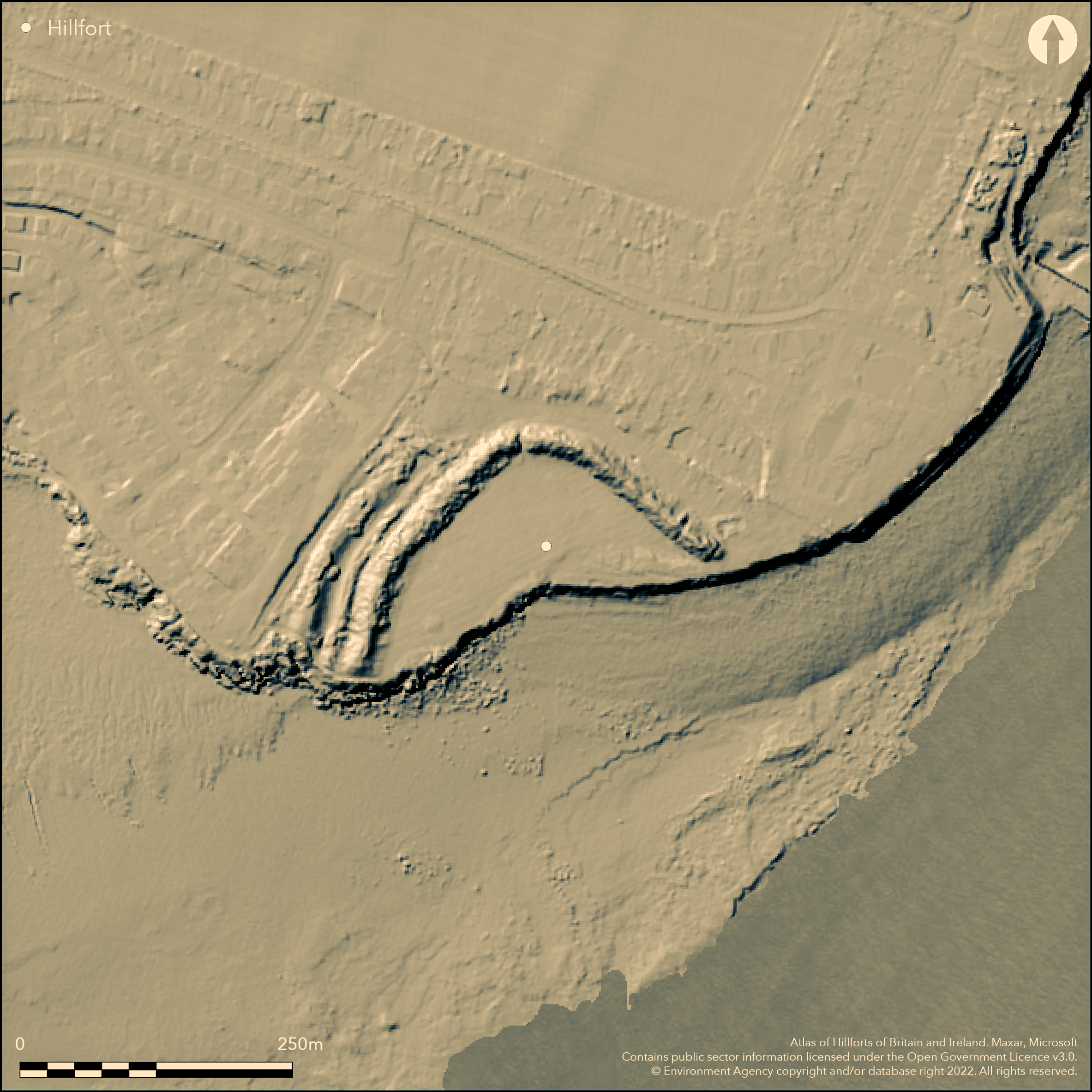
LiDAR 1m DTM Hillshade
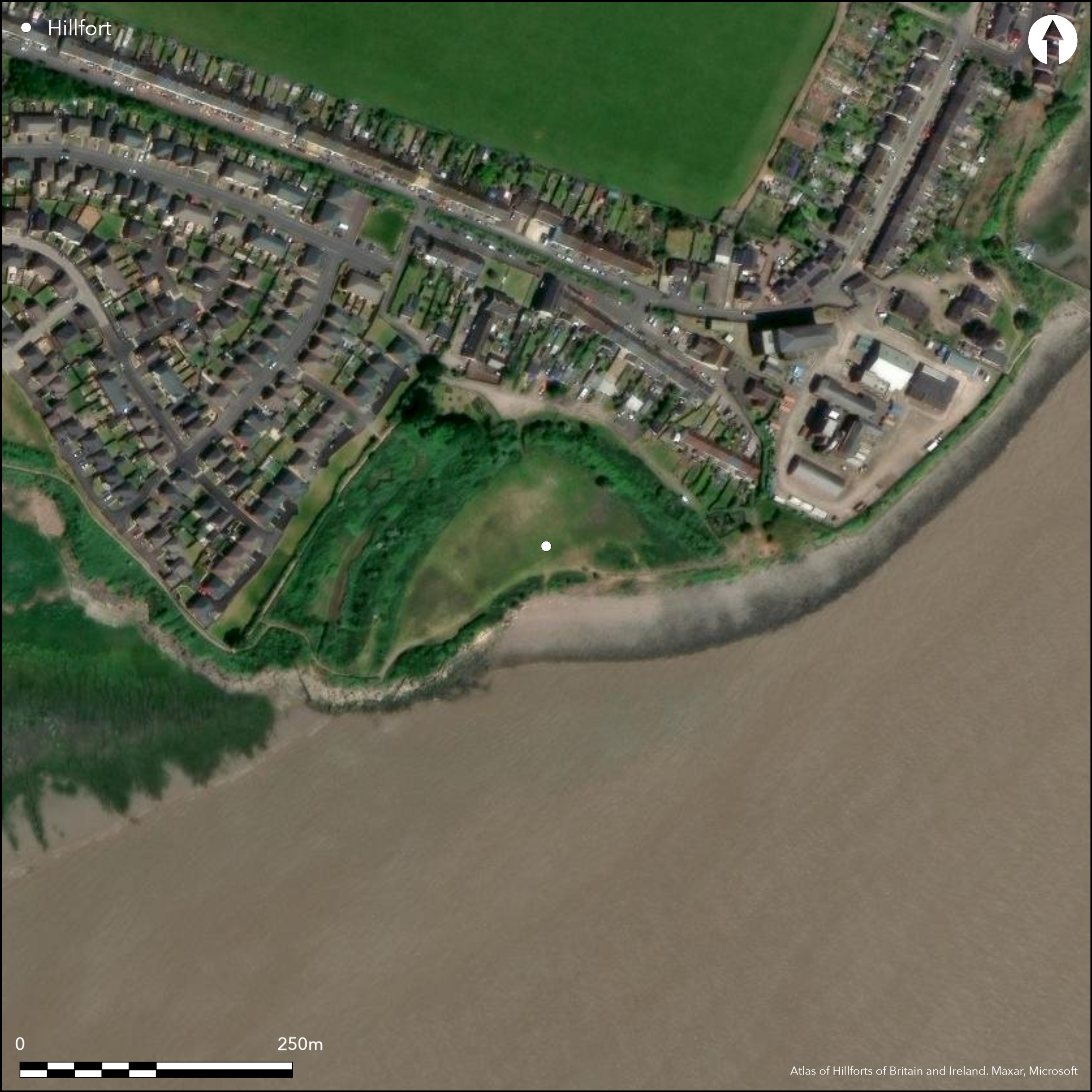
Satellite Imagery
LiDAR 1m DTM Hillshade
Satellite Imagery
Scroll left/right to view further images.
HER: Glamorgan Gwent 01142g (None)
NMR: ST 58 NW (94873)
SM: MM048
NGR: ST50558732
X: 350550 Y: 187320 (OSGB36)
Important, excavated, coastal promontory site on the upper reaches of the Bristol Channel. Strategically placed to control crossing between Aust and Portskewett. Roughly triangular in shape, c. 200m ENE-WSW by 92m, at only 10m O.D., on low eroding shallow cliff line to S, with level interior of area of 1.37ha. Excavated by Nash-Williams between 1934-36 (Nash-Williams 1939). Area much reduced by erosion and once enclosed by three to four banks and ditches on all sides. These have been much affected by development and erosion, and built over/infilled by encroaching housing and gardens and a 12-14th century church and graveyard, to N. However, still enclosed by massive bank on NE and NW, with two or three smaller banks outside on NW side, as shown on Spencer and Nash-Williams's plan of 1936 (ibid.) . These outer banks now not visible on NE, but excavation proved once existed, with V-shaped ditches between. Main bank built in four stages and inner face had two steeply sloping rough walled revetments. Quarry ditches found. Shallow sea-cliff to S has eroded much and subsequently been built up with rubble from the 1873-86 Severn Tunnel construction. Entrance gap to N. The Spencer/Nash-Williams plan also shows prehistoric hut floors, and a possible barrow, but investigation in 2000 (GGAT HER refers) suggests that location of the huts not definite and only seen as occupation scatter. Excavations produced late Iron Age, Romano-British and medieval pottery, although interpretation of contexts questioned by Sell (2001). Also evidence of glass and iron working on site. Excavations by S.H. Sell 1998-99 found construction of central rampart of W defences incorporated at least one revetment on inner face; outer face seaward mostly lost to erosion. One of trenches outside W defences showed possible flattened fourth bank. Encroached, and setting affected, by development and interior used as community playing field. On 1st Ed. OS map (1882-87).
Citizen Science: ✗
Reliability of Data: Confirmed
Reliability of Interpretation: Confirmed
X: -302244 Y: 6724987 (EPSG: 3857)
Longitude: -2.715104323116982 Latitude: 51.582510639906026 (EPSG:4326)
Country: Wales
Current County or Unitary Authority: Monmouth
Historic County: Monmouthshire
Current Parish/Community/Council/Townland: Portskewett
Area much reduced by erosion and encroached, and setting affected, by development. Public footpath to site. Interior used as community playing field.
| Extant | ✓ |
| Cropmark | ✗ |
| Likely Destroyed | ✓ |
Grass and scrub and interior used as community playing field.
| Woodland | ✗ |
| Commercial Forestry Plantation | ✗ |
| Parkland | ✗ |
| Pasture (Grazing) | ✗ |
| Arable | ✗ |
| Scrub/Bracken | ✓ |
| Bare Outcrop | ✗ |
| Heather/Moorland | ✗ |
| Heath | ✗ |
| Built-up | ✗ |
| Coastal Grassland | ✗ |
| Other | ✓ |
Important excavated coastal promontory site on the upper reaches of the Bristol Channel; one of a series of forts. Strategically placed to control crossing between Aust and Portskewett.
| Contour Fort | ✗ |
| Partial Contour Fort | ✗ |
| Promontory Fort | ✓ |
| Hillslope Fort | ✗ |
| Level Terrain Fort | ✗ |
| Marsh Fort | ✗ |
| Multiple Enclosure Fort | ✗ |
| Hilltop | ✗ |
| Coastal Promontory | ✓ |
| Inland Promontory | ✗ |
| Valley Bottom | ✗ |
| Knoll/Hillock/Outcrop | ✗ |
| Ridge | ✗ |
| Cliff/Plateau-edge/Scarp | ✗ |
| Hillslope | ✗ |
| Lowland | ✗ |
| Spur | ✗ |
Dominant Topographic Feature: Coastal headland.
| North | ✗ |
| Northeast | ✗ |
| East | ✗ |
| Southeast | ✗ |
| South | ✗ |
| Southwest | ✗ |
| West | ✗ |
| Northwest | ✗ |
| Level | ✓ |
Altitude: 10.0m
N/A
Excavated pottery finds indicate mid 2nd century BC to early 2nd century AD, but interpretation of contexts questioned by Sell (2001).
Reliability: B - Medium
| Pre 1200BC | ✗ |
| 1200BC - 800BC | ✗ |
| 800BC - 400BC | ✗ |
| 400BC - AD50 | ✓ |
| AD50 - AD400 | ✓ |
| AD400 - AD 800 | ✗ |
| Post AD800 | ✗ |
| Unknown | ✗ |
| Pre Hillfort: | None |
| Post Hillfort: | None |
| Artefactual: | Finds indicate mid 2nd century BC to early 2nd century AD. |
On 1st Ed. OS map (1882-87). Excavation Nash-Williams 1939. Excavation and survey 1998-99 by S.H. Sell. GGAT survey 2000. GGAT Prehistoric defended enclosures in Glamorgan survey 2005.
| Excavation (1939): | Nash-Williams. |
| Other (1991): | Visited by Hillfort Study Group |
| Other (2000): | GGAT survey. |
| Other (2005): | GGAT Prehistoric defended enclosures in Glamorgan survey. |
| 1st Identified Map Depiction (None): | OS map. |
| Excavation (None): | S.H. Sell. |
Roundhouses from excavation with pottery and evidence of glass and iron working on site.
None
| None | ✓ |
| Spring | ✗ |
| Stream | ✗ |
| Pool | ✗ |
| Flush | ✗ |
| Well | ✗ |
| Other | ✗ |
None
| No Known Features | ✓ |
| Round Stone Structures | ✗ |
| Rectangular Stone Structures | ✗ |
| Curvilinear Platforms | ✗ |
| Other Roundhouse Evidence | ✗ |
| Pits | ✗ |
| Quarry Hollows | ✗ |
| Other | ✗ |
Possible prehistoric hut floors and a possible barrow. Quarry ditches.
| No Known Excavation | ✗ |
| Pits | ✗ |
| Postholes | ✗ |
| Roundhouses | ✓ |
| Rectangular Structures | ✗ |
| Roads/Tracks | ✗ |
| Quarry Hollows | ✓ |
| Other | ✓ |
| Nothing Found | ✗ |
None
| No Known Geophysics | ✓ |
| Pits | ✗ |
| Roundhouses | ✗ |
| Rectangular Structures | ✗ |
| Roads/Tracks | ✗ |
| Quarry Hollows | ✗ |
| Other | ✗ |
| Nothing Found | ✗ |
Evidence of glass and iron working on site. Amphorae fragments. Late Iron Age, Romano-British and medieval pottery, although interpretation of contexts questioned by Sell (2001).
| No Known Finds | ✗ |
| Pottery | ✓ |
| Metal | ✗ |
| Metalworking | ✓ |
| Human Bones | ✗ |
| Animal Bones | ✗ |
| Lithics | ✗ |
| Environmental | ✗ |
| Other | ✓ |
None
| APs Not Checked | ✓ |
| None | ✗ |
| Roundhouses | ✗ |
| Rectangular Structures | ✗ |
| Pits | ✗ |
| Postholes | ✗ |
| Roads/Tracks | ✗ |
| Other | ✗ |
Entrance gap to N but no details.
| 1: | None |
| 2: | None |
Guard Chambers: ✗
Chevaux de Frise: ✗
| 1. Simple Gap (North): | None |
Enclosed by massive bank on NE and NW, with two or three smaller banks outside on NW side, as shown on Spencer and Nash-Williams plan of 1936. These outer banks now not visible on NE, but excavation proved once existed, with V-shaped ditches between. Main bank built in four stages and inner face had two steeply sloping rough walled revetments.
| Area 1: | 1.37ha. |
| Total: | 1.37ha. |
Total Footprint Area: Noneha.
None
| ✗ | None |
| ✗ | Probable that once three banks completed circuit. possible fourth bank on W. |
| NE Quadrant: | 1 |
| SE Quadrant: | 0 |
| SW Quadrant: | 0 |
| NW Quadrant: | 3 |
| Total: | 3 |
| Partial Univallate | ✓ |
| Univallate | ✗ |
| Partial Bivallate | ✗ |
| Bivallate | ✗ |
| Partial Multivallate | ✓ |
| Multivallate | ✗ |
| Unknown | ✗ |
| Partial Univallate | ✗ |
| Univallate | ✗ |
| Partial Bivallate | ✗ |
| Bivallate | ✗ |
| Partial Multivallate | ✗ |
| Multivallate | ✗ |
None
| None | ✗ |
| Earthen Bank | ✓ |
| Stone Wall | ✗ |
| Rubble | ✗ |
| Wall-walk | ✗ |
| Evidence of Timber | ✗ |
| Vitrification | ✗ |
| Other Burning | ✗ |
| Palisade | ✗ |
| Counter Scarp Bank | ✗ |
| Berm | ✗ |
| Unfinished | ✗ |
| Other | ✗ |
Outer banks not visible on NE, but excavation proved existed with V-shaped ditches between. Excavations by S.H. Sell 1998-99 found construction of central rampart of W defences incorporated at least one revetment on inner face; outer face seaward mostly lost to erosion. One of trenches outside W defences showed possible flattened fourth bank.
| None | ✗ |
| Earthen Bank | ✗ |
| Stone Wall | ✓ |
| Murus Duplex | ✗ |
| Timber-framed | ✗ |
| Timber-laced | ✗ |
| Vitrification | ✗ |
| Other Burning | ✗ |
| Palisade | ✗ |
| Counter Scarp Bank | ✗ |
| Berm | ✗ |
| Unfinished | ✗ |
| No Known Excavation | ✗ |
| Other | ✓ |
| ✗ | None |
| ✓ | Outer banks not visible on NE, but excavation proved existed with V-shaped ditches between. |
Number of Ditches: 3
| ✗ | None |
Hogg, A.H.A 1965. Early Iron Age, In Foster, I.LL and Daniel, G. (eds) Prehistoric and Early Wales, 145, London: Routledge and Kegan Paul.
Nash-Williams, V.E. 1939. An early Iron Age coastal camp at Sudbrook, near the Severn tunnel, Monmouthshire, Arch Camb, 94 (1939) 42-79.
Savory, H.N. 1950. List of hill-fort and other earthworks in Wales, II. Monmouthshire, Bull Board Celtic Stud, 13, 233.
Sell, S.H. 2001. Recent excavation and survey work at Sudbrook Camo, Portskewett, Monmouthshire (ST507837), Studia Celtica, 35(2001), 109-141.
Whittle, E. 1992. A guide to ancient and historic Wales - Glamorgan and Gwent, 49, London: HMSO, 49.
Atlas of Hillforts:
Wikidata:
This work is licensed under CC BY-SA 4.0

 and should be cited as:
Lock, Gary and Ralston, Ian. 2024. Atlas of Hillforts of Britain and Ireland. Available at: https://hillforts.arch.ox.ac.uk
Document Version 1.1