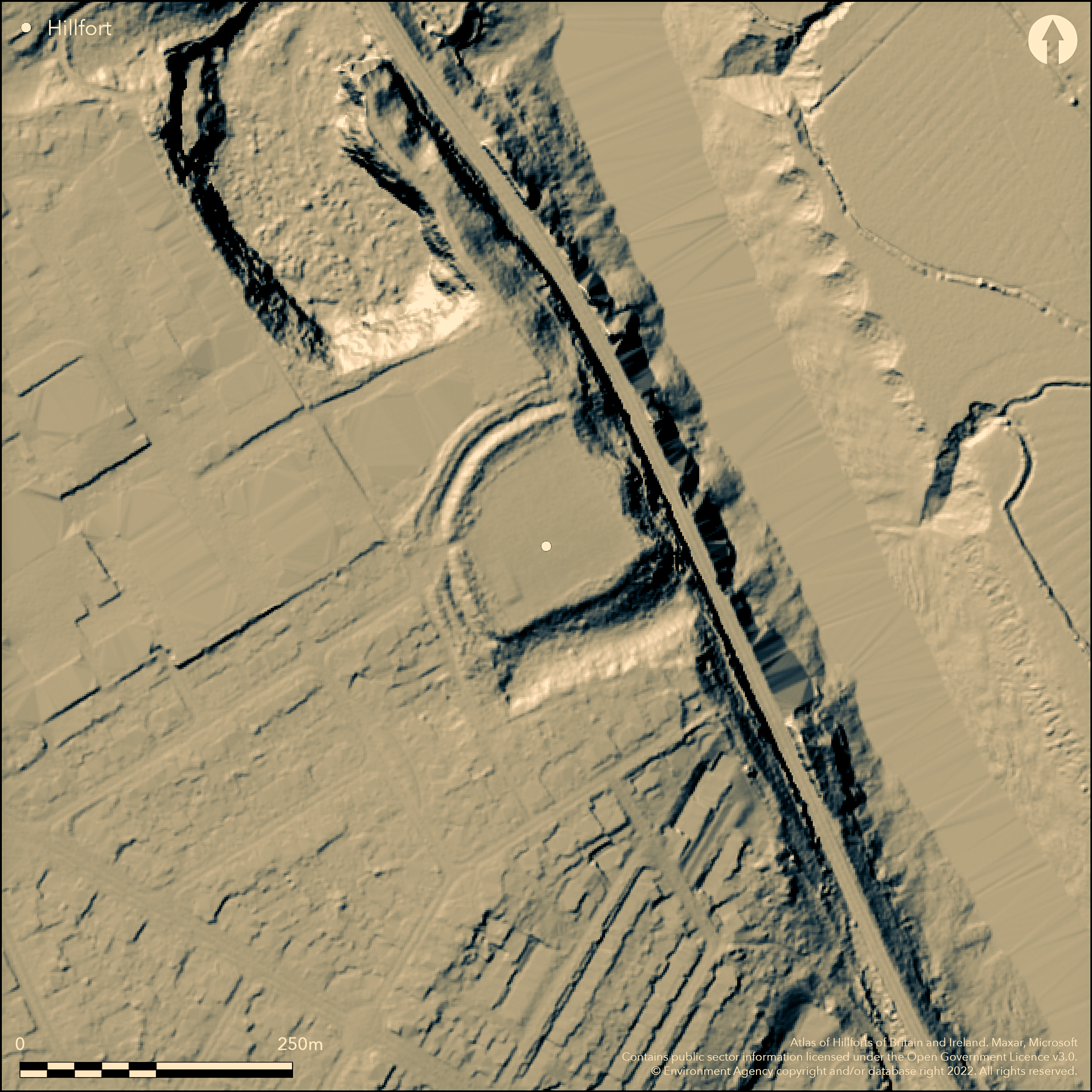
LiDAR 1m DTM Hillshade
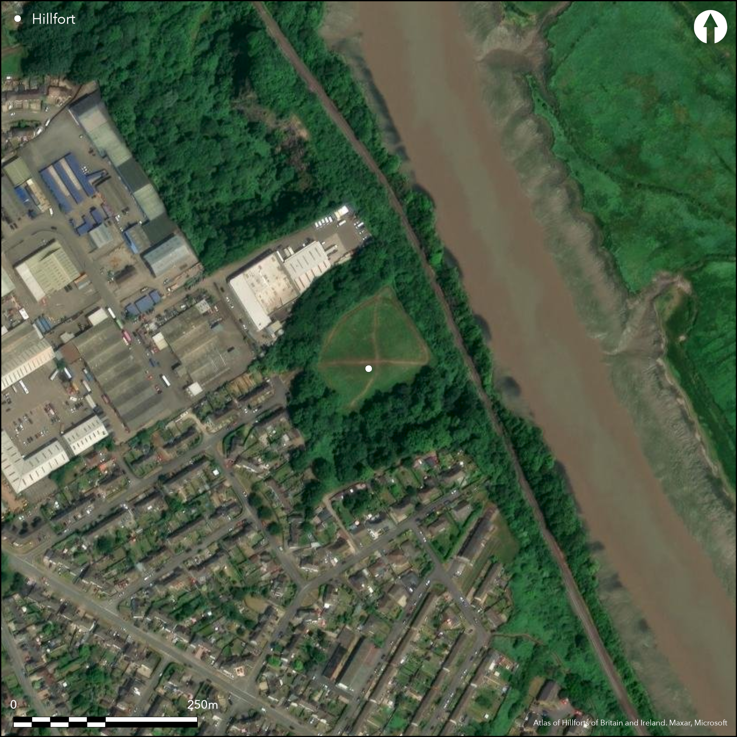
Satellite Imagery
LiDAR 1m DTM Hillshade
Satellite Imagery
Scroll left/right to view further images.
HER: Glamorgan Gwent 01193g (None)
NMR: ST 59 SW (301207)
SM: MM093
NGR: ST53799273
X: 353790 Y: 192730 (OSGB36)
Bivallate inland promontory fort strategically situated in a superb position on cliffs above the River Wye and the Beachley Peninsula, near its confluence with the River Severn. Surrounding slopes to N and S steep, E precipitous and W moderate to strong. Roughly triangular measuring 104m E-W by 120m, with internal area c. 1.2ha. The River Wye flows below Hardwick Cliffs on the E side of the fort and there is a deep ravine on S side running W-E to join the river. Thus, the cliff to the Wye below Hardwick Cliffs on E and ravine on S form major part of defences, but there are two semicircular in shape curving ramparts from NE round to SW, so cutting off the promontory, the inner the most massive. W rampart begins at W edge of ravine to S, and separated from it by bank of c. 4m high. W ramparts then continue N with ditch separating inner and outer bank, the former c. 2.25m high, the latter c.1.5-2m high. Ditch c. 2m wide. Entire rampart c. 30m across. N ramparts measure similar in height but width c. 25m, partly due to encroachment of electricity sub-station sited immediately N of ramparts. Present and probably original entrance to SW. The fort is now hemmed in by development and interior used as community playing field, but generally well preserved. On 1st Ed. OS map (1881-88). Minimal investigations, undated.
Citizen Science: ✗
Reliability of Data: Confirmed
Reliability of Interpretation: Confirmed
X: -297118 Y: 6733755 (EPSG: 3857)
Longitude: -2.6690607986319796 Latitude: 51.63142681625898 (EPSG:4326)
Country: Wales
Current County or Unitary Authority: Monmouth
Historic County: Monmouthshire
Current Parish/Community/Council/Townland: Chepstow
Setting compromised and hemmed in by development and interior used for as a community field for public access and sports, but generally well preserved. Encroachment of electricity sub-station situated immediately N of the ramparts.
| Extant | ✓ |
| Cropmark | ✗ |
| Likely Destroyed | ✗ |
Interior managed as community field. Wooded slopes.
| Woodland | ✓ |
| Commercial Forestry Plantation | ✗ |
| Parkland | ✗ |
| Pasture (Grazing) | ✗ |
| Arable | ✗ |
| Scrub/Bracken | ✓ |
| Bare Outcrop | ✗ |
| Heather/Moorland | ✗ |
| Heath | ✗ |
| Built-up | ✗ |
| Coastal Grassland | ✗ |
| Other | ✓ |
Bivallate inland promontory fort strategically situated in a superb position on cliffs above the River Wye and the Beachley Peninsula, near its confluence with the River Severn. Surrounding slopes to N and S steep, E precipitous and W moderate to strong.
| Contour Fort | ✗ |
| Partial Contour Fort | ✗ |
| Promontory Fort | ✓ |
| Hillslope Fort | ✗ |
| Level Terrain Fort | ✗ |
| Marsh Fort | ✗ |
| Multiple Enclosure Fort | ✗ |
| Hilltop | ✗ |
| Coastal Promontory | ✗ |
| Inland Promontory | ✓ |
| Valley Bottom | ✗ |
| Knoll/Hillock/Outcrop | ✗ |
| Ridge | ✗ |
| Cliff/Plateau-edge/Scarp | ✗ |
| Hillslope | ✗ |
| Lowland | ✗ |
| Spur | ✗ |
Dominant Topographic Feature: Promontory
| North | ✗ |
| Northeast | ✗ |
| East | ✗ |
| Southeast | ✗ |
| South | ✗ |
| Southwest | ✗ |
| West | ✗ |
| Northwest | ✗ |
| Level | ✓ |
Altitude: 50.0m
N/A
None, but possibly late Iron Age.
Reliability: D - None
| Pre 1200BC | ✗ |
| 1200BC - 800BC | ✗ |
| 800BC - 400BC | ✗ |
| 400BC - AD50 | ✗ |
| AD50 - AD400 | ✗ |
| AD400 - AD 800 | ✗ |
| Post AD800 | ✗ |
| Unknown | ✓ |
| Pre Hillfort: | None |
| Post Hillfort: | None |
| Morphology/Earthwork/Typology: | Possibly late Iron Age. |
On 1st Ed. OS map (1881-88). GGAT Prehistoric defended enclosures in Glamorgan survey 2005.
| Other (1991): | Visited by Hillfort Study Group |
| Other (2005): | GGAT Prehistoric defended enclosures in Glamorgan survey 2005. |
| 1st Identified Map Depiction (None): | OS map. |
None
River Wye 0.05km outside fort below Hardwick Cliifs.
| None | ✓ |
| Spring | ✗ |
| Stream | ✗ |
| Pool | ✗ |
| Flush | ✗ |
| Well | ✗ |
| Other | ✗ |
None
| No Known Features | ✓ |
| Round Stone Structures | ✗ |
| Rectangular Stone Structures | ✗ |
| Curvilinear Platforms | ✗ |
| Other Roundhouse Evidence | ✗ |
| Pits | ✗ |
| Quarry Hollows | ✗ |
| Other | ✗ |
None
| No Known Excavation | ✓ |
| Pits | ✗ |
| Postholes | ✗ |
| Roundhouses | ✗ |
| Rectangular Structures | ✗ |
| Roads/Tracks | ✗ |
| Quarry Hollows | ✗ |
| Other | ✗ |
| Nothing Found | ✗ |
None
| No Known Geophysics | ✓ |
| Pits | ✗ |
| Roundhouses | ✗ |
| Rectangular Structures | ✗ |
| Roads/Tracks | ✗ |
| Quarry Hollows | ✗ |
| Other | ✗ |
| Nothing Found | ✗ |
None
| No Known Finds | ✓ |
| Pottery | ✗ |
| Metal | ✗ |
| Metalworking | ✗ |
| Human Bones | ✗ |
| Animal Bones | ✗ |
| Lithics | ✗ |
| Environmental | ✗ |
| Other | ✗ |
None
| APs Not Checked | ✓ |
| None | ✗ |
| Roundhouses | ✗ |
| Rectangular Structures | ✗ |
| Pits | ✗ |
| Postholes | ✗ |
| Roads/Tracks | ✗ |
| Other | ✗ |
Present and probably original entrance to SW.
| 1: | None |
| 2: | None |
Guard Chambers: ✗
Chevaux de Frise: ✗
| 1. Simple Gap (South west): | None |
W rampart begins at W edge of ravine to S, and separated from it by bank of c. 4m high. W ramparts then continue N with ditch separating inner and outer bank, the former c. 2.25m high, the latter c.1.5-2m high. Ditch c. 2m wide. Entire rampart c. 30m across. N ramparts measure similar in height but width c. 25m, partly due to encroachment of electricity sub-station sited immediately N of ramparts.
| Area 1: | 1.2ha. |
| Total: | 1.2ha. |
Total Footprint Area: Noneha.
None
| ✗ | None |
| ✗ | Ramparts run NE to SW in an arc. |
| NE Quadrant: | 2 |
| SE Quadrant: | 0 |
| SW Quadrant: | 2 |
| NW Quadrant: | 2 |
| Total: | 2 |
| Partial Univallate | ✗ |
| Univallate | ✗ |
| Partial Bivallate | ✓ |
| Bivallate | ✗ |
| Partial Multivallate | ✗ |
| Multivallate | ✗ |
| Unknown | ✗ |
| Partial Univallate | ✗ |
| Univallate | ✗ |
| Partial Bivallate | ✗ |
| Bivallate | ✗ |
| Partial Multivallate | ✗ |
| Multivallate | ✗ |
Probably earthen bank.
| None | ✗ |
| Earthen Bank | ✓ |
| Stone Wall | ✗ |
| Rubble | ✗ |
| Wall-walk | ✗ |
| Evidence of Timber | ✗ |
| Vitrification | ✗ |
| Other Burning | ✗ |
| Palisade | ✗ |
| Counter Scarp Bank | ✗ |
| Berm | ✗ |
| Unfinished | ✗ |
| Other | ✗ |
None
| None | ✗ |
| Earthen Bank | ✗ |
| Stone Wall | ✗ |
| Murus Duplex | ✗ |
| Timber-framed | ✗ |
| Timber-laced | ✗ |
| Vitrification | ✗ |
| Other Burning | ✗ |
| Palisade | ✗ |
| Counter Scarp Bank | ✗ |
| Berm | ✗ |
| Unfinished | ✗ |
| No Known Excavation | ✓ |
| Other | ✗ |
| ✗ | None |
| ✓ | None |
Number of Ditches: 2
| ✗ | None |
Gerrard, C., Wiggins, H., and Evans, E. 2006. Prehistoric defended enclosures in Glamorgan with recommendations for fieldwork: Year 3 Report, GGAT Report No. 2006/089, Project No. GGAT78, Swansea: GGAT.
Savory, H.N. 1950. List of hill-fort and other earthworks in Wales, II. Monmouthshire, Bull Board Celtic Stud, 13, 235.
Whittle, E. 1992. A guide to ancient and historic Wales - Glamorgan and Gwent, London: HMSO, 47.
Atlas of Hillforts:
Wikidata:
This work is licensed under CC BY-SA 4.0

 and should be cited as:
Lock, Gary and Ralston, Ian. 2024. Atlas of Hillforts of Britain and Ireland. Available at: https://hillforts.arch.ox.ac.uk
Document Version 1.1