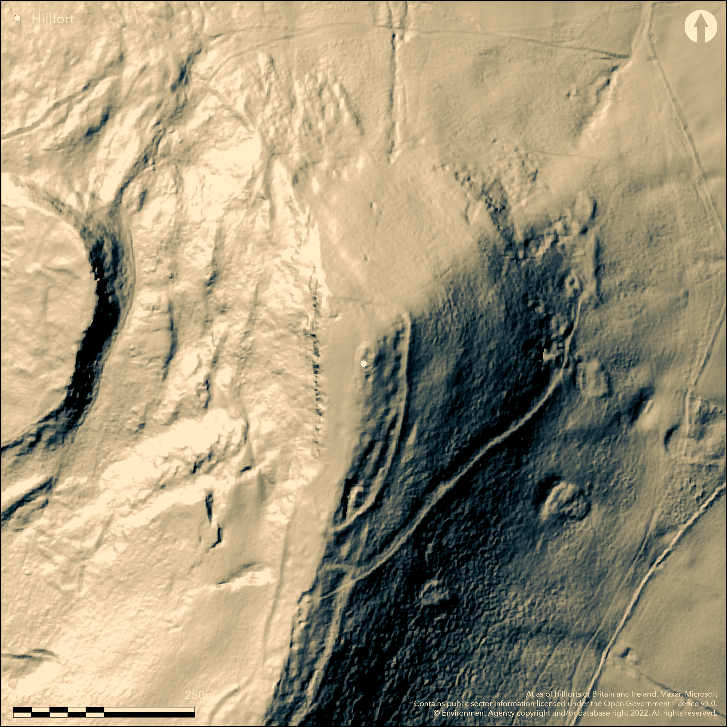
LiDAR 1m DTM Hillshade
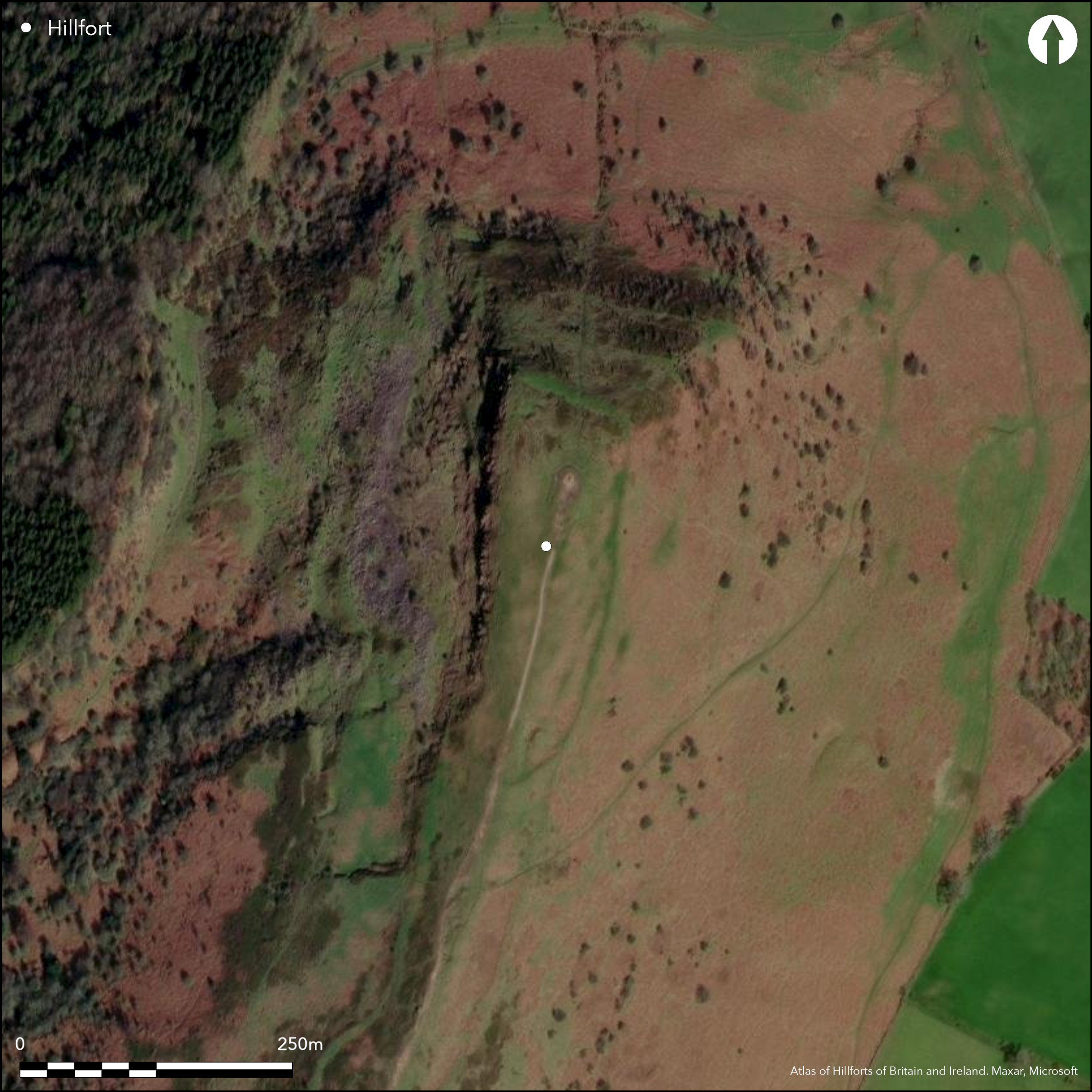
Satellite Imagery
LiDAR 1m DTM Hillshade
Satellite Imagery
Scroll left/right to view further images.
HER: Glamorgan Gwent 01497g (None)
NMR: SO 31 NW (None)
SM: MM182
NGR: SO33111827
X: 333110 Y: 218270 (OSGB36)
High, possible contour hillfort located on isolated summit of Skirrid Fawr dominating the landscape for miles around. Surrounding slopes very steep on N but precipitous on S, E and W. Elongated enclosure measures c. 320m N-S by 100m, with internal area c. 3.2ha. The site is probably Iron Age in origin, but medieval ruins with banks make interpretation difficult and leave some doubt. Site almond-shaped with three low banks and ditches to N, S and W. Remains of St Michael's chapel on highest point of the site. Inner rampart possibly Iron Age but earthworks of chapel cause confusion, chapel and circular enclosure in interior. Second and sub-rectangular circuit surrounds first at a distance of 30-60m, its nature unknown and much affected by the Skirrid quarry in NW side. Third circuit surrounds first and second and ultimately joins the S side of the latter. It is possible a fourth circuit lies within first and second but uncertain. Second and third circuits c. 0.5m high and c. 1m wide. Possible house platform just outside first enclosure, and further house platforms and small quarried area exist just within third enclosure; all of unknown date. Length of rampart seems to continue along W end beginning in N at quarry and following contours of Skirrid Fawr until S point of mountain reached; c. 0.5m high and 1m wide. No ditches in evidence. Minimal investigations, undated.
Citizen Science: ✗
Reliability of Data: Unconfirmed
Reliability of Interpretation: Confirmed
X: -330923 Y: 6774662 (EPSG: 3857)
Longitude: -2.972727990775135 Latitude: 51.85894862797511 (EPSG:4326)
Country: Wales
Current County or Unitary Authority: Monmouth
Historic County: Monmouthshire
Current Parish/Community/Council/Townland: Llantilio Pertholey
Site contains medieval chapel of St Michael. National Trust site.
| Extant | ✓ |
| Cropmark | ✗ |
| Likely Destroyed | ✗ |
High moorland.
| Woodland | ✗ |
| Commercial Forestry Plantation | ✗ |
| Parkland | ✗ |
| Pasture (Grazing) | ✗ |
| Arable | ✗ |
| Scrub/Bracken | ✗ |
| Bare Outcrop | ✗ |
| Heather/Moorland | ✓ |
| Heath | ✗ |
| Built-up | ✗ |
| Coastal Grassland | ✗ |
| Other | ✗ |
High, possible contour hillfort located on summit of Skirrid Fawr dominating the landscape for miles around. Surrounding slopes very steep on N but precipitous on S, E and W
| Contour Fort | ✓ |
| Partial Contour Fort | ✗ |
| Promontory Fort | ✗ |
| Hillslope Fort | ✗ |
| Level Terrain Fort | ✗ |
| Marsh Fort | ✗ |
| Multiple Enclosure Fort | ✗ |
| Hilltop | ✓ |
| Coastal Promontory | ✗ |
| Inland Promontory | ✗ |
| Valley Bottom | ✗ |
| Knoll/Hillock/Outcrop | ✗ |
| Ridge | ✗ |
| Cliff/Plateau-edge/Scarp | ✗ |
| Hillslope | ✗ |
| Lowland | ✗ |
| Spur | ✗ |
Dominant Topographic Feature: Hill top
| North | ✗ |
| Northeast | ✗ |
| East | ✗ |
| Southeast | ✗ |
| South | ✗ |
| Southwest | ✗ |
| West | ✗ |
| Northwest | ✗ |
| Level | ✓ |
Altitude: 486.0m
N/A
None
Reliability: D - None
| Pre 1200BC | ✗ |
| 1200BC - 800BC | ✗ |
| 800BC - 400BC | ✗ |
| 400BC - AD50 | ✗ |
| AD50 - AD400 | ✗ |
| AD400 - AD 800 | ✗ |
| Post AD800 | ✗ |
| Unknown | ✓ |
| Pre Hillfort: | None |
| Post Hillfort: | None |
GGAT Prehistoric defended enclosures in Glamorgan survey 2005.
| Other (1991): | Visited by Hillfort Study Group |
| Other (2005): | GGAT Prehistoric defended enclosures in Glamorgan survey. |
Possible house platform just outside first enclosure, and further house platforms and small quarried area exist just within third enclosure; all of unknown date.
Stream 0.15km outside site.
| None | ✓ |
| Spring | ✗ |
| Stream | ✗ |
| Pool | ✗ |
| Flush | ✗ |
| Well | ✗ |
| Other | ✗ |
Possible house platform just outside first enclosure, and further house platforms and small quarried area exist just within third enclosure; all of unknown date.
| No Known Features | ✗ |
| Round Stone Structures | ✗ |
| Rectangular Stone Structures | ✗ |
| Curvilinear Platforms | ✓ |
| Other Roundhouse Evidence | ✗ |
| Pits | ✗ |
| Quarry Hollows | ✗ |
| Other | ✗ |
None
| No Known Excavation | ✓ |
| Pits | ✗ |
| Postholes | ✗ |
| Roundhouses | ✗ |
| Rectangular Structures | ✗ |
| Roads/Tracks | ✗ |
| Quarry Hollows | ✗ |
| Other | ✗ |
| Nothing Found | ✗ |
None
| No Known Geophysics | ✓ |
| Pits | ✗ |
| Roundhouses | ✗ |
| Rectangular Structures | ✗ |
| Roads/Tracks | ✗ |
| Quarry Hollows | ✗ |
| Other | ✗ |
| Nothing Found | ✗ |
None
| No Known Finds | ✓ |
| Pottery | ✗ |
| Metal | ✗ |
| Metalworking | ✗ |
| Human Bones | ✗ |
| Animal Bones | ✗ |
| Lithics | ✗ |
| Environmental | ✗ |
| Other | ✗ |
On aerial photograph taken in 2000.
| APs Not Checked | ✗ |
| None | ✓ |
| Roundhouses | ✗ |
| Rectangular Structures | ✗ |
| Pits | ✗ |
| Postholes | ✗ |
| Roads/Tracks | ✗ |
| Other | ✗ |
None determined.
| 0: | None |
| 2: | None |
Guard Chambers: ✗
Chevaux de Frise: ✗
Inner rampart possibly Iron Age but earthworks of chapel make interpretation difficult. and chapel and circular enclosure in interior. Second and sub-rectangular circuit surrounds first at a distance of 30-60m, its nature unknown and much affected by the Skirrid quarry in NW side. Third circuit surrounds first and second and ultimately joins the S side of the latter. It is possible a fourth circuit lies within first and second but uncertain. Second and third circuits c. 0.5m high and c. 1m wide. No ditches in evidence.
| Area 1: | 3.2ha. |
| Total: | 3.2ha. |
Total Footprint Area: Noneha.
None
| ✗ | Area estimated. |
| ✓ | None |
| NE Quadrant: | 3 |
| SE Quadrant: | 3 |
| SW Quadrant: | 3 |
| NW Quadrant: | 3 |
| Total: | 3 |
| Partial Univallate | ✗ |
| Univallate | ✗ |
| Partial Bivallate | ✗ |
| Bivallate | ✗ |
| Partial Multivallate | ✗ |
| Multivallate | ✓ |
| Unknown | ✗ |
| Partial Univallate | ✗ |
| Univallate | ✗ |
| Partial Bivallate | ✗ |
| Bivallate | ✗ |
| Partial Multivallate | ✗ |
| Multivallate | ✗ |
None
| None | ✗ |
| Earthen Bank | ✓ |
| Stone Wall | ✗ |
| Rubble | ✗ |
| Wall-walk | ✗ |
| Evidence of Timber | ✗ |
| Vitrification | ✗ |
| Other Burning | ✗ |
| Palisade | ✗ |
| Counter Scarp Bank | ✗ |
| Berm | ✗ |
| Unfinished | ✗ |
| Other | ✗ |
None
| None | ✗ |
| Earthen Bank | ✗ |
| Stone Wall | ✗ |
| Murus Duplex | ✗ |
| Timber-framed | ✗ |
| Timber-laced | ✗ |
| Vitrification | ✗ |
| Other Burning | ✗ |
| Palisade | ✗ |
| Counter Scarp Bank | ✗ |
| Berm | ✗ |
| Unfinished | ✗ |
| No Known Excavation | ✓ |
| Other | ✗ |
| ✗ | None |
| ✗ | None |
Number of Ditches: 0
| ✗ | None |
Gerrard, C., Wiggins, H., and Evans, E. 2006. Prehistoric defended enclosures in Glamorgan with recommendations for fieldwork: Year 3 Report, GGAT Report No. 2006/089, Project No. GGAT78, Swansea: GGAT.
Savory, H.N 1954. List of hill-forts and other earthworks in Wales and Monmouthshire. Additions and corrections to Sections I-III, Bull Board Celtic Stud, 15 (1952-54), 229.
Atlas of Hillforts:
Wikidata:
This work is licensed under CC BY-SA 4.0

 and should be cited as:
Lock, Gary and Ralston, Ian. 2024. Atlas of Hillforts of Britain and Ireland. Available at: https://hillforts.arch.ox.ac.uk
Document Version 1.1