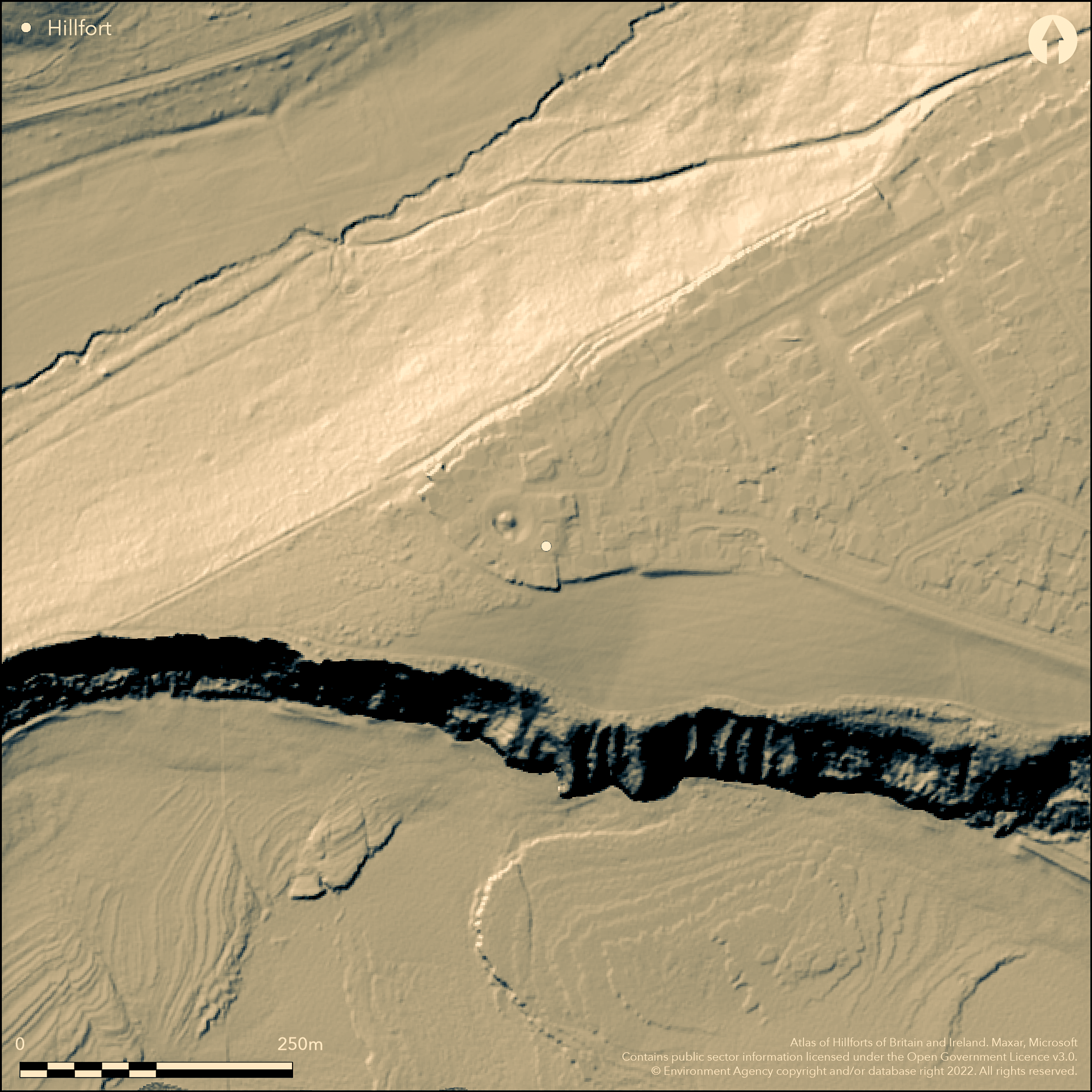
LiDAR 1m DTM Hillshade
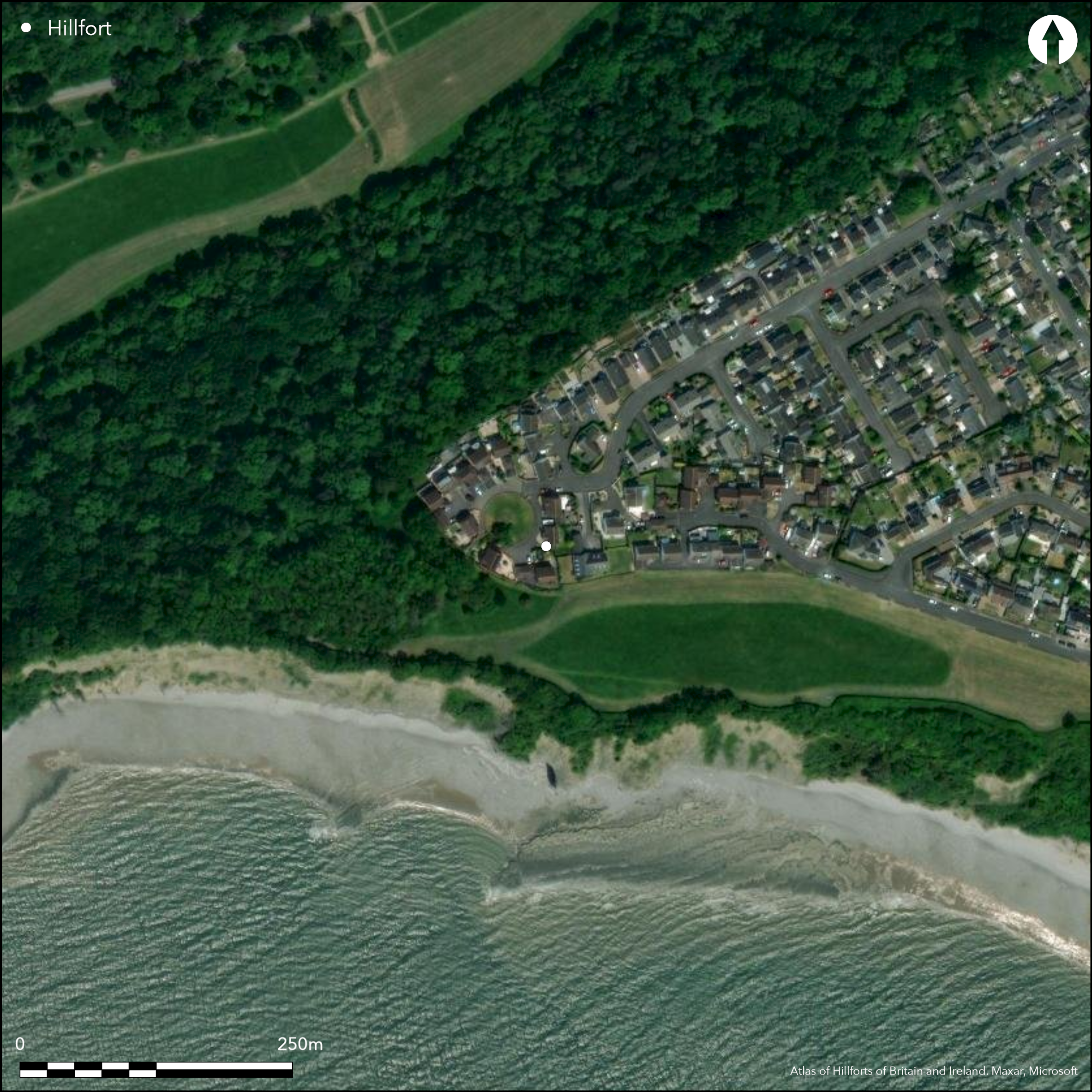
Satellite Imagery
LiDAR 1m DTM Hillshade
Satellite Imagery
Scroll left/right to view further images.
HER: Glamorgan Gwent 02103s (None)
NMR: ST 06 NE (None)
SM: None
NGR: ST09196689
X: 309190 Y: 166890 (OSGB36)
Destroyed, possible inland promontory fort located on a promontory overlooking Porthkerry Bay and NW of The Bulwarks, Porthkerry. Very steep surrounding slopes to NW and steep to S. Other sides obscured by development. No area defined as only discovered as result of rescue excavations in 1981 undertaken after service trenches dug for housing development uncovered a rock-cut ditch containing Iron Age pottery. Two further ditches then found after topsoil stripping. First ditch ran NNW-SSE, appearing to cut across the base of the promontory between the coast and a deep cwm, but line was not fully established. Measured 4.5m wide at top, 1.4m wide at bottom and to 2m deep, sides slightly stepped stepped and ditch seemingly terminating towards S, with depth decreasing to 0.6m towards possible terminal, as sides curved inwards and undisturbed bedrock noted further along. Two postholes near terminal possibly part of an entrance. The second ditch running c. SW-NE, possible third ditch at right angles also excavated, but relationships uncertain. A scheduled Bronze Age barrow lies in the vicinity of this site. Site now destroyed and under housing estate.
Citizen Science: ✗
Reliability of Data: Confirmed
Reliability of Interpretation: Confirmed
X: -368094 Y: 6691233 (EPSG: 3857)
Longitude: -3.3066467226621863 Latitude: 51.39370504991262 (EPSG:4326)
Country: Wales
Current County or Unitary Authority: Vale of Glamorgan
Historic County: Glamorgan
Current Parish/Community/Council/Townland: Barry
Now destroyed by housing development.
| Extant | ✗ |
| Cropmark | ✗ |
| Likely Destroyed | ✓ |
Housing estate.
| Woodland | ✗ |
| Commercial Forestry Plantation | ✗ |
| Parkland | ✗ |
| Pasture (Grazing) | ✗ |
| Arable | ✗ |
| Scrub/Bracken | ✗ |
| Bare Outcrop | ✗ |
| Heather/Moorland | ✗ |
| Heath | ✗ |
| Built-up | ✓ |
| Coastal Grassland | ✗ |
| Other | ✗ |
Destroyed, but scheduled, possible inland promontory fort located on a promontory overlooking Porthkerry Bay. Very steep surrounding slopes to NW and steep to S.
| Contour Fort | ✗ |
| Partial Contour Fort | ✗ |
| Promontory Fort | ✓ |
| Hillslope Fort | ✗ |
| Level Terrain Fort | ✗ |
| Marsh Fort | ✗ |
| Multiple Enclosure Fort | ✗ |
| Hilltop | ✗ |
| Coastal Promontory | ✗ |
| Inland Promontory | ✓ |
| Valley Bottom | ✗ |
| Knoll/Hillock/Outcrop | ✗ |
| Ridge | ✗ |
| Cliff/Plateau-edge/Scarp | ✗ |
| Hillslope | ✗ |
| Lowland | ✗ |
| Spur | ✗ |
Dominant Topographic Feature: Promontory
| North | ✗ |
| Northeast | ✗ |
| East | ✗ |
| Southeast | ✗ |
| South | ✗ |
| Southwest | ✗ |
| West | ✗ |
| Northwest | ✗ |
| Level | ✗ |
Altitude: 60.0m
N/A
Rescue excavations in 1981 undertaken after service trenches dug for housing development uncovered a rock-cut ditch containing Iron Age pottery.
Reliability: B - Medium
| Pre 1200BC | ✗ |
| 1200BC - 800BC | ✗ |
| 800BC - 400BC | ✗ |
| 400BC - AD50 | ✓ |
| AD50 - AD400 | ✗ |
| AD400 - AD 800 | ✗ |
| Post AD800 | ✗ |
| Unknown | ✗ |
| Pre Hillfort: | None |
| Post Hillfort: | None |
| Artefactual: | iron Age pottery. |
Trench rescue excavation by Owen-John 1981 - no details. GGAT Prehistoric defended enclosures in Glamorgan survey 2005.
| Excavation (1981): | Rescue excavation. |
| Other (2005): | GGAT Prehistoric defended enclosures in Glamorgan survey. |
Two post holes possibly part of entrance.
None
| None | ✓ |
| Spring | ✗ |
| Stream | ✗ |
| Pool | ✗ |
| Flush | ✗ |
| Well | ✗ |
| Other | ✗ |
None
| No Known Features | ✓ |
| Round Stone Structures | ✗ |
| Rectangular Stone Structures | ✗ |
| Curvilinear Platforms | ✗ |
| Other Roundhouse Evidence | ✗ |
| Pits | ✗ |
| Quarry Hollows | ✗ |
| Other | ✗ |
Two post holes possibly part of entrance.
| No Known Excavation | ✗ |
| Pits | ✗ |
| Postholes | ✓ |
| Roundhouses | ✗ |
| Rectangular Structures | ✗ |
| Roads/Tracks | ✗ |
| Quarry Hollows | ✗ |
| Other | ✗ |
| Nothing Found | ✗ |
None
| No Known Geophysics | ✓ |
| Pits | ✗ |
| Roundhouses | ✗ |
| Rectangular Structures | ✗ |
| Roads/Tracks | ✗ |
| Quarry Hollows | ✗ |
| Other | ✗ |
| Nothing Found | ✗ |
None
| No Known Finds | ✓ |
| Pottery | ✗ |
| Metal | ✗ |
| Metalworking | ✗ |
| Human Bones | ✗ |
| Animal Bones | ✗ |
| Lithics | ✗ |
| Environmental | ✗ |
| Other | ✗ |
None
| APs Not Checked | ✓ |
| None | ✗ |
| Roundhouses | ✗ |
| Rectangular Structures | ✗ |
| Pits | ✗ |
| Postholes | ✗ |
| Roads/Tracks | ✗ |
| Other | ✗ |
Two postholes near terminal possibly part of an entrance on S.
| 1: | None |
| 2: | None |
Guard Chambers: ✗
Chevaux de Frise: ✗
| 1. Simple Gap (South): | Entrance possible only. |
Rock-cut ditch and two further ditches then found after topsoil stripping. First ditch NNW-SSE, appearing to cut across the base of the promontory, but line not fully established. Measured 4.5m wide at top, 1.4m wide at bottom and to 2m deep, sides slightly stepped stepped and ditch seemingly terminating towards S, with depth decreasing to 0.6m towards possible terminal, as sides curved inwards and undisturbed bedrock noted further along. The second ditch running c. SW-NE, possible third ditch at right angles also excavated, but relationships uncertain.
| Area 1: | Noneha. |
| Total: | Noneha. |
Total Footprint Area: Noneha.
None
| ✗ | Site destroyed and area cannot be defined. |
| ✗ | Site destroyed and cannot be defined. |
| NE Quadrant: | None |
| SE Quadrant: | None |
| SW Quadrant: | None |
| NW Quadrant: | None |
| Total: | None |
| Partial Univallate | ✗ |
| Univallate | ✗ |
| Partial Bivallate | ✗ |
| Bivallate | ✗ |
| Partial Multivallate | ✗ |
| Multivallate | ✗ |
| Unknown | ✓ |
| Partial Univallate | ✗ |
| Univallate | ✗ |
| Partial Bivallate | ✗ |
| Bivallate | ✗ |
| Partial Multivallate | ✗ |
| Multivallate | ✗ |
None
| None | ✓ |
| Earthen Bank | ✗ |
| Stone Wall | ✗ |
| Rubble | ✗ |
| Wall-walk | ✗ |
| Evidence of Timber | ✗ |
| Vitrification | ✗ |
| Other Burning | ✗ |
| Palisade | ✗ |
| Counter Scarp Bank | ✗ |
| Berm | ✗ |
| Unfinished | ✗ |
| Other | ✗ |
Ditches found.
| None | ✗ |
| Earthen Bank | ✗ |
| Stone Wall | ✗ |
| Murus Duplex | ✗ |
| Timber-framed | ✗ |
| Timber-laced | ✗ |
| Vitrification | ✗ |
| Other Burning | ✗ |
| Palisade | ✗ |
| Counter Scarp Bank | ✗ |
| Berm | ✗ |
| Unfinished | ✗ |
| No Known Excavation | ✗ |
| Other | ✓ |
| ✗ | None |
| ✓ | Rock-cut ditch found. |
Number of Ditches: 1
| ✗ | None |
Gerrard, C., Wiggins, H., and Evans, E. 2006. Prehistoric defended enclosures in Glamorgan with recommendations for fieldwork: Year 3 Report, GGAT Report No. 2006/089, Project No. GGAT78, Swansea: GGAT.
Atlas of Hillforts:
Wikidata:
This work is licensed under CC BY-SA 4.0

 and should be cited as:
Lock, Gary and Ralston, Ian. 2024. Atlas of Hillforts of Britain and Ireland. Available at: https://hillforts.arch.ox.ac.uk
Document Version 1.1