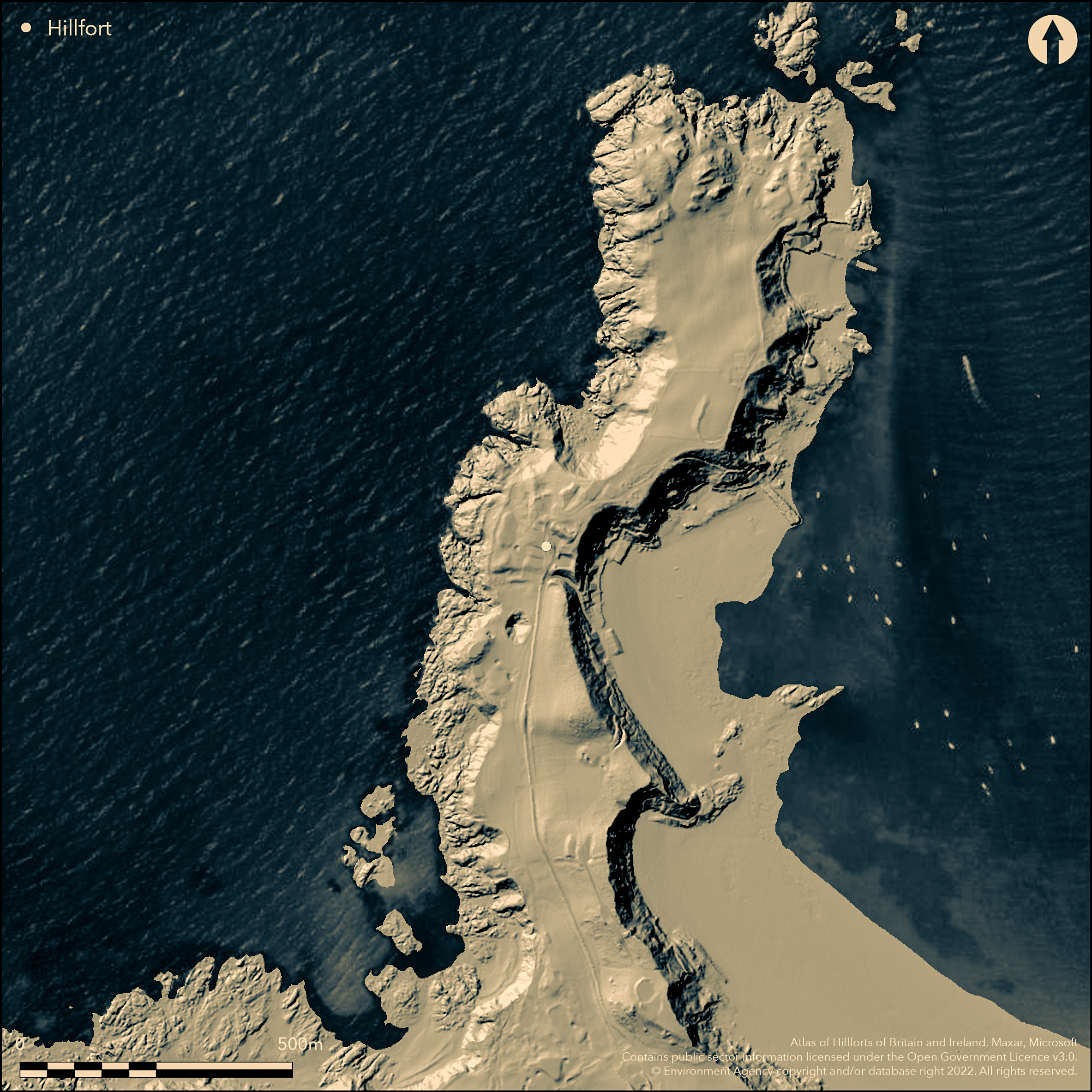
LiDAR 1m DTM Hillshade
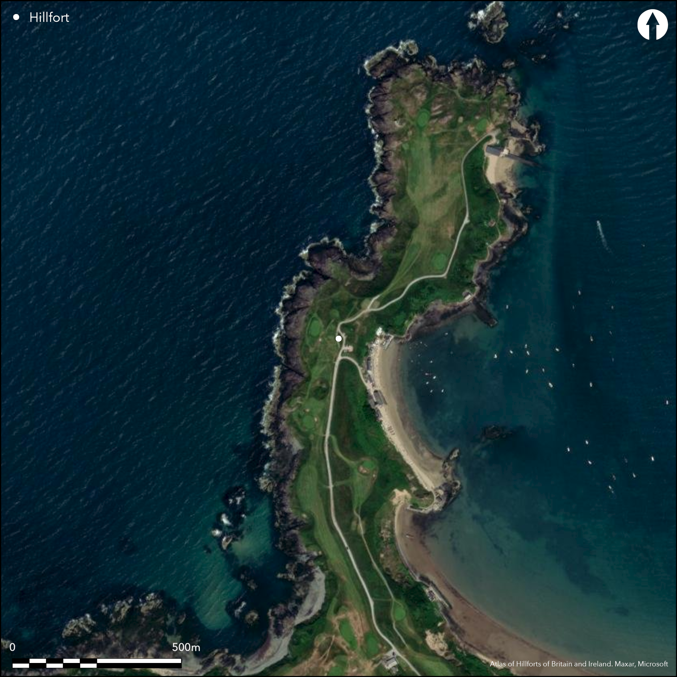
Satellite Imagery
LiDAR 1m DTM Hillshade
Satellite Imagery
Scroll left/right to view further images.
HER: Gwynedd 421 (None)
NMR: SH 24 SE 1 (302273)
SM: None
NGR: SH27504160
X: 227500 Y: 341600 (OSGB36)
Large, rocky, coastal promontory fort located at tip of N-facing promontory on N Ll_n. Rocky cliffs to NE, SW and NW, moderate landward to SE. Measures c. 400m by c. 120m with internal area c. 6ha. Enclosed by two lines of banks and/or ditches that cross the c. 100m wide neck. Interior and ramparts much affected by golf course. W half of S defences are preserved for c. 40m, consisting of 11m wide flat-bottomed ditch, with inner side 1.5m high, and with rounded counterscarp bank 4.5m wide and 0.9m high. 60m N of this bank are N defences (only E half survives) of a bank 37m long and 12m high external, 1.8m high from inside. To N two enclosures, but possibly result of modern turf cutting. Golf green lies on E part of inner rampart. Track to the beach has been cut between the ramparts. Interior and ramparts much damaged by golf-course. Flint fragments from beach pebbles in and outside fort. On 1st Ed. OS map (1885-1900). Minimal investigations, undated.
Citizen Science: ✗
Reliability of Data: Confirmed
Reliability of Interpretation: Confirmed
X: -508590 Y: 6972641 (EPSG: 3857)
Longitude: -4.568738556705042 Latitude: 52.94397193489167 (EPSG:4326)
Country: Wales
Current County or Unitary Authority: Gwynedd
Historic County: Caernarfonshire
Current Parish/Community/Council/Townland: Nefyn
Interior and ramparts much damaged by golf course. . Golf green lies on E part of inner rampart. Track to the beach has been cut between the ramparts.
| Extant | ✓ |
| Cropmark | ✗ |
| Likely Destroyed | ✗ |
Golf course.
| Woodland | ✗ |
| Commercial Forestry Plantation | ✗ |
| Parkland | ✗ |
| Pasture (Grazing) | ✗ |
| Arable | ✗ |
| Scrub/Bracken | ✗ |
| Bare Outcrop | ✗ |
| Heather/Moorland | ✗ |
| Heath | ✗ |
| Built-up | ✗ |
| Coastal Grassland | ✓ |
| Other | ✓ |
Large, rocky, coastal promontory fort located at tip of N-facing promontory on N Ll_n. Rocky cliffs to NE, SW and NW, moderate landward to SE.
| Contour Fort | ✗ |
| Partial Contour Fort | ✗ |
| Promontory Fort | ✓ |
| Hillslope Fort | ✗ |
| Level Terrain Fort | ✗ |
| Marsh Fort | ✗ |
| Multiple Enclosure Fort | ✗ |
| Hilltop | ✗ |
| Coastal Promontory | ✓ |
| Inland Promontory | ✗ |
| Valley Bottom | ✗ |
| Knoll/Hillock/Outcrop | ✗ |
| Ridge | ✗ |
| Cliff/Plateau-edge/Scarp | ✗ |
| Hillslope | ✗ |
| Lowland | ✗ |
| Spur | ✗ |
Dominant Topographic Feature: Coastal headland
| North | ✓ |
| Northeast | ✗ |
| East | ✗ |
| Southeast | ✗ |
| South | ✗ |
| Southwest | ✗ |
| West | ✗ |
| Northwest | ✗ |
| Level | ✗ |
Altitude: 20.0m
N/A
None
Reliability: D - None
| Pre 1200BC | ✗ |
| 1200BC - 800BC | ✗ |
| 800BC - 400BC | ✗ |
| 400BC - AD50 | ✗ |
| AD50 - AD400 | ✗ |
| AD400 - AD 800 | ✗ |
| Post AD800 | ✗ |
| Unknown | ✓ |
| Pre Hillfort: | None |
| Post Hillfort: | None |
On 1st Ed. OS map (1885-1900). Ordnance Survey observation 1971, 1975. GAT Coastal Erosion Survey: Aberdaron Bay to the Great Orme 1993. GAT prehistoric defended enclosures survey 2005-2006.
| Other (1993): | GAT coastal erosion survey. |
| 1st Identified Map Depiction (None): | OS map. |
| Other (None): | Ordnance Survey observation. |
| Other (None): | GAT prehistoric defended enclosures survey. |
Flint fragments from water-worn pebbles from the shore found in and outside fort.
None
| None | ✓ |
| Spring | ✗ |
| Stream | ✗ |
| Pool | ✗ |
| Flush | ✗ |
| Well | ✗ |
| Other | ✗ |
None
| No Known Features | ✓ |
| Round Stone Structures | ✗ |
| Rectangular Stone Structures | ✗ |
| Curvilinear Platforms | ✗ |
| Other Roundhouse Evidence | ✗ |
| Pits | ✗ |
| Quarry Hollows | ✗ |
| Other | ✗ |
None
| No Known Excavation | ✓ |
| Pits | ✗ |
| Postholes | ✗ |
| Roundhouses | ✗ |
| Rectangular Structures | ✗ |
| Roads/Tracks | ✗ |
| Quarry Hollows | ✗ |
| Other | ✗ |
| Nothing Found | ✗ |
None
| No Known Geophysics | ✓ |
| Pits | ✗ |
| Roundhouses | ✗ |
| Rectangular Structures | ✗ |
| Roads/Tracks | ✗ |
| Quarry Hollows | ✗ |
| Other | ✗ |
| Nothing Found | ✗ |
Flint fragments from water-worn pebbles from the shore found in and outside fort.
| No Known Finds | ✗ |
| Pottery | ✗ |
| Metal | ✗ |
| Metalworking | ✗ |
| Human Bones | ✗ |
| Animal Bones | ✗ |
| Lithics | ✓ |
| Environmental | ✗ |
| Other | ✗ |
NO APPARENT FEATURES
| APs Not Checked | ✓ |
| None | ✗ |
| Roundhouses | ✗ |
| Rectangular Structures | ✗ |
| Pits | ✗ |
| Postholes | ✗ |
| Roads/Tracks | ✗ |
| Other | ✗ |
None defined.
| 0: | None |
| 2: | None |
Guard Chambers: ✗
Chevaux de Frise: ✗
Enclosed by two lines of banks and/or ditches that cross the c. 100m wide neck. Interior and ramparts much affected by golf course. W half of S defences are preserved for c. 40m, consisting of 11m wide flat-bottomed ditch, with inner side 1.5m high, and with rounded counterscarp bank 4.5m wide and 0.9m high. 60m N of this bank are N defences (only E half survives) of a bank 37m long and 12m high external, 1.8m high from inside.
| Area 1: | 6.0ha. |
| Total: | 6.0ha. |
Total Footprint Area: Noneha.
None
| ✗ | None |
| ✗ | None |
| NE Quadrant: | 2 |
| SE Quadrant: | 2 |
| SW Quadrant: | 0 |
| NW Quadrant: | 0 |
| Total: | 2 |
| Partial Univallate | ✗ |
| Univallate | ✗ |
| Partial Bivallate | ✓ |
| Bivallate | ✗ |
| Partial Multivallate | ✗ |
| Multivallate | ✗ |
| Unknown | ✗ |
| Partial Univallate | ✗ |
| Univallate | ✗ |
| Partial Bivallate | ✗ |
| Bivallate | ✗ |
| Partial Multivallate | ✗ |
| Multivallate | ✗ |
None
| None | ✗ |
| Earthen Bank | ✓ |
| Stone Wall | ✗ |
| Rubble | ✗ |
| Wall-walk | ✗ |
| Evidence of Timber | ✗ |
| Vitrification | ✗ |
| Other Burning | ✗ |
| Palisade | ✗ |
| Counter Scarp Bank | ✓ |
| Berm | ✗ |
| Unfinished | ✗ |
| Other | ✗ |
Rounded counterscarp.
| None | ✗ |
| Earthen Bank | ✗ |
| Stone Wall | ✗ |
| Murus Duplex | ✗ |
| Timber-framed | ✗ |
| Timber-laced | ✗ |
| Vitrification | ✗ |
| Other Burning | ✗ |
| Palisade | ✗ |
| Counter Scarp Bank | ✓ |
| Berm | ✗ |
| Unfinished | ✗ |
| No Known Excavation | ✓ |
| Other | ✗ |
| ✗ | None |
| ✓ | Wide flat-bottomed ditch. |
Number of Ditches: 1
| ✗ | None |
Berks, T., Davidson, A. and Evans, R. 2010. Arfordir/Coastal Heritage: Gwynedd, GAT Report No. 861, Bangor: Gwynedd Archaeological Trust.
Evans, R. 2010. Porthdinllaen Lifeboat Station, Nefyn, GAT Report No. 843, Bangor: Gwynedd Archaeological Trust.
RCAHMW 1964. Caernarvonshire Vol III: West, A survey and inventory by the Royal Commission on Ancient and Historical Monuments in Wales and Monmouthshire, No 1567, London: HMSO.
Riley, H. and Smith, G. 1993. Coastal Erosion Survey: Aberdaron Bay to the Great Orme, GAT Report No. 079, Bangor: Gwynedd Archaeological Trust.
Smith, G.H. 2006. A survey of prehistoric defended enclosures in north-west Wales 2005-2006: Gwynedd Dwyfor and Meirionnydd. Report No 634. Part I: Survey Report. Bangor: Gwynedd Archaeological Trust.
Waddington, K. 2013. The Settlements of Northwest Wales: From the Late Bronze Age to the Early Medieval Period, Cardiff: University of Wales Press.
Atlas of Hillforts:
Wikidata:
This work is licensed under CC BY-SA 4.0

 and should be cited as:
Lock, Gary and Ralston, Ian. 2024. Atlas of Hillforts of Britain and Ireland. Available at: https://hillforts.arch.ox.ac.uk
Document Version 1.1