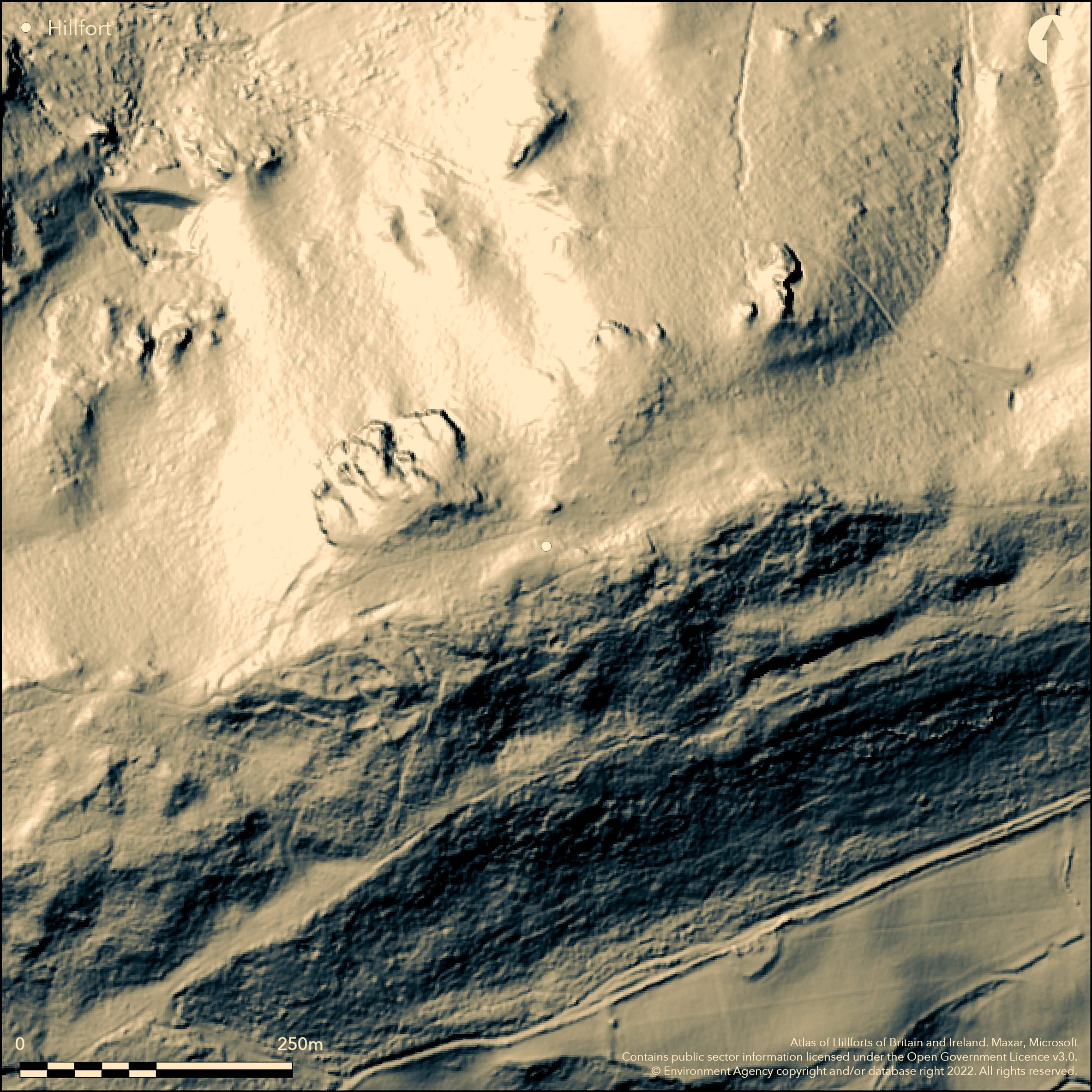
LiDAR 1m DTM Hillshade
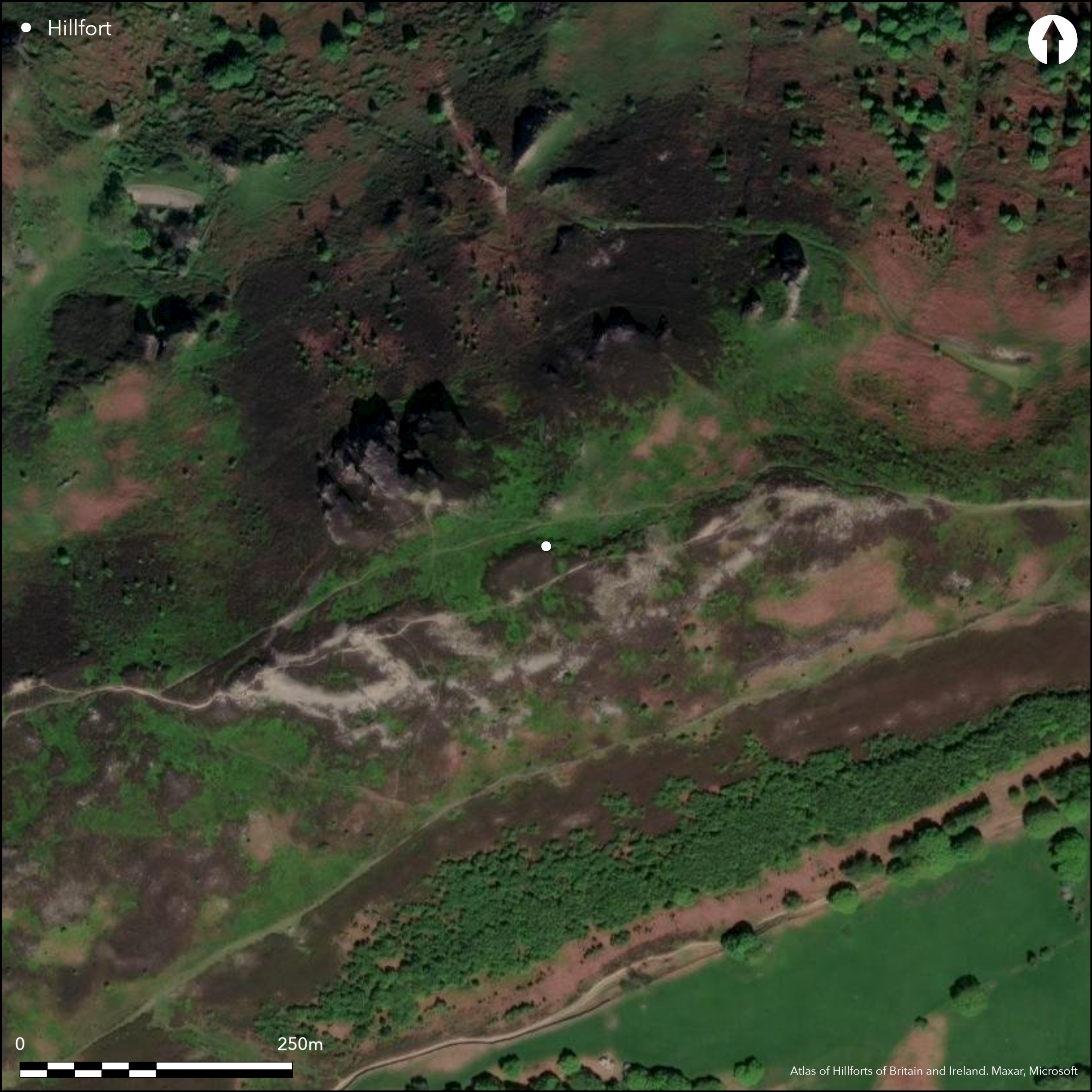
Satellite Imagery
LiDAR 1m DTM Hillshade
Satellite Imagery
Scroll left/right to view further images.
HER: Gwynedd 2816 (None)
NMR: SH 77 NE 3 (95279)
SM: CN012
NGR: SH76047784
X: 276040 Y: 377840 (OSGB36)
Important contour hillfort in a prominent, exposed and rocky strategic position on Conwy Mountain overlooking and commanding the coastal plain and Conwy estuary. Surrounding slopes to N precipitous, S very steep, E and W steep. Massive tumbled walls and scree cover large parts of area. Measures c. 330m ENE-WSW by 100m, with internal area c. 2.7ha. Excavated by W.E. Griffiths and A.H.A. Hogg 1951 finding two periods of pre-Roman occupation. Site defined generally by massive stone-wall defences and precipitous slopes to N result in no defences to the main enclosure here but a thick stone wall to S. There is a small 'citadel' at SW end, similar to that at Carn Boduan (Atlas No.1681) and Carn Fadrun (Atlas No. 1678 ) on the Ll_n. Here the defences are strengthened by an earthen rampart and ditch running across the hill just below E wall. Citadel entered independently from a small annexe on the S side. The citadel and annexe complex is subject to much debate at to its sequence. Two well-preserved entrances survive. To the main enclosure a simple gap entrance still shows orthostats and construction, with possible timber bridge taking rampart over. Entrance to the citadel on the S from the annexe has a blocked gate. Some 50 hut circles survive, mostly platforms, ranging from 3m to 10m diameter. Little change of these in two periods. Lack of dateable finds and little change in huts over both periods from excavations suggest that site not reoccupied in late Roman period is the case with some north Welsh sites such as Dinorben (Atlas No. 1168). Re-excavation of old trenches (Smith 2011) yielded three C14 dates 400-200 cal BC for occupation. Rough upland grass, moorland and bare rock. Traditional associations with the 6th century king Maelwyn Gwynedd. Upland rough grass and moorland. Much bare rock. Tumbled walls, but in good condition. On 1st Ed. OS map (1889).
Citizen Science: ✗
Reliability of Data: Confirmed
Reliability of Interpretation: Confirmed
X: -429786 Y: 7035515 (EPSG: 3857)
Longitude: -3.8608295109625894 Latitude: 53.28298490721152 (EPSG:4326)
Country: Wales
Current County or Unitary Authority: Conwy
Historic County: Caernarfonshire
Current Parish/Community/Council/Townland: Conwy
Tumbled walls, but in good condition.
| Extant | ✓ |
| Cropmark | ✗ |
| Likely Destroyed | ✗ |
Upland rough grass and moorland. Much bare rock. 'Citadel'.
| Woodland | ✗ |
| Commercial Forestry Plantation | ✗ |
| Parkland | ✗ |
| Pasture (Grazing) | ✓ |
| Arable | ✗ |
| Scrub/Bracken | ✗ |
| Bare Outcrop | ✗ |
| Heather/Moorland | ✓ |
| Heath | ✗ |
| Built-up | ✗ |
| Coastal Grassland | ✗ |
| Other | ✓ |
Important contour hillfort in a prominent, exposed and rocky strategic position on Conwy Mountain overlooking and commanding the coastal plain and Conwy estuary. Surrounding slopes to N precipitous, S very steep, E and W steep.
| Contour Fort | ✓ |
| Partial Contour Fort | ✗ |
| Promontory Fort | ✗ |
| Hillslope Fort | ✗ |
| Level Terrain Fort | ✗ |
| Marsh Fort | ✗ |
| Multiple Enclosure Fort | ✗ |
| Hilltop | ✓ |
| Coastal Promontory | ✗ |
| Inland Promontory | ✗ |
| Valley Bottom | ✗ |
| Knoll/Hillock/Outcrop | ✗ |
| Ridge | ✗ |
| Cliff/Plateau-edge/Scarp | ✗ |
| Hillslope | ✗ |
| Lowland | ✗ |
| Spur | ✗ |
Dominant Topographic Feature: Hill top
| North | ✗ |
| Northeast | ✗ |
| East | ✗ |
| Southeast | ✗ |
| South | ✗ |
| Southwest | ✗ |
| West | ✗ |
| Northwest | ✗ |
| Level | ✓ |
Altitude: 230.0m
N/A
Excavations found two periods of fortification; both within the latter part of pre-Roman Iron Age, both periods including a large and a small enclosure. Finds and little change in huts in both periods, identified in excavations, strongly indicate a pre-Roman date. Three C14 dates 400-200 cal BC for occupation (Smith 2011).
Reliability: B - Medium
| Pre 1200BC | ✗ |
| 1200BC - 800BC | ✗ |
| 800BC - 400BC | ✗ |
| 400BC - AD50 | ✓ |
| AD50 - AD400 | ✗ |
| AD400 - AD 800 | ✗ |
| Post AD800 | ✗ |
| Unknown | ✗ |
| Pre Hillfort: | None |
| Post Hillfort: | None |
| Artefactual: | Interpretation from excavations. |
| C14: | None |
| Morphology/Earthwork/Typology: | Interpretation from excavations. |
On 1st Ed. OS map (1889). Excavations by W.E. Griffiths and A.H.A. Hogg 1951. Ordnace survey investigations 1970, 1971. Field observations by GAT from 1988-2005 recorded. GAT prehistoric defended enclosures survey 2004-2005. Re-excavation of old trenches in 2008 (Smith 2011).
| 1st Identified Map Depiction (1889): | OS map. |
| Excavation (1951): | W.E. Griffiths and A.H.A. Hogg. |
| Other (1967): | Visited by Hillfort Study Group |
| Other (1992): | Visited by Hillfort Study Group |
| Excavation (2008): | None |
| Other (None): | Ordnance Survey investigations. |
| Other (None): | GAT field observations. |
| Other (None): | GAT prehistoric defended enclosures survey. |
Some 50 hut platforms visible. General lack of finds in excavations, but slingstones, saddle querns, stone spindle whorls, rubbers, pounders and stone pestles and mortars found.
Stream 0.5 km outside fort.
| None | ✓ |
| Spring | ✗ |
| Stream | ✗ |
| Pool | ✗ |
| Flush | ✗ |
| Well | ✗ |
| Other | ✗ |
Some 50 hut platforms visible, some defined by visible stone walling.
| No Known Features | ✗ |
| Round Stone Structures | ✓ |
| Rectangular Stone Structures | ✗ |
| Curvilinear Platforms | ✓ |
| Other Roundhouse Evidence | ✗ |
| Pits | ✗ |
| Quarry Hollows | ✗ |
| Other | ✗ |
None
| No Known Excavation | ✗ |
| Pits | ✗ |
| Postholes | ✗ |
| Roundhouses | ✓ |
| Rectangular Structures | ✗ |
| Roads/Tracks | ✗ |
| Quarry Hollows | ✗ |
| Other | ✗ |
| Nothing Found | ✗ |
None
| No Known Geophysics | ✓ |
| Pits | ✗ |
| Roundhouses | ✗ |
| Rectangular Structures | ✗ |
| Roads/Tracks | ✗ |
| Quarry Hollows | ✗ |
| Other | ✗ |
| Nothing Found | ✗ |
General lack of finds in excavations, but slingstones, saddle querns, stone spindle whorls, rubbers, pounders and stone pestles and mortars found.
| No Known Finds | ✗ |
| Pottery | ✗ |
| Metal | ✗ |
| Metalworking | ✗ |
| Human Bones | ✗ |
| Animal Bones | ✗ |
| Lithics | ✓ |
| Environmental | ✗ |
| Other | ✗ |
None
| APs Not Checked | ✓ |
| None | ✗ |
| Roundhouses | ✗ |
| Rectangular Structures | ✗ |
| Pits | ✗ |
| Postholes | ✗ |
| Roads/Tracks | ✗ |
| Other | ✗ |
To the main enclosure a simple gap entrance on S still shows orthostats and construction. Citadel entered independently from a small annexe on the S side.
| 2: | None |
| 2: | None |
Guard Chambers: ✗
Chevaux de Frise: ✗
| 1. Simple Gap (South): | Self-contained citadel entrance from annexe |
| 2. Simple Gap (South): | Entrance to main enclosure. Still shows orthostats and construction. |
Site defined generally by massive stone-wall defences and precipitous slopes to N result in no defences to the main enclosure here but a thick stone wall to S. There is a small 'citadel' at SW end. Here defences strengthened by earthen rampart and ditch running across the hill just below E wall.
| Area 1: | 2.7ha. |
| Total: | 2.7ha. |
Total Footprint Area: Noneha.
None
| ✓ | Excavations found two periods of construction; both within the latter part of pre-Roman Iron Age, and both periods include a large and a small enclosure. |
| ✓ | Overall defence. Additional walls define citadel and annexe at SW. |
| NE Quadrant: | 1 |
| SE Quadrant: | 1 |
| SW Quadrant: | 1 |
| NW Quadrant: | 1 |
| Total: | 1 |
| Partial Univallate | ✗ |
| Univallate | ✓ |
| Partial Bivallate | ✗ |
| Bivallate | ✗ |
| Partial Multivallate | ✗ |
| Multivallate | ✗ |
| Unknown | ✗ |
| Partial Univallate | ✗ |
| Univallate | ✗ |
| Partial Bivallate | ✗ |
| Bivallate | ✗ |
| Partial Multivallate | ✗ |
| Multivallate | ✗ |
Mainly massive stone-walled site. Defences strengthened by earthen rampart and ditch running across the hill just below E wall.
| None | ✗ |
| Earthen Bank | ✓ |
| Stone Wall | ✓ |
| Rubble | ✗ |
| Wall-walk | ✗ |
| Evidence of Timber | ✗ |
| Vitrification | ✗ |
| Other Burning | ✗ |
| Palisade | ✗ |
| Counter Scarp Bank | ✗ |
| Berm | ✗ |
| Unfinished | ✗ |
| Other | ✗ |
Structural details of construction and phasing of site.
| None | ✗ |
| Earthen Bank | ✓ |
| Stone Wall | ✓ |
| Murus Duplex | ✗ |
| Timber-framed | ✗ |
| Timber-laced | ✗ |
| Vitrification | ✗ |
| Other Burning | ✗ |
| Palisade | ✗ |
| Counter Scarp Bank | ✗ |
| Berm | ✗ |
| Unfinished | ✗ |
| No Known Excavation | ✗ |
| Other | ✗ |
| ✗ | None |
| ✓ | Defences strengthened by earthen rampart and ditch running across the hill just below E wall. |
Number of Ditches: 1
| ✓ | Small annexe associated with the citadel at SW end of site. |
Brown, I. 2009. Beacons in the landscape. The hillforts of England and Wales, Oxford: Windgather Press/Oxbow Books.
Griffiths, W. E. and Hogg, A. H. A. 1956, The Hillfort on Conway Mountain, Caernarvonshire, Arch Camb, 105, 49-80.
Picton, H. 1909. Caer Seiont, Conway Mountain, Arch Camb, 6th Series, 9, 500- 504.
RCAHMW 1956. Caernarvonshire Vol I: East, A survey and inventory by the Royal Commission on Ancient and Historical Monuments in Wales and Monmouthshire, London: HMSO.
Smith, G. 2011. Re-assessment of two hillforts in North Wales: Pen-y-Dinas, Llandudno, and Caer Seion, Conwy, Arch Wales, 51, 61-78.
Atlas of Hillforts:
Wikidata:
This work is licensed under CC BY-SA 4.0

 and should be cited as:
Lock, Gary and Ralston, Ian. 2024. Atlas of Hillforts of Britain and Ireland. Available at: https://hillforts.arch.ox.ac.uk
Document Version 1.1