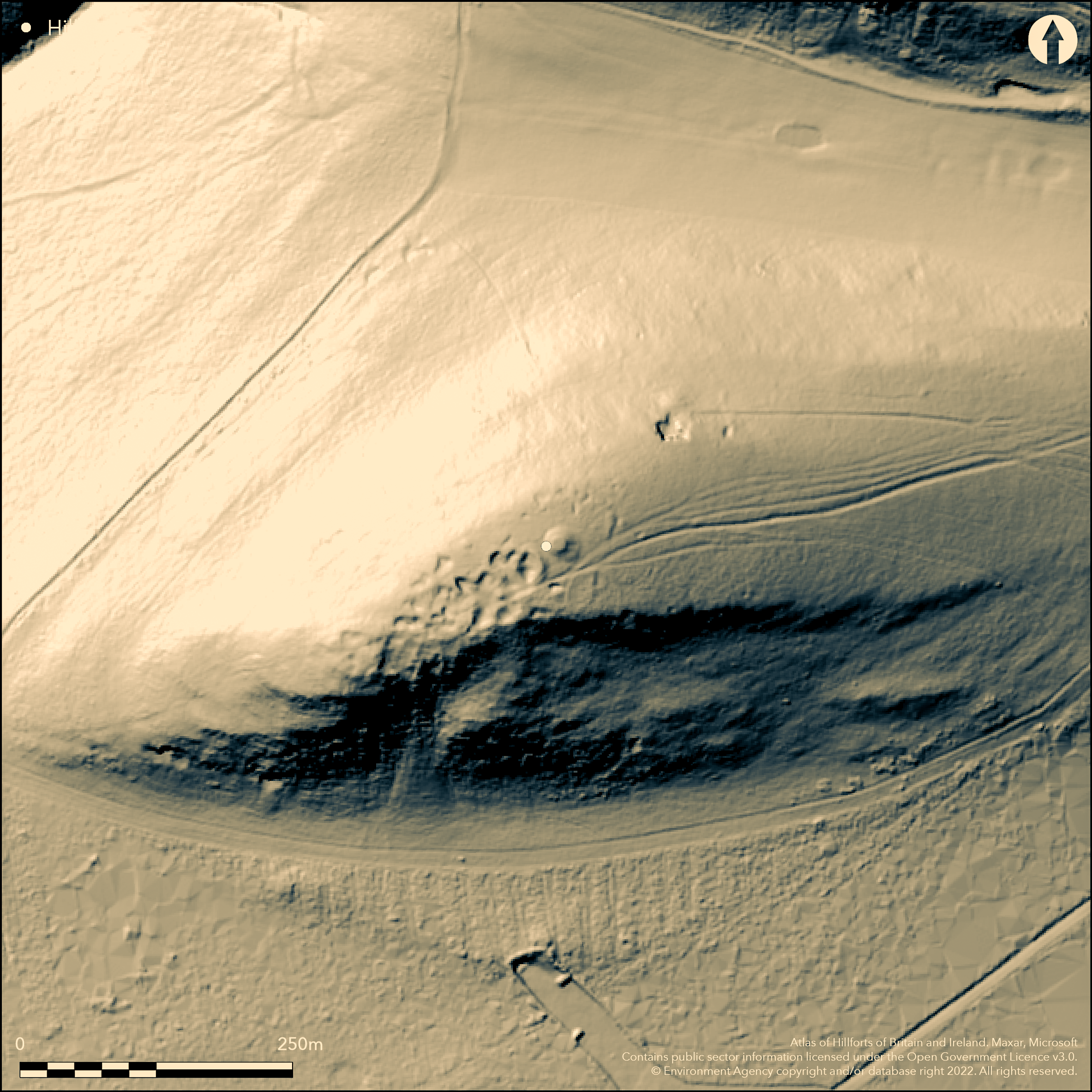
LiDAR 1m DTM Hillshade
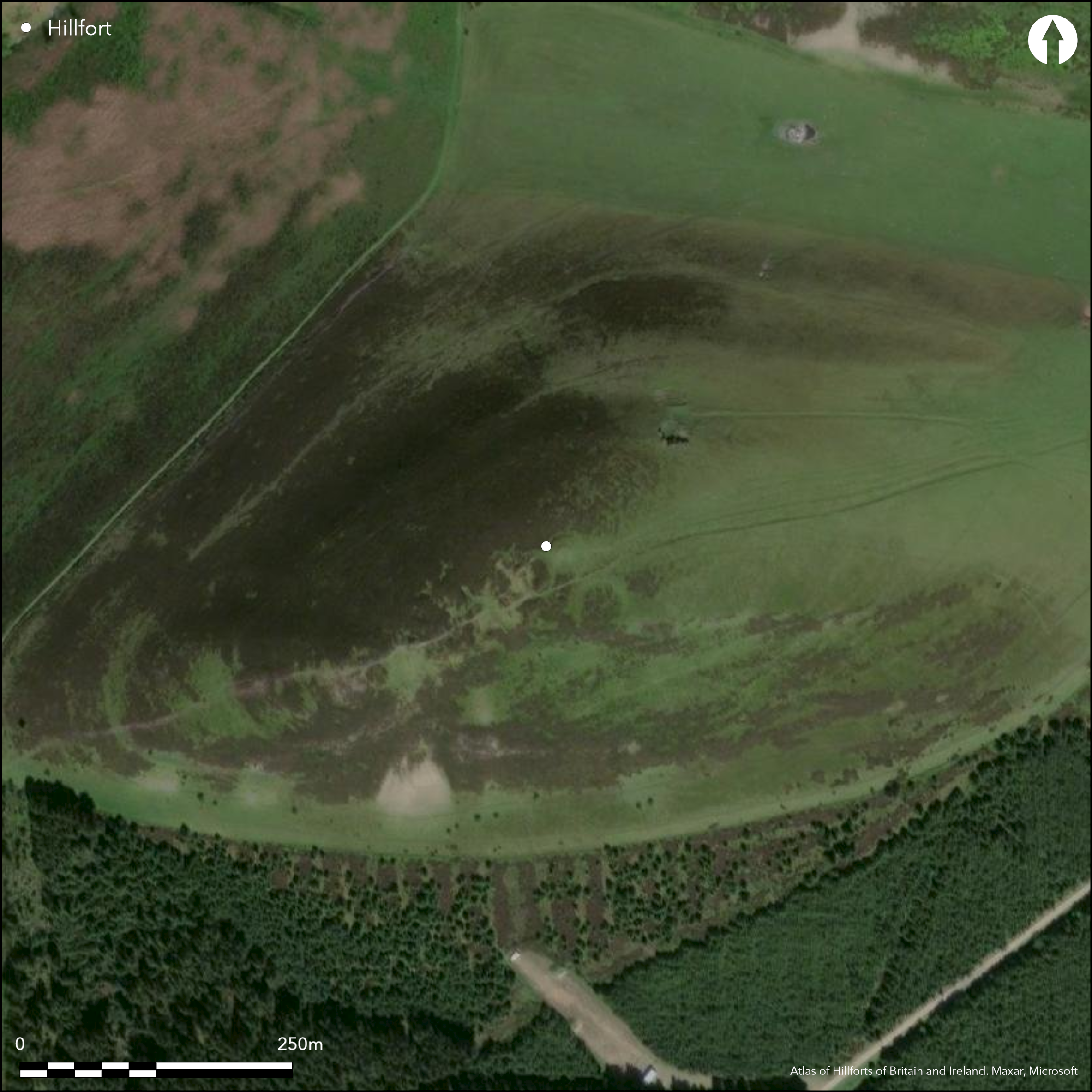
Satellite Imagery
LiDAR 1m DTM Hillshade
Satellite Imagery
Scroll left/right to view further images.
HER: Clwyd Powys 26297 (None)
NMR: SO 26 SW (401557)
SM: None
NGR: SO 2053 6266
X: 320509 Y: 262643 (OSGB36)
Very high (590m O.D.) contour hillfort located on summit of the Whimble, an isolated hill NW of the Walton Basin, N of New Radnor. Very steep surrounding slopes, less on E where more accessible. Measures c. 180m ENE-WSW by 100m, with internal area c. 1.8ha. On E, below summit, low curving bank c. 36m long with outer ditch to c. 0.9m high. About 20m from N end hollowing of the bank is possible entrance, or just a track leading into summit enclosure and its barrow or cairn. Eventually bank disappears amid tracks running up the hill. Then starts again and overlain by earthworks of the Whimble enclosure re-emerging as gentle bank and curving for short distance to SW. Rough upland grazing. Confusing site as much is lost. No evidence for internal features. Minimal investigations, undated.
Citizen Science: ✗
Reliability of Data: Confirmed
Reliability of Interpretation: Confirmed
X: -352439 Y: 6846576 (EPSG: 3857)
Longitude: -3.1660094363393876 Latitude: 52.25616018685208 (EPSG:4326)
Country: Wales
Current County or Unitary Authority: Powys
Historic County: Radnorshire
Current Parish/Community/Council/Townland: New Radnor
Confusing site as much lost.
| Extant | ✓ |
| Cropmark | ✗ |
| Likely Destroyed | ✗ |
Rough upland grazing and bare rock.
| Woodland | ✗ |
| Commercial Forestry Plantation | ✗ |
| Parkland | ✗ |
| Pasture (Grazing) | ✓ |
| Arable | ✗ |
| Scrub/Bracken | ✗ |
| Bare Outcrop | ✗ |
| Heather/Moorland | ✗ |
| Heath | ✗ |
| Built-up | ✗ |
| Coastal Grassland | ✗ |
| Other | ✗ |
Very high contour hillfort klocated on summit of the Whimble, an isolated hill NW of the Walton Basin, N of New Radnor. Very steep surrounding slopes, less on E where more accessible.
| Contour Fort | ✓ |
| Partial Contour Fort | ✗ |
| Promontory Fort | ✗ |
| Hillslope Fort | ✗ |
| Level Terrain Fort | ✗ |
| Marsh Fort | ✗ |
| Multiple Enclosure Fort | ✗ |
| Hilltop | ✓ |
| Coastal Promontory | ✗ |
| Inland Promontory | ✗ |
| Valley Bottom | ✗ |
| Knoll/Hillock/Outcrop | ✗ |
| Ridge | ✗ |
| Cliff/Plateau-edge/Scarp | ✗ |
| Hillslope | ✗ |
| Lowland | ✗ |
| Spur | ✗ |
Dominant Topographic Feature: Hill top
| North | ✗ |
| Northeast | ✗ |
| East | ✗ |
| Southeast | ✗ |
| South | ✗ |
| Southwest | ✗ |
| West | ✗ |
| Northwest | ✗ |
| Level | ✓ |
Altitude: 590.0m
N/A
None
Reliability: D - None
| Pre 1200BC | ✗ |
| 1200BC - 800BC | ✗ |
| 800BC - 400BC | ✗ |
| 400BC - AD50 | ✗ |
| AD50 - AD400 | ✗ |
| AD400 - AD 800 | ✗ |
| Post AD800 | ✗ |
| Unknown | ✓ |
| Pre Hillfort: | Probable summit barrow (cairn). |
| Post Hillfort: | None |
CPAT defended enclosures survey 2006.
| Other (2006): | CPAT defended enclosures survey. |
None
None
| None | ✓ |
| Spring | ✗ |
| Stream | ✗ |
| Pool | ✗ |
| Flush | ✗ |
| Well | ✗ |
| Other | ✗ |
None
| No Known Features | ✓ |
| Round Stone Structures | ✗ |
| Rectangular Stone Structures | ✗ |
| Curvilinear Platforms | ✗ |
| Other Roundhouse Evidence | ✗ |
| Pits | ✗ |
| Quarry Hollows | ✗ |
| Other | ✗ |
None
| No Known Excavation | ✓ |
| Pits | ✗ |
| Postholes | ✗ |
| Roundhouses | ✗ |
| Rectangular Structures | ✗ |
| Roads/Tracks | ✗ |
| Quarry Hollows | ✗ |
| Other | ✗ |
| Nothing Found | ✗ |
None
| No Known Geophysics | ✓ |
| Pits | ✗ |
| Roundhouses | ✗ |
| Rectangular Structures | ✗ |
| Roads/Tracks | ✗ |
| Quarry Hollows | ✗ |
| Other | ✗ |
| Nothing Found | ✗ |
None
| No Known Finds | ✓ |
| Pottery | ✗ |
| Metal | ✗ |
| Metalworking | ✗ |
| Human Bones | ✗ |
| Animal Bones | ✗ |
| Lithics | ✗ |
| Environmental | ✗ |
| Other | ✗ |
None
| APs Not Checked | ✓ |
| None | ✗ |
| Roundhouses | ✗ |
| Rectangular Structures | ✗ |
| Pits | ✗ |
| Postholes | ✗ |
| Roads/Tracks | ✗ |
| Other | ✗ |
About 20m from N end hollowing of the bank is possible entrance, or just a track leading into summit enclosure and its barrow or cairn.
| 1: | None |
| 2: | Possible entrance only. |
Guard Chambers: ✗
Chevaux de Frise: ✗
| 1. In-turned (East): | Possible entrance only. |
On E, below summit, low curving bank c. 36m long with outer ditch to c. 0.9m high. About 20m from N end hollowing of the bank is possible entrance, or just a track leading into summit enclosure and its barrow or cairn. Eventually bank disappears amid tracks running up the hill. Then starts again and overlain by earthworks of the Whimble enclosure re-emerging as gentle bank and curving for short distance to SW.
| Area 1: | 1.8ha. |
| Total: | 1.8ha. |
Total Footprint Area: Noneha.
None
| ✗ | None |
| ✗ | Quadrants estimated. |
| NE Quadrant: | 1 |
| SE Quadrant: | 0 |
| SW Quadrant: | 1 |
| NW Quadrant: | 0 |
| Total: | 1 |
| Partial Univallate | ✓ |
| Univallate | ✗ |
| Partial Bivallate | ✗ |
| Bivallate | ✗ |
| Partial Multivallate | ✗ |
| Multivallate | ✗ |
| Unknown | ✗ |
| Partial Univallate | ✗ |
| Univallate | ✗ |
| Partial Bivallate | ✗ |
| Bivallate | ✗ |
| Partial Multivallate | ✗ |
| Multivallate | ✗ |
Probably stone-walled site, but only conjecture.
| None | ✗ |
| Earthen Bank | ✓ |
| Stone Wall | ✗ |
| Rubble | ✗ |
| Wall-walk | ✗ |
| Evidence of Timber | ✗ |
| Vitrification | ✗ |
| Other Burning | ✗ |
| Palisade | ✗ |
| Counter Scarp Bank | ✗ |
| Berm | ✗ |
| Unfinished | ✗ |
| Other | ✗ |
None
| None | ✗ |
| Earthen Bank | ✗ |
| Stone Wall | ✗ |
| Murus Duplex | ✗ |
| Timber-framed | ✗ |
| Timber-laced | ✗ |
| Vitrification | ✗ |
| Other Burning | ✗ |
| Palisade | ✗ |
| Counter Scarp Bank | ✗ |
| Berm | ✗ |
| Unfinished | ✗ |
| No Known Excavation | ✓ |
| Other | ✗ |
| ✗ | None |
| ✓ | None |
Number of Ditches: 1
| ✗ | None |
Silvester, R.J. and Hankinson, R. 2006. Defended enclosures in Radnorshire. Project report, CPAT Report 781, Welshpool: CPAT.
Atlas of Hillforts:
Wikidata:
This work is licensed under CC BY-SA 4.0

 and should be cited as:
Lock, Gary and Ralston, Ian. 2024. Atlas of Hillforts of Britain and Ireland. Available at: https://hillforts.arch.ox.ac.uk
Document Version 1.1