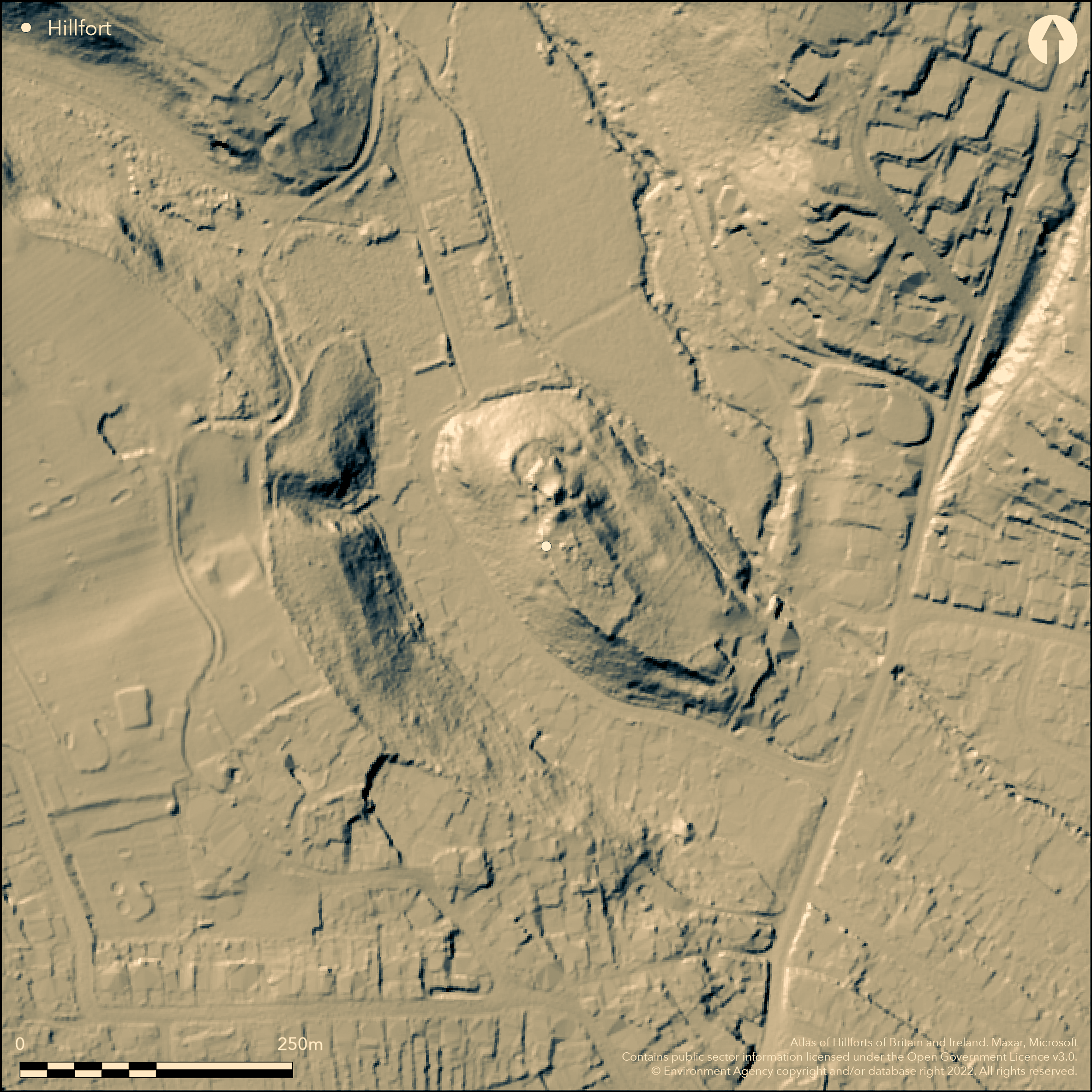
LiDAR 1m DTM Hillshade
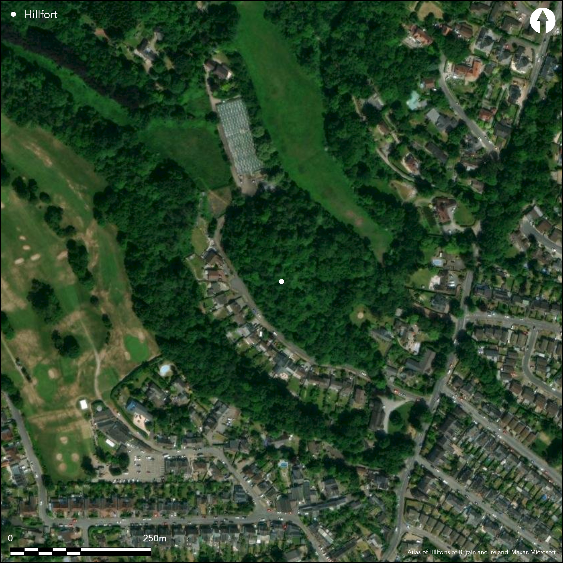
Satellite Imagery
LiDAR 1m DTM Hillshade
Satellite Imagery
Scroll left/right to view further images.
HER: Glamorgan Gwent 00014s (None)
NMR: ST 17 SW 13 (301314)
SM: None
NGR: ST15207160
X: 315254 Y: 171645 (OSGB36)
Very small possible promontory enclosure occupying the highest N spur of an isolated limestone ridge, some 2km from the Ely estuary, and above the present Dinas Powys village. Steep surrounding slopes, except on S, facing the level hill top. Many questions remain as to whether this very small , roughly oval, site of only 0.8ha, with substantial early medieval connotations, is a settlement/princely llys, as referred to by Alcock, its excavater in 1954-9, or an early medieval settlement, and morphologically a ringwork or small promontory fort, as suggested by RCAHME (Coflein). An early medival defended enclosure would be more appropriate as designated in the HER and by Wiggins and Evans (2005). Alcock considered that this complex sequence was of an earlier, unenclosed, Iron Age settlement, overlain by an early medieval enclosure and itself overlain by a massively enclosed earthwork castle. To disentangle matters is problematic in the present state of knowledge of the site. Defined by broad rampart with ditch and palisade on N. Three further ramparts on S, one possibly continuing around W side. Inner rampart stone revetted with possible timber-framed breastwork. Second, ditched, rampart less. Two outer ramparts massive, inner stone revetted, and seem to be a pair. Traces of two rectangular buildings, to 7.5m wide, in interior. Entrance at far NW, approached along spine of steep slopes below. Site most notable for its, mostly early medieval, finds, with the largest collection of imported goods, many from distant parts of Europe, of any early medieval site in Wales. Also Roman material and fragments of 12th century pot. Beneath lay fragments of Iron Age pottery. Bank and ditch S from enclosure old field boundary shown, as the site, on the 1st edition OS map (1880). Excavation in 2012 produced C14 date of 2852-2476 cal BC at a 95% probability from buried soil beneath the bank and sherds of late and post-medieval pottery from upper ditch fill. Suggested that area to S of site appears devoid of settlement with no evidence that site extended S (Seaman and Lane 2012). Second defended enclosure 130m away on the S edge of hilltop (NPRN 307785).
Citizen Science: ✗
Reliability of Data: Confirmed
Reliability of Interpretation: Unconfirmed
X: -358521 Y: 6699031 (EPSG: 3857)
Longitude: -3.2206469913323117 Latitude: 51.437390508272614 (EPSG:4326)
Country: Wales; None
Current County or Unitary Authority: Vale of Glamorgan
Historic County: Glamorgan
Current Parish/Community/Council/Townland: St Andrews Major; Michaelston le Pit
Fair condition.
| Extant | ✓ |
| Cropmark | ✗ |
| Likely Destroyed | ✗ |
Wooded scrub site.
| Woodland | ✓ |
| Commercial Forestry Plantation | ✗ |
| Parkland | ✗ |
| Pasture (Grazing) | ✗ |
| Arable | ✗ |
| Scrub/Bracken | ✓ |
| Bare Outcrop | ✗ |
| Heather/Moorland | ✗ |
| Heath | ✗ |
| Built-up | ✗ |
| Coastal Grassland | ✗ |
| Other | ✗ |
Very small possible promontory enclosure occupying the highest N spur of an isolated limestone ridge, some 2km from the Ely estuary, and above the present Dinas Powys village. Steep surrounding slopes, except on S, facing the level hill top.
| Contour Fort | ✗ |
| Partial Contour Fort | ✗ |
| Promontory Fort | ✓ |
| Hillslope Fort | ✗ |
| Level Terrain Fort | ✗ |
| Marsh Fort | ✗ |
| Multiple Enclosure Fort | ✗ |
| Hilltop | ✗ |
| Coastal Promontory | ✗ |
| Inland Promontory | ✓ |
| Valley Bottom | ✗ |
| Knoll/Hillock/Outcrop | ✗ |
| Ridge | ✓ |
| Cliff/Plateau-edge/Scarp | ✗ |
| Hillslope | ✗ |
| Lowland | ✗ |
| Spur | ✗ |
Dominant Topographic Feature: Limestone ridge.
| North | ✗ |
| Northeast | ✗ |
| East | ✗ |
| Southeast | ✗ |
| South | ✗ |
| Southwest | ✗ |
| West | ✗ |
| Northwest | ✗ |
| Level | ✓ |
Altitude: Nonem
Boundary Type: Parish/Townland
Site most notable for its, mostly early medieval, finds, with the largest collection of imported goods, many from distant parts of Europe, of any early medieval site in Wales. Also Roman material and fragments of 12th century pot. Beneath lay fragments of Iron Age pottery, seemingly from unenclosed settlement. Two rectangular buildings in interior. It is possible that the enclosure had Roman origins as a defended settlement.
Reliability: B - Medium
| Pre 1200BC | ✗ |
| 1200BC - 800BC | ✗ |
| 800BC - 400BC | ✗ |
| 400BC - AD50 | ✗ |
| AD50 - AD400 | ✓ |
| AD400 - AD 800 | ✓ |
| Post AD800 | ✗ |
| Unknown | ✗ |
| Pre Hillfort: | None |
| Post Hillfort: | None |
| Artefactual: | Early medieval and Roman finds. |
| Other: | Two rectangular buildings in interior. |
On 1st Ed. OS map (1880). Excavation (Southern Banks, Dinas Powys) L. Alcock 1954-9. Ordnance Survey investigations 1962, 1978. DBA Cwm George Woods, Vale of Glamorgan 1997. GGAT Early-Medieval Ecclesiastical Sites Project 2003. Evaluation Tyn Y Coed, Dinas Powys 2011. Excavation Tyn Y Coed, Dinas Powys 2012.
| Other (2003): | GGAT Early-Medieval Ecclesiastical Sites Project. |
| Other (2011): | Evaluation Tyn Y Coed, Dinas Powys. |
| Excavation (2012): | Tyn y Coed, Dinas Powys. |
| Excavation (None): | Southern Banks, L. Alcock. |
| Other (None): | OS investigations. |
Traces of two rectangular buildings, to 7.5m wide, in interior. Site most notable for its, mostly early medieval, finds, with the largest collection of imported goods, many from distant parts of Europe, of any early medieval site in Wales. Also Roman material and fragments of 12th century pot. Beneath lay fragments of Iron Age pottery.
None
| None | ✓ |
| Spring | ✗ |
| Stream | ✗ |
| Pool | ✗ |
| Flush | ✗ |
| Well | ✗ |
| Other | ✗ |
None
| No Known Features | ✓ |
| Round Stone Structures | ✗ |
| Rectangular Stone Structures | ✗ |
| Curvilinear Platforms | ✗ |
| Other Roundhouse Evidence | ✗ |
| Pits | ✗ |
| Quarry Hollows | ✗ |
| Other | ✗ |
Traces of two rectangular buildings, to 7.5m wide, in interior. Pits.
| No Known Excavation | ✗ |
| Pits | ✓ |
| Postholes | ✗ |
| Roundhouses | ✗ |
| Rectangular Structures | ✓ |
| Roads/Tracks | ✗ |
| Quarry Hollows | ✗ |
| Other | ✗ |
| Nothing Found | ✗ |
No details.
| No Known Geophysics | ✓ |
| Pits | ✗ |
| Roundhouses | ✗ |
| Rectangular Structures | ✗ |
| Roads/Tracks | ✗ |
| Quarry Hollows | ✗ |
| Other | ✗ |
| Nothing Found | ✗ |
Site most notable for its, mostly early medieval, finds, with the largest collection of imported goods, many from distant parts of Europe, of any early medieval site in Wales. Also Roman material and fragments of 12th century pot. Beneath lay fragments of Iron Age pottery.
| No Known Finds | ✗ |
| Pottery | ✓ |
| Metal | ✓ |
| Metalworking | ✗ |
| Human Bones | ✗ |
| Animal Bones | ✗ |
| Lithics | ✗ |
| Environmental | ✗ |
| Other | ✓ |
None
| APs Not Checked | ✓ |
| None | ✗ |
| Roundhouses | ✗ |
| Rectangular Structures | ✗ |
| Pits | ✗ |
| Postholes | ✗ |
| Roads/Tracks | ✗ |
| Other | ✗ |
Entrance at far NW, approached along spine of steep slopes below.
| 1: | None |
| 2: | None |
Guard Chambers: ✗
Chevaux de Frise: ✗
| 1. Simple Gap (North west): | Approached along spine of steep slopes below. |
Defined by broad rampart with ditch and palisade on N. Three further ramparts on S, one possibly continuing around W side. Inner rampart stone revetted with possible timber-framed breastwork. Second, ditched, rampart less. Two outer ramparts massive, inner stone revetted, and seem to be a pair. Traces of two rectangular buildings to 7.5m wide, in interior.
| Area 1: | 0.08ha. |
| Total: | 0.08ha. |
Total Footprint Area: Noneha.
None
| ✗ | None |
| ✗ | None |
| NE Quadrant: | 0 |
| SE Quadrant: | 4 |
| SW Quadrant: | 4 |
| NW Quadrant: | 0 |
| Total: | 4 |
| Partial Univallate | ✗ |
| Univallate | ✗ |
| Partial Bivallate | ✗ |
| Bivallate | ✗ |
| Partial Multivallate | ✓ |
| Multivallate | ✗ |
| Unknown | ✗ |
| Partial Univallate | ✗ |
| Univallate | ✗ |
| Partial Bivallate | ✗ |
| Bivallate | ✗ |
| Partial Multivallate | ✗ |
| Multivallate | ✗ |
None
| None | ✗ |
| Earthen Bank | ✓ |
| Stone Wall | ✓ |
| Rubble | ✗ |
| Wall-walk | ✗ |
| Evidence of Timber | ✗ |
| Vitrification | ✗ |
| Other Burning | ✗ |
| Palisade | ✗ |
| Counter Scarp Bank | ✗ |
| Berm | ✗ |
| Unfinished | ✗ |
| Other | ✗ |
Inner rampart stone revetted with possible timber-framed breastwork. Palisade on N.
| None | ✗ |
| Earthen Bank | ✓ |
| Stone Wall | ✓ |
| Murus Duplex | ✗ |
| Timber-framed | ✓ |
| Timber-laced | ✗ |
| Vitrification | ✗ |
| Other Burning | ✗ |
| Palisade | ✓ |
| Counter Scarp Bank | ✗ |
| Berm | ✗ |
| Unfinished | ✗ |
| No Known Excavation | ✗ |
| Other | ✗ |
| ✗ | None |
| ✓ | None |
Number of Ditches: 3
| ✗ | None |
Alcock, L. 1963. Dinas Powys, University of Wales Press.
RCAHMW, 1991. Glamorgan Inventory, III.1a, The Earlier Castles, 95-100.
Seaman, A. and Lane, A. 2012 , Archaeological Excavation at Tyn Y Coed Enclosure, Dinas Powys, South Glamorgan, Unpublished monograph.
Wiggins, H. and Evans, E. 2005, Prehistoric defended enclosures in Glamorgan with recommendations for fieldwork, Unpublished monograph, GGAT.
Atlas of Hillforts:
Wikidata:
This work is licensed under CC BY-SA 4.0

 and should be cited as:
Lock, Gary and Ralston, Ian. 2024. Atlas of Hillforts of Britain and Ireland. Available at: https://hillforts.arch.ox.ac.uk
Document Version 1.1