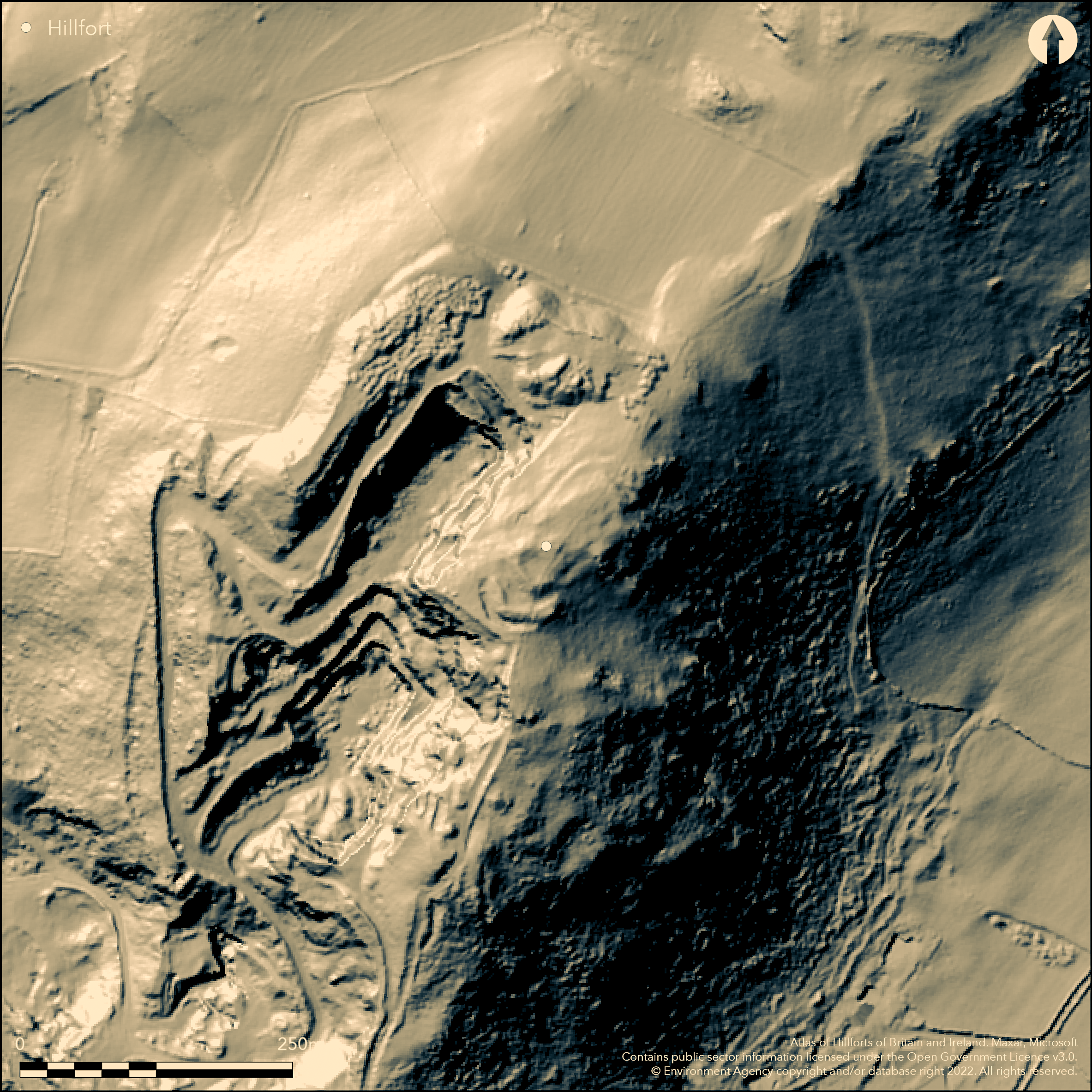
LiDAR 1m DTM Hillshade
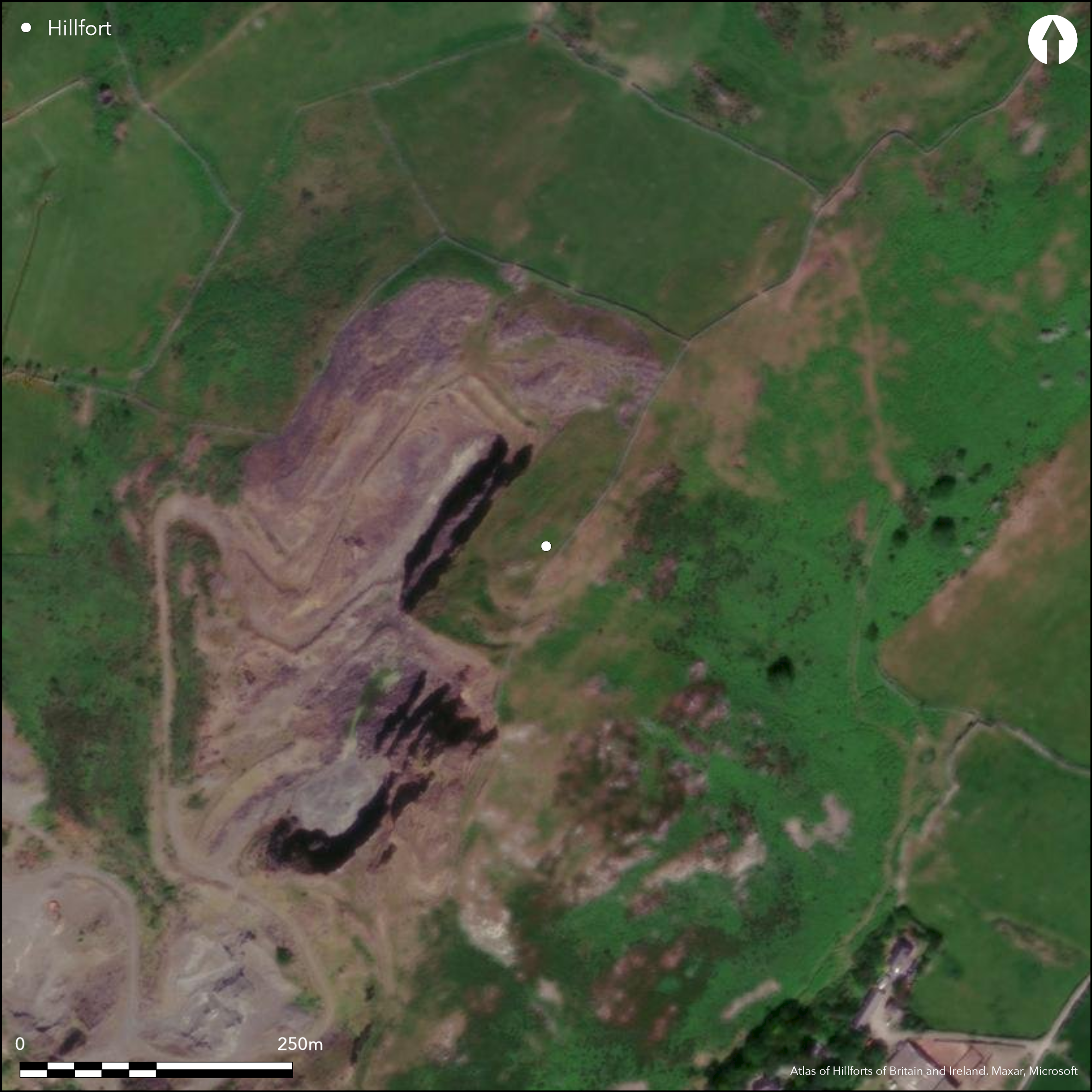
Satellite Imagery
LiDAR 1m DTM Hillshade
Satellite Imagery
Scroll left/right to view further images.
HER: Gwynedd 1778 (None)
NMR: SH 50 SE (301736)
SM: None
NGR: SH57410358
X: 257415 Y: 303585 (OSGB36)
Possible small contour hillfort or defended enclosure located in a very exposed position on ridge-top of Tal y Gareg mountain above Afon Dysynni on E and S, coastal plain, Aber-Dysynni and sea on SW. Now perched just above the extensive Tonfanau Quarry which surrounds site from NE to W and S. Setting totally ruined. Form and date of the enclosure uncertain. Site in many ways resembles Careg-y-Llam, Caernarfonshire (Atlas No 1724), which has sherds found of 8th or 9th century AD, and thought to be similar in function to a small castle. Tal-y-Gareg could be similar, but nothing proven and the site could be multi-period. Defences generally consist of two relatively low earth and stone banks visible, enclosing a rectangular space about 45m long and 22m wide, with very steep quarry and cliff faces on all sides but E. Rock-cut ditches. Collapsed faced walls visible and site probably stone-walled. No entrance visible, but access possibly gained via narrow path between S end of the inner rampart and scarp edge. Rough grass and bare rock. Ditch on very edge of quarry face (2009). Former shipping signal with ring of concrete pegs.
Citizen Science: ✗
Reliability of Data: Confirmed
Reliability of Interpretation: Unconfirmed
X: -457225 Y: 6911411 (EPSG: 3857)
Longitude: -4.107319629669261 Latitude: 52.6112488282101 (EPSG:4326)
Country: Wales
Current County or Unitary Authority: Gwynedd
Historic County: Merioneth
Current Parish/Community/Council/Townland: Llangelynin
Now perched just above the extensive Tonfanau Quarry; setting totally ruined. Ditch on very edge of quarry face (2009).
| Extant | ✓ |
| Cropmark | ✗ |
| Likely Destroyed | ✗ |
Rough grass and bare rock. Former shipping signal with ring of concrete pegs.
| Woodland | ✗ |
| Commercial Forestry Plantation | ✗ |
| Parkland | ✗ |
| Pasture (Grazing) | ✓ |
| Arable | ✗ |
| Scrub/Bracken | ✗ |
| Bare Outcrop | ✗ |
| Heather/Moorland | ✗ |
| Heath | ✗ |
| Built-up | ✗ |
| Coastal Grassland | ✗ |
| Other | ✓ |
Possible small contour hillfort or defended enclosure located in a very exposed position on ridge-top of Tal y Gareg mountain above Afon Dysynni on E and S, coastal plain, Aber-Dysynni and sea on SW. Very steep quarry face and cliffs on all sides except E.
| Contour Fort | ✓ |
| Partial Contour Fort | ✗ |
| Promontory Fort | ✗ |
| Hillslope Fort | ✗ |
| Level Terrain Fort | ✗ |
| Marsh Fort | ✗ |
| Multiple Enclosure Fort | ✗ |
| Hilltop | ✗ |
| Coastal Promontory | ✗ |
| Inland Promontory | ✗ |
| Valley Bottom | ✗ |
| Knoll/Hillock/Outcrop | ✗ |
| Ridge | ✓ |
| Cliff/Plateau-edge/Scarp | ✗ |
| Hillslope | ✗ |
| Lowland | ✗ |
| Spur | ✗ |
Dominant Topographic Feature: Ridge-top.
| North | ✗ |
| Northeast | ✗ |
| East | ✗ |
| Southeast | ✗ |
| South | ✗ |
| Southwest | ✗ |
| West | ✗ |
| Northwest | ✗ |
| Level | ✓ |
Altitude: 152.0m
N/A
Date unknown, but has been suggested as early medieval fort. Nothing proven and the site could be multi-period.
Reliability: D - None
| Pre 1200BC | ✗ |
| 1200BC - 800BC | ✗ |
| 800BC - 400BC | ✗ |
| 400BC - AD50 | ✗ |
| AD50 - AD400 | ✗ |
| AD400 - AD 800 | ✗ |
| Post AD800 | ✗ |
| Unknown | ✓ |
| Pre Hillfort: | None |
| Post Hillfort: | Former site of shipping signal tower - ring of concrete pegs. |
Site visits GAT and FMW 1987, 1994. GAT prehistoric defended enclosures survey 2005-2006.
| Other (1985): | Visited by Hillfort Study Group |
| Other (None): | Site visits GAT and FMW. |
| Other (None): | GAT prehistoric defended enclosures survey. |
None.
None
| None | ✓ |
| Spring | ✗ |
| Stream | ✗ |
| Pool | ✗ |
| Flush | ✗ |
| Well | ✗ |
| Other | ✗ |
None
| No Known Features | ✓ |
| Round Stone Structures | ✗ |
| Rectangular Stone Structures | ✗ |
| Curvilinear Platforms | ✗ |
| Other Roundhouse Evidence | ✗ |
| Pits | ✗ |
| Quarry Hollows | ✗ |
| Other | ✗ |
None
| No Known Excavation | ✓ |
| Pits | ✗ |
| Postholes | ✗ |
| Roundhouses | ✗ |
| Rectangular Structures | ✗ |
| Roads/Tracks | ✗ |
| Quarry Hollows | ✗ |
| Other | ✗ |
| Nothing Found | ✗ |
None
| No Known Geophysics | ✓ |
| Pits | ✗ |
| Roundhouses | ✗ |
| Rectangular Structures | ✗ |
| Roads/Tracks | ✗ |
| Quarry Hollows | ✗ |
| Other | ✗ |
| Nothing Found | ✗ |
None
| No Known Finds | ✓ |
| Pottery | ✗ |
| Metal | ✗ |
| Metalworking | ✗ |
| Human Bones | ✗ |
| Animal Bones | ✗ |
| Lithics | ✗ |
| Environmental | ✗ |
| Other | ✗ |
None
| APs Not Checked | ✓ |
| None | ✗ |
| Roundhouses | ✗ |
| Rectangular Structures | ✗ |
| Pits | ✗ |
| Postholes | ✗ |
| Roads/Tracks | ✗ |
| Other | ✗ |
No formal entrance visible, but access possibly gained via narrow path between S end of the inner rampart and scarp edge. Trace of approach way has also been recorded in past on N.
| 1: | Possible only. |
| 2: | Possibly only. |
Guard Chambers: ✗
Chevaux de Frise: ✗
| 1. Simple Gap (South): | None |
Defences generally consist of two relatively low earth and stone banks visible, enclosing a rectangular space about 45m long and 22m wide, with very steep quarry and cliff faces on all sides but E. Rock-cut ditches. Collapsed faced walls visible and site probably stone-walled.
| Area 1: | Noneha. |
| Total: | Noneha. |
Total Footprint Area: Noneha.
None
| ✗ | Area not determined. |
| ✓ | None |
| NE Quadrant: | 2 |
| SE Quadrant: | 2 |
| SW Quadrant: | 2 |
| NW Quadrant: | 2 |
| Total: | 2 |
| Partial Univallate | ✗ |
| Univallate | ✗ |
| Partial Bivallate | ✗ |
| Bivallate | ✓ |
| Partial Multivallate | ✗ |
| Multivallate | ✗ |
| Unknown | ✗ |
| Partial Univallate | ✗ |
| Univallate | ✗ |
| Partial Bivallate | ✗ |
| Bivallate | ✗ |
| Partial Multivallate | ✗ |
| Multivallate | ✗ |
Earth and stone banks visible, but probably stone-walled site.
| None | ✗ |
| Earthen Bank | ✓ |
| Stone Wall | ✓ |
| Rubble | ✗ |
| Wall-walk | ✗ |
| Evidence of Timber | ✗ |
| Vitrification | ✗ |
| Other Burning | ✗ |
| Palisade | ✗ |
| Counter Scarp Bank | ✗ |
| Berm | ✗ |
| Unfinished | ✗ |
| Other | ✗ |
None
| None | ✗ |
| Earthen Bank | ✗ |
| Stone Wall | ✗ |
| Murus Duplex | ✗ |
| Timber-framed | ✗ |
| Timber-laced | ✗ |
| Vitrification | ✗ |
| Other Burning | ✗ |
| Palisade | ✗ |
| Counter Scarp Bank | ✗ |
| Berm | ✗ |
| Unfinished | ✗ |
| No Known Excavation | ✓ |
| Other | ✗ |
| ✗ | None |
| ✓ | Rock-cut ditches. Possibly two, but exact number not determined. |
Number of Ditches: 2
| ✗ | None |
Bowen E.G. and Gresham, C.A. 1967. History of Merioneth ,1, Dolgellau, 167-8.
Gruffydd, A. and Riley, H. 1992. Minerals: An Archaeological Assessment of Mineral Extraction Sites and Resources within the Snowdonia National Park, GAT Report No. 023b, Bangor: Gwynedd Archaeological Trust.
Longley, D. 2000. Tal-y-garreg: A Multi Period Hillfort in Western Meirionnydd, unpublished monograph.
Royal Commission on the Ancient and Historical Monuments and Constructions in Wales and Monmouthshire 1921. An inventory of the ancient monuments in Wales and Monmouthshire, IV, County of Merioneth, London: HMSO.
Smith, G.H. 2006. A survey of prehistoric defended enclosures in north-west Wales 2005-2006: Gwynedd Dwyfor and Meirionnydd. Report No 634. Part I: Survey Report. Bangor: Gwynedd Archaeological Trust.
Smith, G.H. 2009. A Visitor Guide to the Main Iron Age Hill Forts of Meirionnydd, Bangor: Gwynedd Archaeological Trust.
Waddington, K. 2013. The Settlements of Northwest Wales: From the Late Bronze Age to the Early Medieval Period, Cardiff: University of Wales Press.
Atlas of Hillforts:
Wikidata:
This work is licensed under CC BY-SA 4.0

 and should be cited as:
Lock, Gary and Ralston, Ian. 2024. Atlas of Hillforts of Britain and Ireland. Available at: https://hillforts.arch.ox.ac.uk
Document Version 1.1