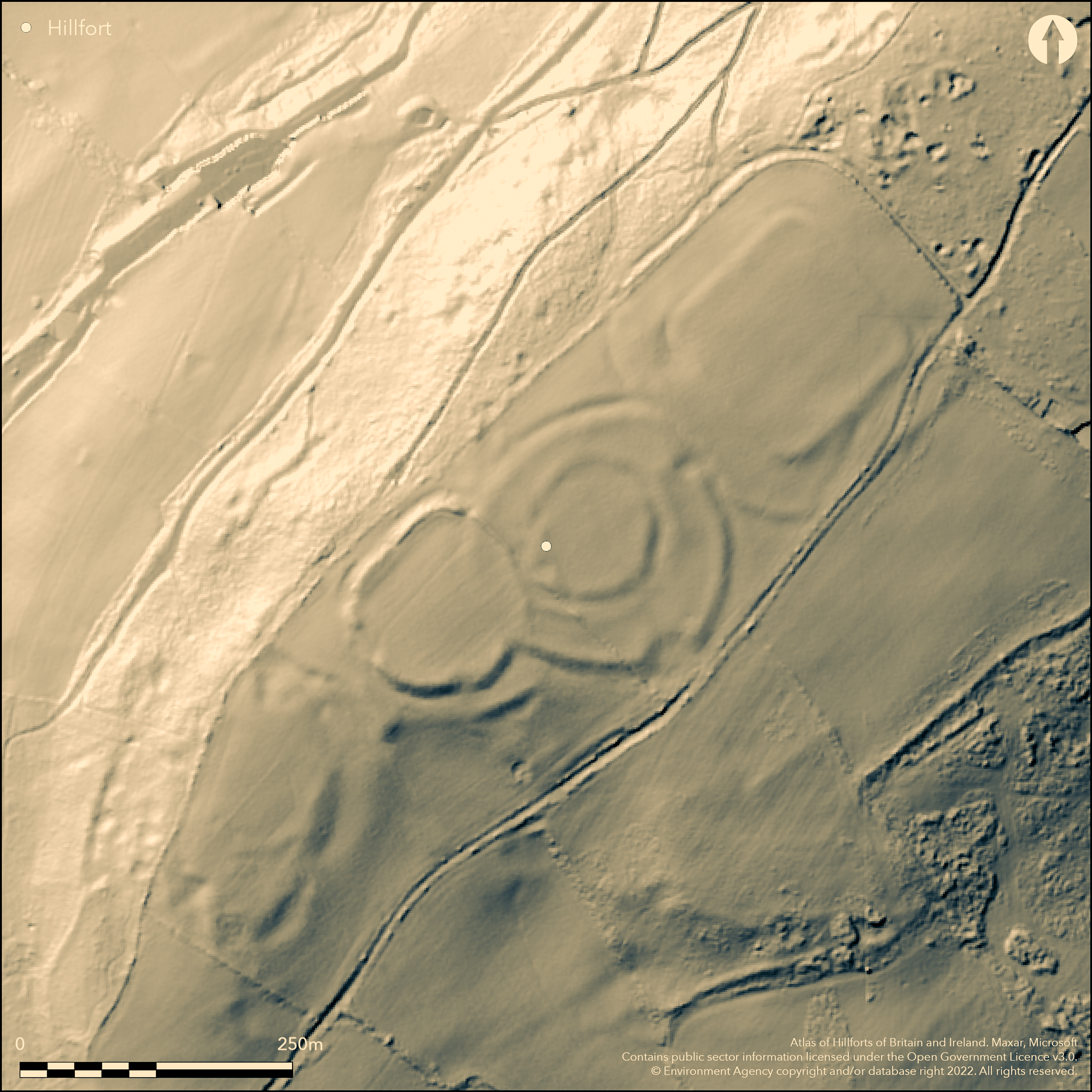
LiDAR 1m DTM Hillshade
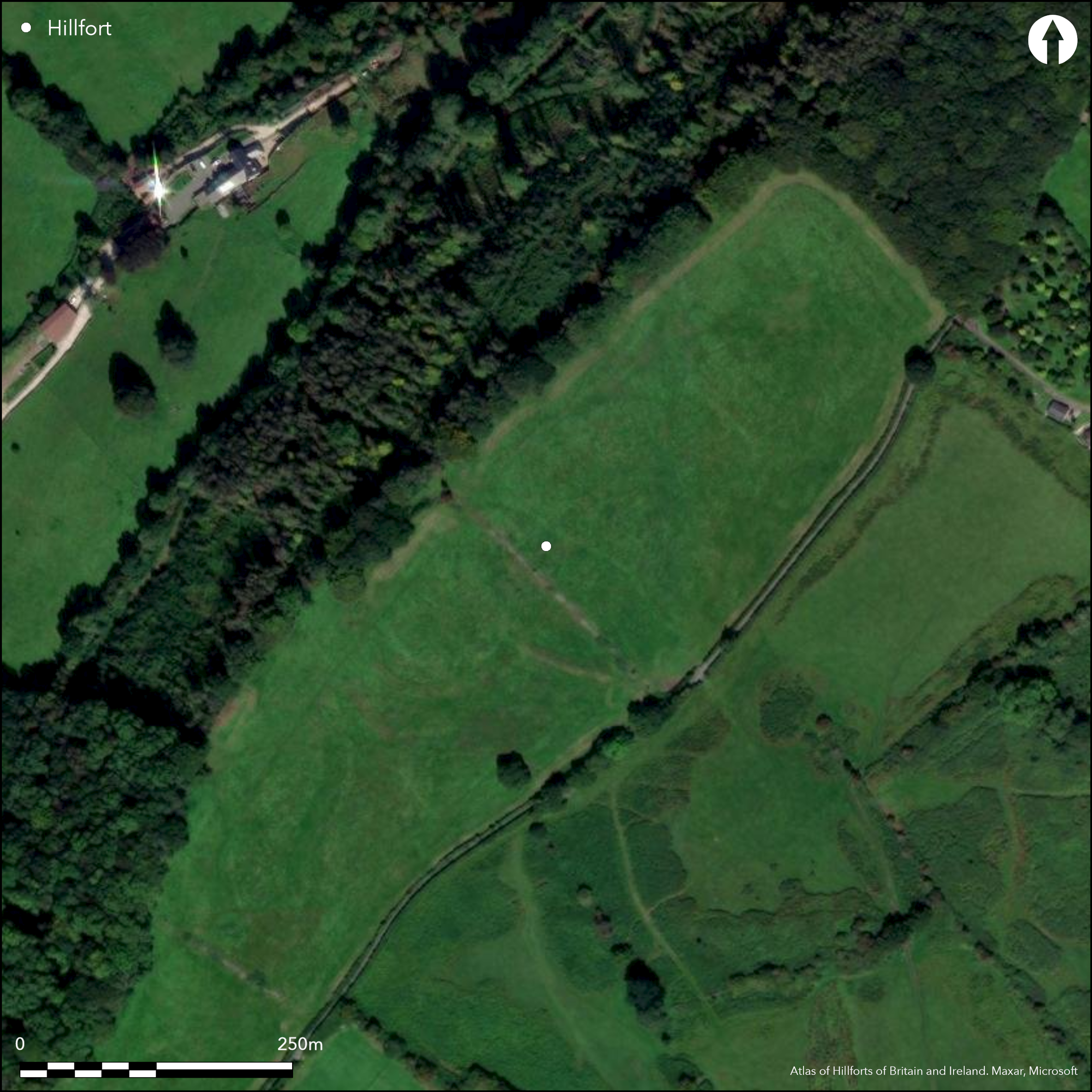
Satellite Imagery
LiDAR 1m DTM Hillshade
Satellite Imagery
Scroll left/right to view further images.
HER: Glamorgan Gwent 00414g; 00415g; 00416g (None)
NMR: ST 39 SE 39 (307891)
SM: None
NGR: ST37899155
X: 337822 Y: 191512 (OSGB36)
Three bivallate or univallate co-joined contour enclosure complex located on summit of a steep ridge above lower Usk. Steep wooded surrounding slopes to NW, less to SE. SW site is a part bivallate enclosure (Coed-y-Caerau) roughly oval and c. 84m-94m in diameter, with internal area estimated at 0.8ha. Single bank with traces of outer circuit on S and SW and possible ploughed-out bank and ditch to far SW, but unclear. Original inturned entrance possibly to SE, that on SW possibly later, but unclear. Sub-circular, bivallate, middle enclosure (Pen Toppen Ash Camp) possibly part-built over Coed-y-Caerau, c. 74m-80m diameter, with internal area estimated at 0.6ha, with partial bank within seemingly concentric outer embanked enclosure, that emerges from the SW enclosure circuit, c. 136m-142m in diameter and internal area c. 1.9ha, counterscarped on NW. Inturned entrances on NE and SE. Third enclosure on NE suggested as Roman fortlet, but may have Iron Age connotations. This is rectangular, c. 96m NE-SW by 108m, with internal area c. 1ha. Defined by single bank with an outer, concentric c. 166m square. Possible further related earthworks to N and W. Generally well-preserved. Upland pasture. Pen-toppen-ash Camp on 1st Ed. OS map (1882). Questions remain as to the nature of these enclosures.
Citizen Science: ✗
Reliability of Data: Unconfirmed
Reliability of Interpretation: Confirmed
X: -322774 Y: 6731515 (EPSG: 3857)
Longitude: -2.8995251137054696 Latitude: 51.61893554285026 (EPSG:4326)
Country: Wales; None
Current County or Unitary Authority: Newport
Historic County: Monmouthshire
Current Parish/Community/Council/Townland: Langstone; Kemeys Inferior
Generally well-preserved, but plough damage, particularly to middle enclosure reduced banks.
| Extant | ✓ |
| Cropmark | ✗ |
| Likely Destroyed | ✗ |
Upland pasture
| Woodland | ✗ |
| Commercial Forestry Plantation | ✗ |
| Parkland | ✗ |
| Pasture (Grazing) | ✓ |
| Arable | ✗ |
| Scrub/Bracken | ✗ |
| Bare Outcrop | ✗ |
| Heather/Moorland | ✗ |
| Heath | ✗ |
| Built-up | ✗ |
| Coastal Grassland | ✗ |
| Other | ✗ |
Three co-joined enclosure complex located on summit of a steep ridge above lower Usk. Steep wooded surrounding slopes to NW, less to SE.
| Contour Fort | ✓ |
| Partial Contour Fort | ✗ |
| Promontory Fort | ✗ |
| Hillslope Fort | ✗ |
| Level Terrain Fort | ✗ |
| Marsh Fort | ✗ |
| Multiple Enclosure Fort | ✗ |
| Hilltop | ✓ |
| Coastal Promontory | ✗ |
| Inland Promontory | ✗ |
| Valley Bottom | ✗ |
| Knoll/Hillock/Outcrop | ✗ |
| Ridge | ✓ |
| Cliff/Plateau-edge/Scarp | ✗ |
| Hillslope | ✗ |
| Lowland | ✗ |
| Spur | ✗ |
Dominant Topographic Feature: Hill top ridge
| North | ✗ |
| Northeast | ✗ |
| East | ✗ |
| Southeast | ✗ |
| South | ✗ |
| Southwest | ✗ |
| West | ✗ |
| Northwest | ✗ |
| Level | ✓ |
Altitude: 192.0m
Boundary Type: Parish/Townland
Possibly Iron Age, but NE enclosure suggested as Roman fortlet and many questions remain.
Reliability: C - Low
| Pre 1200BC | ✗ |
| 1200BC - 800BC | ✗ |
| 800BC - 400BC | ✗ |
| 400BC - AD50 | ✓ |
| AD50 - AD400 | ✓ |
| AD400 - AD 800 | ✗ |
| Post AD800 | ✗ |
| Unknown | ✗ |
| Pre Hillfort: | None |
| Post Hillfort: | None |
| Morphology/Earthwork/Typology: | NE enclosure suggested as Roman fortlet. |
Pen-toppen-ash Camp on 1st Ed. OS map (1882). Geophysical survey D. Roberts 2005. Field visit GGAT 2006. GGAT Prehistoric defended enclosures Gwent 2006.
| 1st Identified Map Depiction (1882): | Pen-toppen-ash Camp on 1st Ed. OS map. |
| Geophysical Survey (2005): | D. Roberts. |
| Other (2006): | Field visit GGAT. |
| Other (2006): | GGAT Prehistoric defended enclosures Gwent. |
Surface and geophysical evidence of hut circles to middle enclosure.
None
| None | ✓ |
| Spring | ✗ |
| Stream | ✗ |
| Pool | ✗ |
| Flush | ✗ |
| Well | ✗ |
| Other | ✗ |
Evidence of two hut circles in middle enclosure.
| No Known Features | ✓ |
| Round Stone Structures | ✗ |
| Rectangular Stone Structures | ✗ |
| Curvilinear Platforms | ✗ |
| Other Roundhouse Evidence | ✓ |
| Pits | ✗ |
| Quarry Hollows | ✗ |
| Other | ✗ |
None
| No Known Excavation | ✓ |
| Pits | ✗ |
| Postholes | ✗ |
| Roundhouses | ✗ |
| Rectangular Structures | ✗ |
| Roads/Tracks | ✗ |
| Quarry Hollows | ✗ |
| Other | ✗ |
| Nothing Found | ✗ |
Possible evidence of huts in interior found in middle enclosure.
| No Known Geophysics | ✗ |
| Pits | ✗ |
| Roundhouses | ✓ |
| Rectangular Structures | ✗ |
| Roads/Tracks | ✗ |
| Quarry Hollows | ✗ |
| Other | ✗ |
| Nothing Found | ✗ |
None
| No Known Finds | ✓ |
| Pottery | ✗ |
| Metal | ✗ |
| Metalworking | ✗ |
| Human Bones | ✗ |
| Animal Bones | ✗ |
| Lithics | ✗ |
| Environmental | ✗ |
| Other | ✗ |
None
| APs Not Checked | ✓ |
| None | ✗ |
| Roundhouses | ✗ |
| Rectangular Structures | ✗ |
| Pits | ✗ |
| Postholes | ✗ |
| Roads/Tracks | ✗ |
| Other | ✗ |
SW enclosure possible inturned entrance on SE, that on SW possibly later. Middle enclosure has inturned entrances on NE and SW. Entrance to NE enclosure unclear.
| 4: | SW entrance to SW enclosure possibly later. |
| 2: | None |
Guard Chambers: ✗
Chevaux de Frise: ✗
| 1. In-turned (South east): | Entrance to SW enclosure. |
| 2. In-turned (North east): | Entrance to middle enclosure. |
| 3. In-turned (South east): | Entrance to middle enclosure. |
SW enclosure defined by single bank and traces of outer circuit on S and SW. Sub-circular middle enclosure with partial bank within seemingly concentric outer embanked enclosure, that emerges from the SW enclosure circuit. Part counterscarped. Third enclosure on NE suggested as Roman fortlet, but may have Iron Age connotations. This is rectangular, c. 96m NE-SW by 108m, with internal area c. 1ha. Defined by single bank with an outer, concentric c. 166m square.
| Area 1: | 0.8ha. |
| Area 2: | 1.9ha. |
| Area 3: | 1ha. |
| Total: | 1.9ha. |
Total Footprint Area: Noneha.
None
| ✓ | Three co-joined enclosures. SW c. 0.8ha. Middle c. 1.9ha. NE c. 1ha. Estimates only. Possibly built in succession, but conjecture only. |
| ✗ | Three co-joined enclosures. Only SW enclosure (Coed-y-Caerau) quadrants defined. |
| NE Quadrant: | 1 |
| SE Quadrant: | 2 |
| SW Quadrant: | 2 |
| NW Quadrant: | 1 |
| Total: | 2 |
| Partial Univallate | ✓ |
| Univallate | ✗ |
| Partial Bivallate | ✓ |
| Bivallate | ✗ |
| Partial Multivallate | ✗ |
| Multivallate | ✗ |
| Unknown | ✗ |
| Partial Univallate | ✗ |
| Univallate | ✗ |
| Partial Bivallate | ✗ |
| Bivallate | ✗ |
| Partial Multivallate | ✗ |
| Multivallate | ✗ |
Middle enclosure part counterscarped.
| None | ✗ |
| Earthen Bank | ✓ |
| Stone Wall | ✗ |
| Rubble | ✗ |
| Wall-walk | ✗ |
| Evidence of Timber | ✗ |
| Vitrification | ✗ |
| Other Burning | ✗ |
| Palisade | ✗ |
| Counter Scarp Bank | ✓ |
| Berm | ✗ |
| Unfinished | ✗ |
| Other | ✗ |
None
| None | ✗ |
| Earthen Bank | ✗ |
| Stone Wall | ✗ |
| Murus Duplex | ✗ |
| Timber-framed | ✗ |
| Timber-laced | ✗ |
| Vitrification | ✗ |
| Other Burning | ✗ |
| Palisade | ✗ |
| Counter Scarp Bank | ✗ |
| Berm | ✗ |
| Unfinished | ✗ |
| No Known Excavation | ✓ |
| Other | ✗ |
| ✗ | None |
| ✗ | No details, but sites probably ditched. |
Number of Ditches: 0
| ✗ | None |
Wiggins, H. 2006. Prehistoric defended enclosures in Gwent, GGAT.
Atlas of Hillforts:
Wikidata:
This work is licensed under CC BY-SA 4.0

 and should be cited as:
Lock, Gary and Ralston, Ian. 2024. Atlas of Hillforts of Britain and Ireland. Available at: https://hillforts.arch.ox.ac.uk
Document Version 1.1